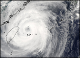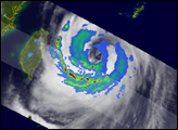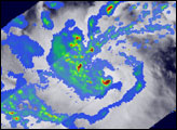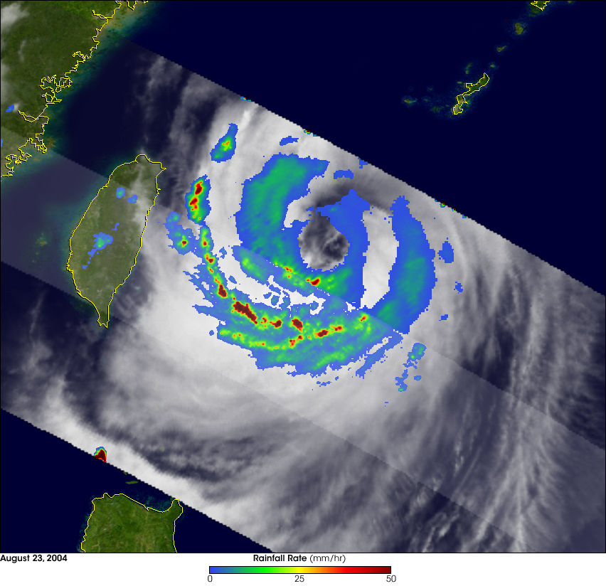
The Tropical Rainfall Measuring Mission or TRMM satellite provided this image of Typhoon Aere over the western Philippine Sea as it was approaching Taiwan. Images and data collected by TRMM help to provide valuable estimates of storm location and intensity especially over remote ocean areas. This particular image was taken at 09:23 UTC on 23 August 2004. At the time of this image, Aere was a minimal Category 1 typhoon with winds estimated at 65 knots (75 mph) by the Joint Typhoon Warning Center. The image shows a top down view of the horizontal distribution of rain intensity obtained from the TRMM satellite. Rain rates in the center part of the swath are from the TRMM Precipitation Radar (PR), the first and only precipitation radar in space. The PR can provide fine resolution rainfall data and details on the vertical structure. Rain rates in the outer swath are from the TRMM Microwave Imager (TMI). The rain rates are overlaid on infrared (IR) data from the TRMM Visible Infrared Scanner (VIRS). TRMM reveals that Aere has a large, closed eye. However, only the southern portion of the eyewall contains any moderate (green) to heavy (red) rain. The northern portion of the eyewall contains only light (blue) rain and is almost open, which is supported by the IR data. It reveals that Aere is not a strong, well-organized storm and is unlikely to intensify at this time. The heaviest rainfall (darker reds) is contained in an outer rainband south of the center. Aere originally formed as a tropical depression on the 19th of August about 1000 km east of the central Philippines and never intensified beyond Category 1.
TRMM is a joint mission between NASA and the Japanese space agency JAXA.
NASA image produced by Hal Pierce (SSAI/NASA GSFC) and caption by Steve Lang (SSAI/NASA GSFC), NASA's Tropical Rainfall Measuring Mission