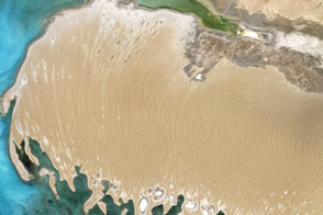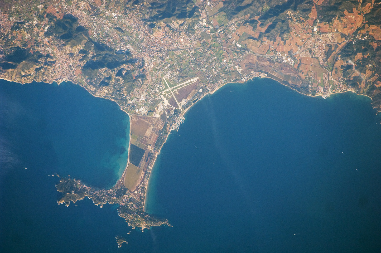
This detailed astronaut photograph shows the Giens Peninsula, located along the Mediterranean coastline of France. The peninsula is part of the Côte d’Azur, also known as the French Riviera. The coastal region is bounded by the Rhône River to the west, the Rhône Alps to the north, and the Italian border to the east. The peninsula extends southwards from the city of Hyères to the resort community of Giens.
The Giens Peninsula is formed from two tombolos. A tombolo is a ridge of beach material (typically sand), built by wave action, that connects an island to the mainland. Tombolos, like many coastal features, typically change dramatically over geologic time due to fluctuating sediment supply, coastal currents, sea levels and storm events. The tombolos of the Giens Peninsula have been modified by human activities, as well, including sand dune removal, construction of roadways, and replacement of the original sand by other materials. The long-term survival of these tombolos will be determined by the effects of these changes on the natural coastal processes, with potential sea level rise presenting an additional threat.
In addition to Giens, three other urban areas are visible in this image: Carqueiranne, Hyères, and La Londe-les-Maures. The urban areas are recognizable by both light pink rooftops and grey street grids. These colors contrast with green to brown vegetated areas, including agricultural fields between Hyères and La Londe-les-Maures and more natural vegetation (dark green) on hills between Hyères and Carqueiranne. Small white dots and streaks in the Mediterranean Sea are yachts and other recreational boats.
Astronaut photograph ISS022-E-5403 was acquired on December 2, 2009, with a Nikon D2Xs digital camera fitted with a 400 mm lens, and is provided by the ISS Crew Earth Observations experiment and Image Science & Analysis Laboratory, Johnson Space Center. The image was taken by the Expedition 22 crew. The image in this article has been cropped and enhanced to improve contrast. Lens artifacts have been removed. The International Space Station Program supports the laboratory to help astronauts take pictures of Earth that will be of the greatest value to scientists and the public, and to make those images freely available on the Internet. Additional images taken by astronauts and cosmonauts can be viewed at the NASA/JSC Gateway to Astronaut Photography of Earth. Caption by William L. Stefanov, NASA-JSC.