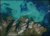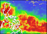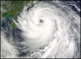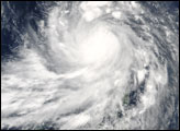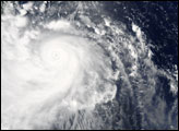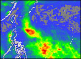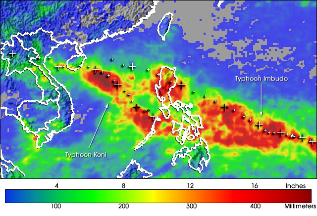
There were two tropical cyclones in the West Pacific this past week. Koni went through the central Philippines (below and to the left of center) as a tropical storm where it dumped heavy rains before becoming a minimal typhoon with maximum sustained winds of 75 mph over the South China Sea. It crossed the island of Hainan, and then weakened slightly and made landfall on the coast of northern Vietnam (left). Imbudo, meanwhile, became a super typhoon with winds of 150 mph before striking the Island of Luzon in the northern Philippines (center) where it did extensive damage and was responsible for at least 9 deaths. Both of these storms were spawned by an intra-seasonal oscillation that moved eastward across the West Pacific ocean.
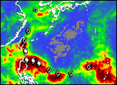
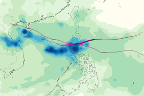
The image above shows the rainfall totals associated with these two storms. The near-real time observations were collected by the Tropical Rainfall Measuring Mission (TRMM)-based, Multi-satellite Precipitation Analysis (MPA) at NASA Goddard Space Flight Center. Areas of the central and northern Philippines received upwards of 12 inches of rainfall as a result (red areas). Combined, the two systems generated a broad area of very heavy rain from well east of the Philippines to the mainland coast (red and yellow areas). White crosses mark the positions of each cyclone as it crossed the western Pacific. Accumulations are for the period of July 15-23, 2003. TRMM is a joint mission between NASA and the Japanese space agency, NASDA. Additional images of this event, including animations, are available on the TRMM Website.Images produced by Hal Pierce (SSAI/NASA GSFC) and captions by Steve Lang (SSAI/NASA GSFC).