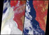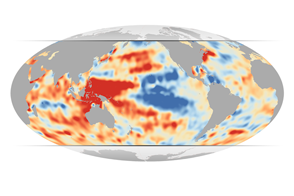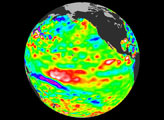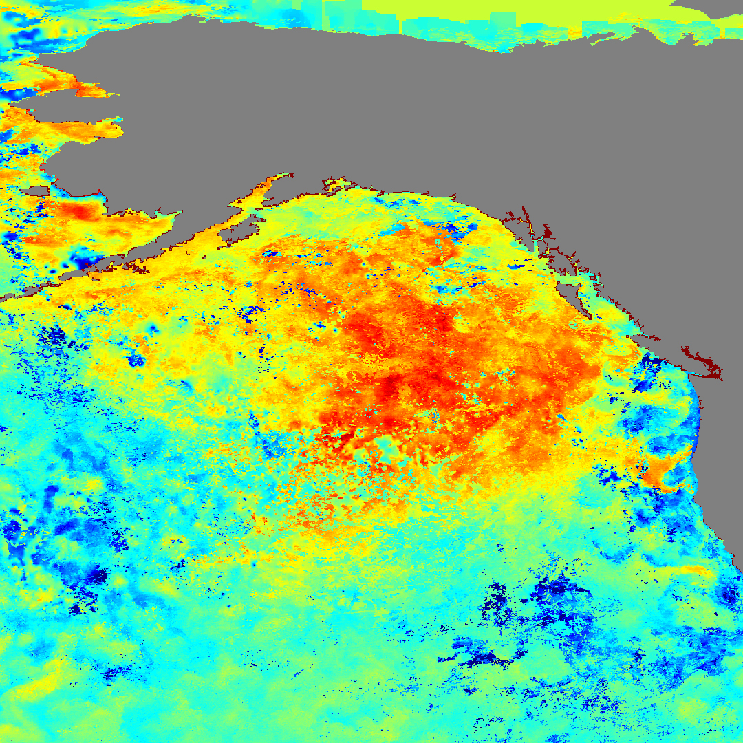
Since early October 2002, sea surface temperatures in the Gulf of Alaska and the northeastern Pacific Ocean have risen between 2 and 4 degrees Celsius (4 and 7 degrees Fahrenheit) higher than average for this time of year. The above image shows the sea surface temperature anomaly over the region for the week beginning November 4, 2002. Pieced together from seven days of data gathered by the Moderate Resolution Imaging Spectroradiometer (MODIS), aboard NASA’s Terra satellite, the image depicts the relative nighttime temperatures of the ocean compared to years past. In this image, bright red and orange represent areas where sea surface temperatures for the first full week in November were greater than they have been on average for the past 20 years, and the bright blue represents areas where sea surface temperature was lower than average.
The reason for the temperature increase is an unusually high level of stability between layers of the ocean. Typically, as the water in the northeastern Pacific and the Gulf of Alaska begins to cool off in October, the warmer upper layers of the ocean mix with the cool nutrient-rich deep layers. This year, however, the layers of the ocean have stayed remarkably stable well into the fall. As such, the upper layers have remained relatively stagnant, retaining heat from the sun and failing to mix with deeper waters.
If the sea surface temperatures continue to be abnormally high into the winter, they could result in more rainfall than normal over British Columbia and the Pacific Northwest this winter. The anomaly could also impact aquatic life in and around the Bay of Alaska. Without nutrients from the cool, deeper layers of the ocean, the local algae (phytoplankton) population could drop. Since algae sit at the bottom of the aquatic food chain, such a drop could impact everything from shrimp to seals to seabirds.
Image courtesy Jesse Allen, NASA’s Earth Observatory