
full-size images:
true color (620 KB)
3-d anagylph (780 KB)
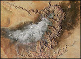
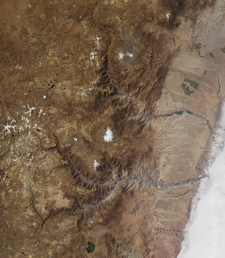
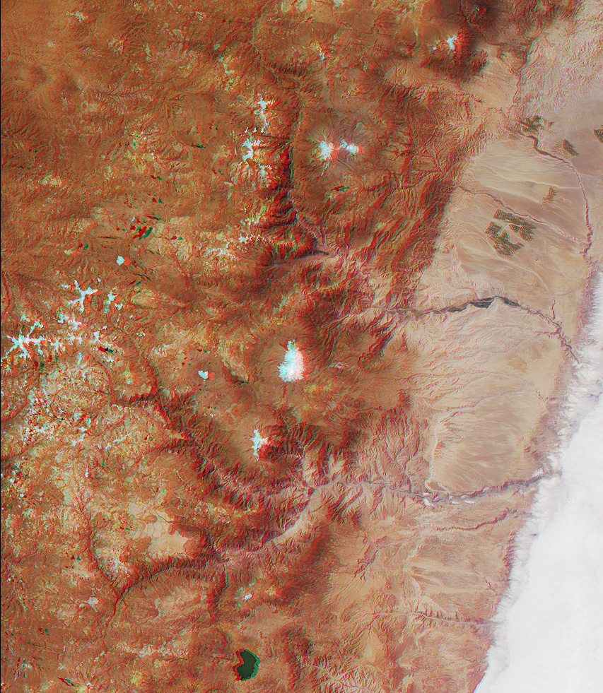
The spectacular canyons of the central Andes, in the Peruvian department of Arequipa, provide a striking demonstration of the power of water erosion. This image was acquired by the Multi-angle Imaging SpectroRadiometer (MISR) on July 17, 2000. The image is a natural color view from the instrument’s nadir (vertical-viewing) camera. In addition, a stereo anaglyph was created with data from the 26-degree forward-viewing and nadir cameras. To facilitate stereo viewing, the images are oriented with north at the left and west at the bottom. Viewing the stereo image in 3-D requires red/blue glasses with the red filter placed over your left eye. Information on ordering glasses is available at http://photojournal.jpl.nasa.gov/Help/VendorList.html#Glasses
Two main erosion formations can be seen. The one above image center is carved by the Rio Camana and the one below it (to the west) by the Rio Ocona. These rivers empty into the Pacific Ocean, which is located at the right-hand side of the images but obscured by a stratus cloud layer. Between the canyons, at image center, is the snow-capped peak of the Nudo Coropuna, the highest mountain in the Cordillera Occidental (elevation 6613 meters). To the west is the smaller Nevado Solimana (6117 meters), part of which has been cut away by a tributary of the Rio Ocona. Both of these mountains are inactive stratovolcanoes.
The Rio Camana’s main tributaries are the rivers Andahua and Colca. Colca canyon was once thought to be the deepest in the area, but it is outdone by the canyon of the Rio Cotahuasi (Rio Ocona’s main tributary). Reaching a depth of 3354 meters below the top of the plateau, Cotahuasi Canyon is believed to be the deepest of any continental surface on Earth. It is more than twice as deep as Arizona’s Grand Canyon.
Image courtesy NASA/GSFC/LaRC/JPL, MISR Team

