Every year, tens of thousands of birds flock to Lake Abert as they journey from parts of the Great Basin toward the Pacific flyway, a migration route that extends from Alaska and Canada, through California, to Mexico and South America. The shallow, salty lake in southern Oregon has long functioned like an all-you-can-eat buffet for many of these winged travelers. But the food source has become threatened in recent years.
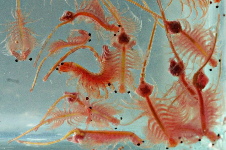
Under normal circumstances, the lake’s water is too salty for fish. Instead, it supports large quantities of alkali flies and tiny crustaceans called brine shrimp (below), which have long provided a feast for several species of migrating birds. But the past few decades have been anything but normal for Lake Abert. The lake mostly dried up in 2014, 2015, 2021, and 2022 due to water withdrawals and dry weather, which caused the salinity of the lake’s remaining water to spike—becoming, at times, too high even for brine shrimp and flies.
In order to improve understanding of why Abert is drying up, a team of researchers led by University of Maryland and NASA research scientist Dorothy Hall analyzed two decades of environmental data collected by the Terra satellite. They found that between 2001 and 2021, fewer days of snow cover and higher surface temperatures led to greater evaporation over Lake Abert. The research was recently published in Earth and Space Science.“Lake Abert is largely fed by snowmelt emanating from the mountains to the west of the lake,” Hall said. “What we’re seeing in Lake Abert is worrying, and it is consistent with what you'd expect from this region because of climate warming.”
“We haven’t seen Lake Abert so low since the Dust Bowl,” added Ron Larson, a retired biologist with the U.S. Fish and Wildlife Service and one of the study’s coauthors. “There has been little or no inflow from the Chewaucan River, at the south end of the lake for the past two years.”
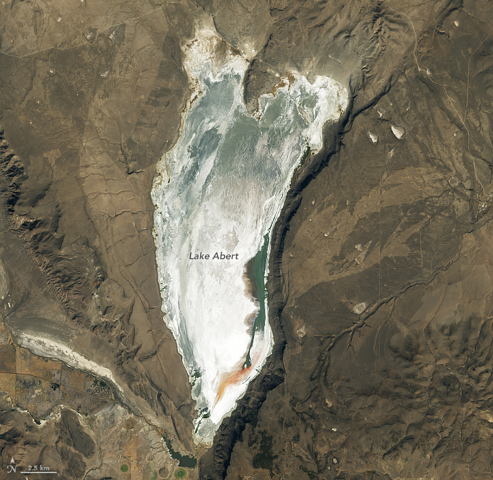
Researchers use a gauge on the eastern shore of the lake to track water levels and calculate the level and volume of the lake, but water levels fell below the lowest level of the gauge in 2019. To fill the gap in recent years, some researchers have relied on Landsat observations of the lake’s areal extent to provide estimates of the remaining water volume.
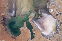
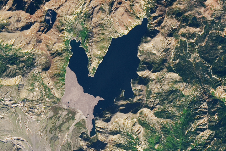
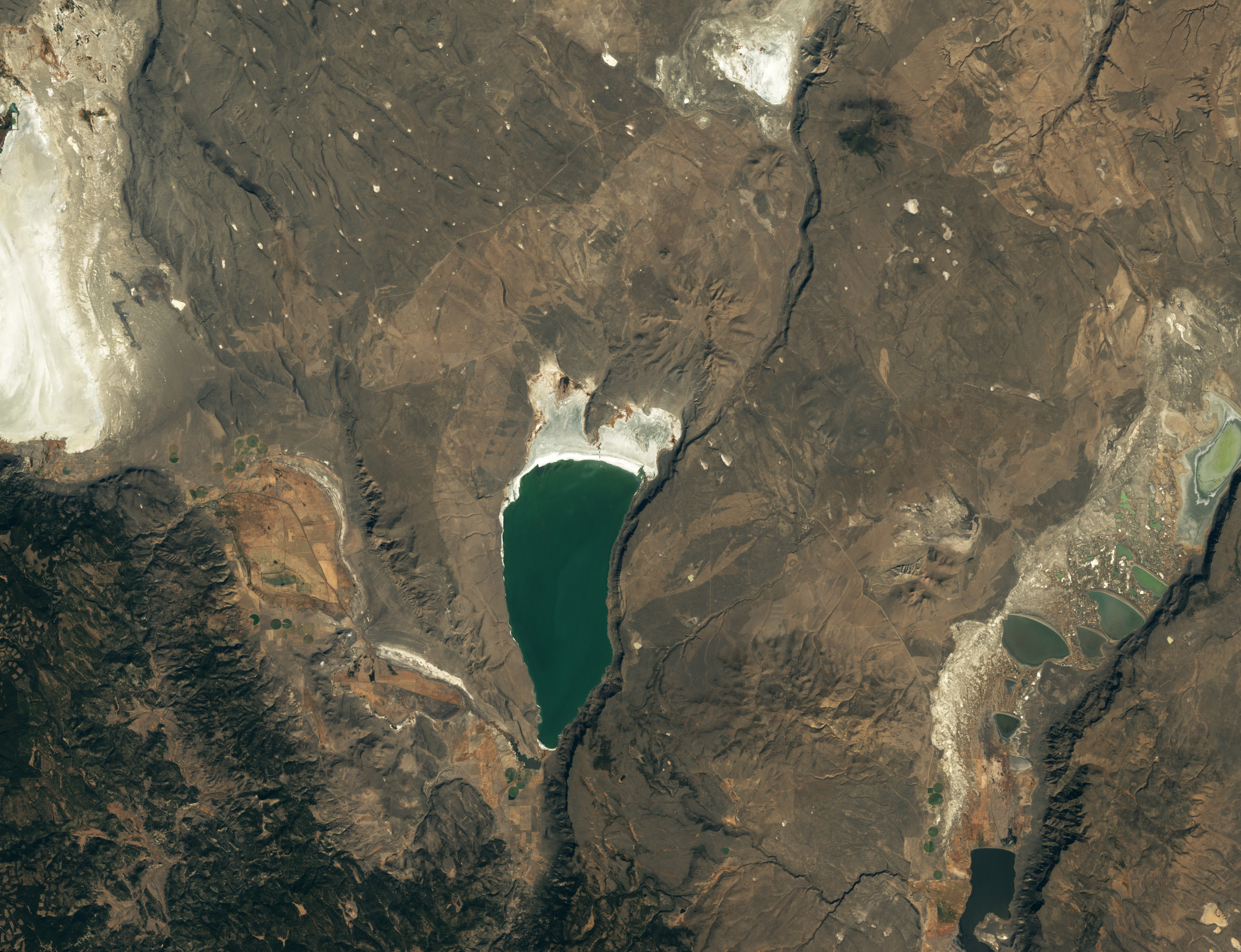
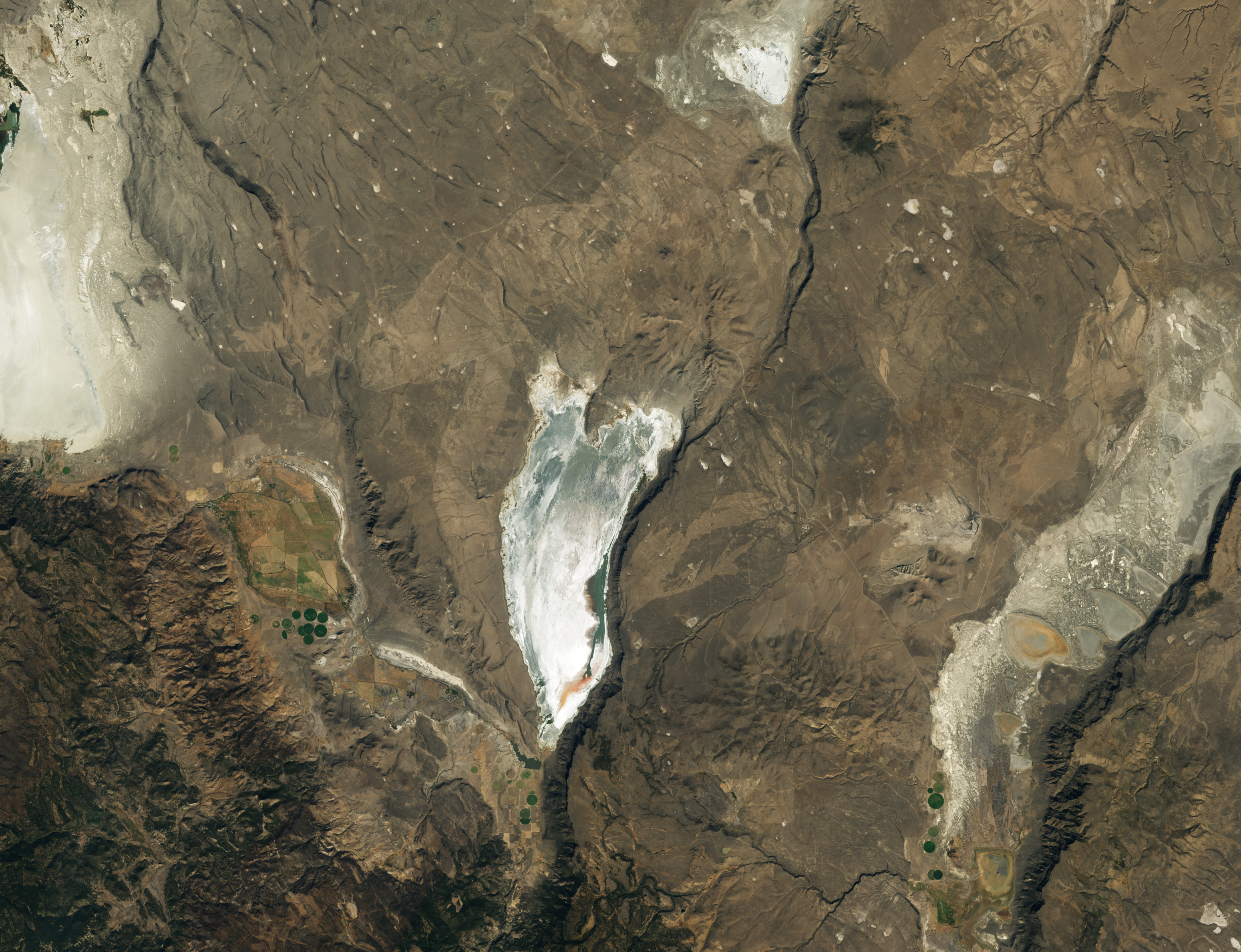
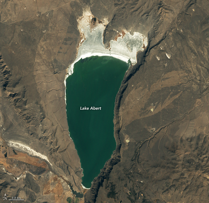
The natural-color image at the top of the page (right) was captured by the Operational Land Imager (OLI) on Landsat 8 on October 18, 2022. A Landsat 7 image (left) shows the same area in October 2002, when water levels were at nearly the highest levels they have been during the past two decades.
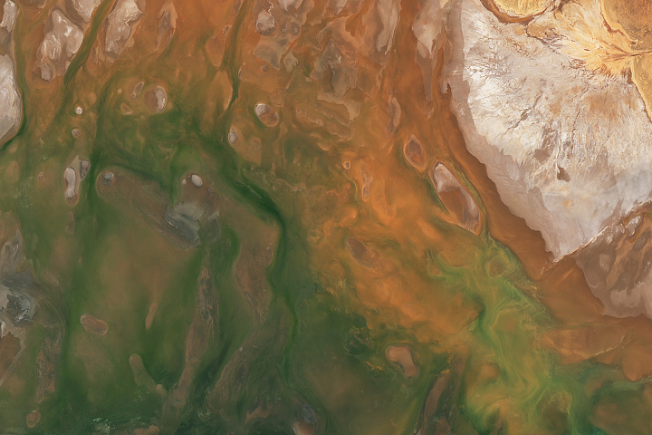
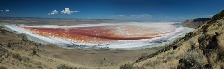
Most of the water still present in the lake in October 2022 likely seeped down from a cluster of springs at the base of the cliffs that make up Abert Rim, a long fault scarp just east of the lake. As the volume of water stored in the lake declined, the water became saltier and more hospitable to blooms of certain types of salt-loving archaea, bacteria-like microbes that turn the water red. The photograph below, taken by Larson, shows red water in the parched lake on October 10, 2014.
Before the water dropped below the gauge, measurements indicated that the water level had dropped by roughly 15 feet (5 meters). What little water remains is roughly 1 to 2 feet (0.3 to 0.6 meters) deep. Water samples collected by Larson show that starting in 2020, the salinity of the water rose above 250 grams per liter (above 25 percent)—more than 10 times higher than salinities in the early 2000s. Brine shrimp and alkali flies in Lake Abert prefer salinities of 30 to 80 grams per liter and struggle to survive once salinity surpasses 200 grams per liter, according to Larson.
Without enough food in the lake, some species of birds are staying away. Ecological data collected by volunteers for the East Cascades Audubon Society indicate that the number of birds visiting dropped by more than tenfold, from more than 250,000 per year a decade ago to 11,000 in 2021—the lowest number recorded in decades.
Among the birds seeing the biggest drop-offs are phalaropes. More than 100,000 Wilson’s phalaropes have come to the lake during past years, where they were known for a unique type of foraging that involved spinning on open water to stir up brine shrimp.
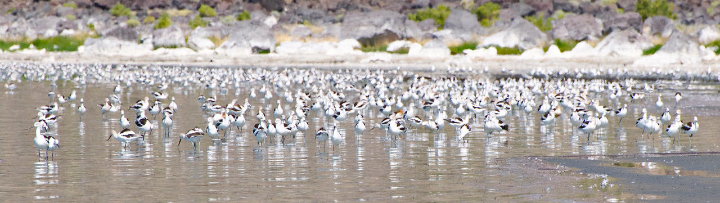
Since 2020, very few phalaropes have been seen at Lake Abert. Eared grebes, another species that requires relatively deep water to forage, have completely stopped coming as well. American avocets and willets, birds that can forage effectively in very shallow water, have shown more resilience and continue to arrive in some numbers. The photograph above shows a group of American avocets foraging in lake mudflats on November 13, 2020, when they were numerous.
Environmental data indicates that temperatures have risen, and less snow is falling in this part of Oregon, likely due to climate change. But water diversions are the key reason that the lake is drying up, according to research conducted by Johnnie Moore, an emeritus geoscience professor at the University of Montana. “Without water withdrawals, the lake would have maintained annual mean salinities mostly within the optimal range of brine shrimp and alkali fly growth,” said Moore.
Recent data from NASA’s OpenET project indicates that irrigated crops near the lake likely consume a large portion of the incoming water from the Chewaucan basin, according to a December 2022 analysis conducted by the Oregon Lakes Association. “We know the pressures on this lake are probably only going to get more intense in the coming years and decades,” said Moore. “The key thing is that we develop better management tools to ensure that this ecosystem continues to exist.”
NASA Earth Observatory images by Lauren Dauphin, using Landsat data from the U.S. Geological Survey. All photographs by Ron Larson. Story by Adam Voiland.