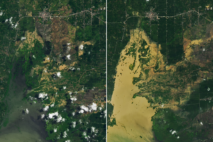

Waves of heavy rainfall left vast areas of eastern Australia under water in October 2022. By the month’s end, swollen rivers flooded landscapes from southern Queensland and New South Wales to northern Victoria.
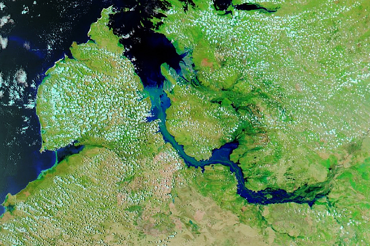
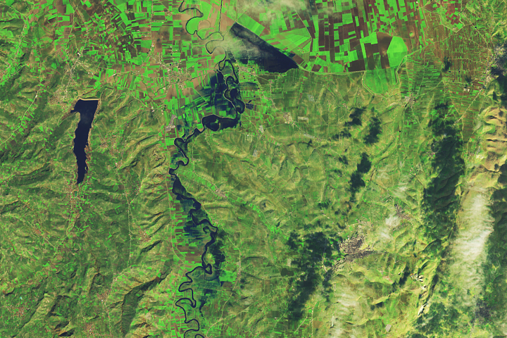
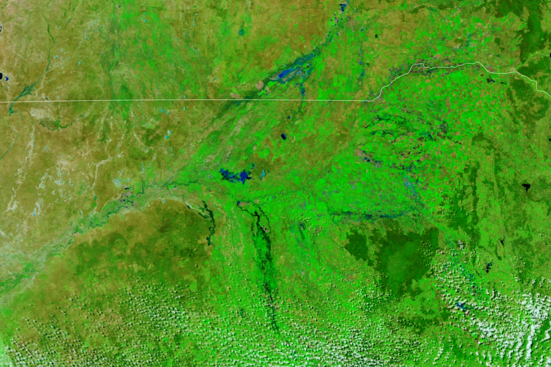
Flooding in New South Wales and along the border in Queensland is visible in this false-color image (right) acquired on October 29, 2022, with the Visible Infrared Imaging Radiometer Suite (VIIRS) on the Suomi NPP satellite. Water appears light to dark blue. Vegetation is green and bare land is brown. For comparison, the VIIRS image on the left shows the same area on September 18, 2022, prior to the month of heavy rain.
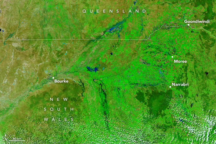
The flooding visible in the October 29 image occurred along permanent and impermanent rivers and streams located about 500 kilometers (300 miles) northwest from the coastal city of Sydney. They are part of the Murray-Darling basin, which includes Australia’s longest system of rivers. The basin saw its wettest October on record in 2022, according to news reports. Rainfall totals across the basin neared 150 millimeters—four times the average for the month and well above the previous record from 1950.
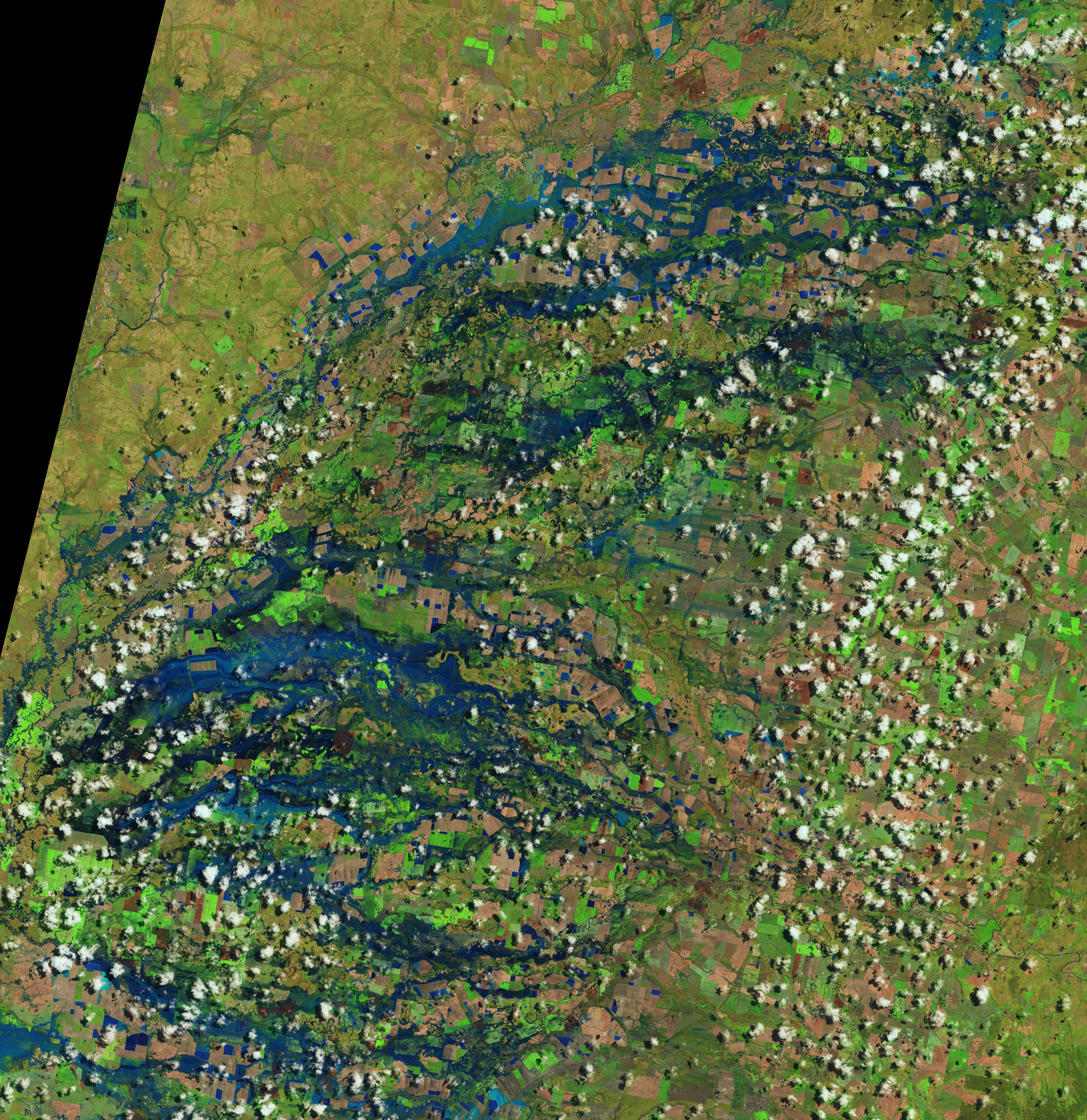
Floodwater in many places had started to recede by the end of the month, but not before devastating thousands of homes and farms. In Moree, New South Wales, about 4,000 people were told to evacuate as water level rose on the Mehi River, leading to the fourth-worst flood on record for the area. According to some estimates, flooding around Moree wiped out 120,000 hectares (460 square miles) of wheat that was almost ready for harvesting.
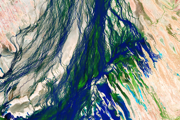
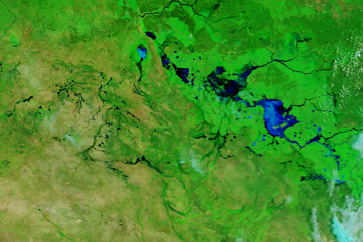
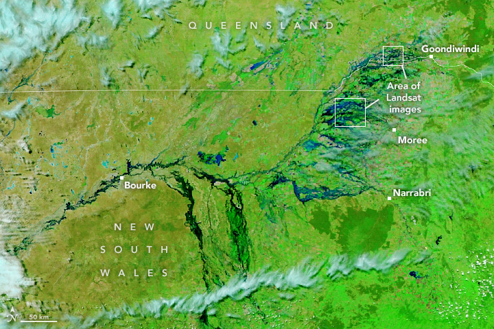
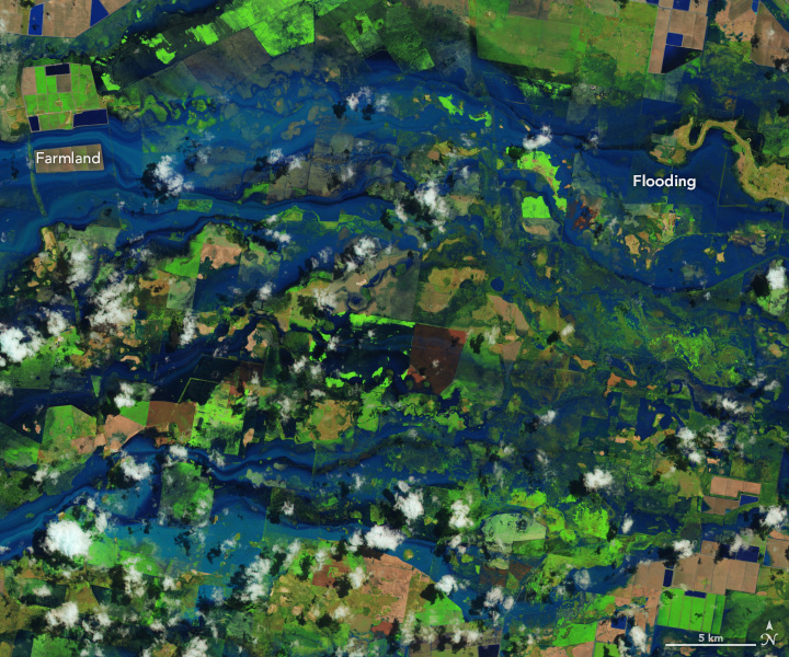
The second pair of false-color images above show detailed views of flooded farmland in New South Wales (top) and spanning the border with Queensland (bottom). Note that some of the blue geometrical shapes contained water prior to the floods. These are likely areas of water storage on farms. The images were acquired on October 27, 2022, with the Operational Land Imager (OLI) on Landsat 8.
The flooding in October 2022 is the latest in a series of major floods to affect eastern Australia since unusually wet conditions began in early 2021. One reason for the wetness is likely La Niña, which for the first time this century has returned for three consecutive years. La Niña events can influence weather in different ways across the planet. In Australia, it usually means heavy rainfall and flooding. According to the World Meteorological Organization, La Niña conditions are expected to continue through at least the remainder of the year.
NASA Earth Observatory images by Lauren Dauphin, using VIIRS data from NASA EOSDIS LANCE, GIBS/Worldview, and the Suomi National Polar-orbiting Partnership and Landsat data from the U.S. Geological Survey. Story by Kathryn Hansen.