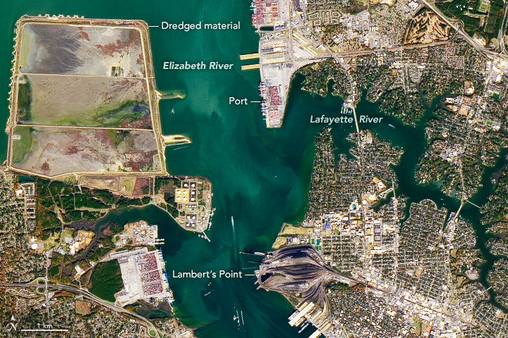
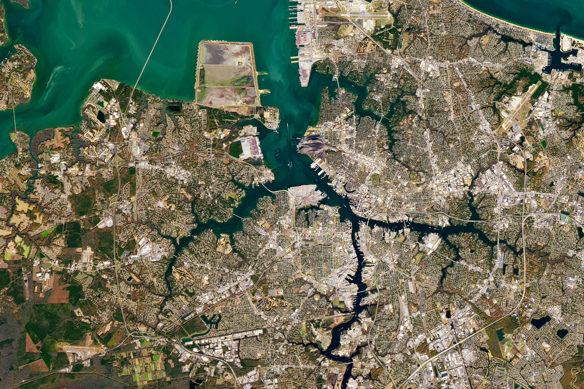
“Roads” may bring cars, trucks, and pavement to mind, but the word has a nautical meaning as well. For sailors, roadsteads are sheltered stretches of water near the shore where it is possible to safely drop anchor. This meaning is what originally gave Hampton Roads—the body of water where the James, Nansemond, and Elizabeth Rivers pour into the mouth of the Chesapeake Bay—its name.
On November 25, 2019, the Operational Land Imager (OLI) on Landsat 8 captured these images showing outflow from the Elizabeth River joining the others in Hampton Roads. The deep, natural channels in this area have defined the character of the region by making it possible for ships to access Norfolk and Portsmouth, Virginia.
Since early United States history, companies and government entities in Norfolk and Portsmouth have been on the forefront of shipping, trade, and defense. Today, Hampton Roads is the largest coal-exporting port in North America, with much of the coal arriving from Appalachia via rail and passing through the Norfolk Southern’s coal terminal at Lamberts Point.
Immediately north of Lamberts Point lie the Norfolk International Terminals, the largest container port in the area. The piers are a nexus where ships, trains, trucks, and cranes come together to transfer vast quantities of cargo. Norfolk is typically among the busiest ports in the United States, trailing only New York and Savannah on the East Coast.
Hampton Roads is also home to the world’s largest naval station. More than 70 ships are based at Norfolk Naval Station, including aircraft carriers, submarines, destroyers, and cruisers. In the wide view above, several piers of the naval station are visible at the top of the image.
For decades, coastal engineers have dredged the channels leading into port to make them deeper and wider. Prior to World War II, much of the dredged material was delivered to open water sites, but in 1946 the U.S. Congress designated Craney Island as a disposal site. In December 2019, dredging began on a new project that aims to make the port the deepest on the East Coast.
NASA Earth Observatory images by Joshua Stevens, using Landsat data from the U.S. Geological Survey. Story by Adam Voiland.