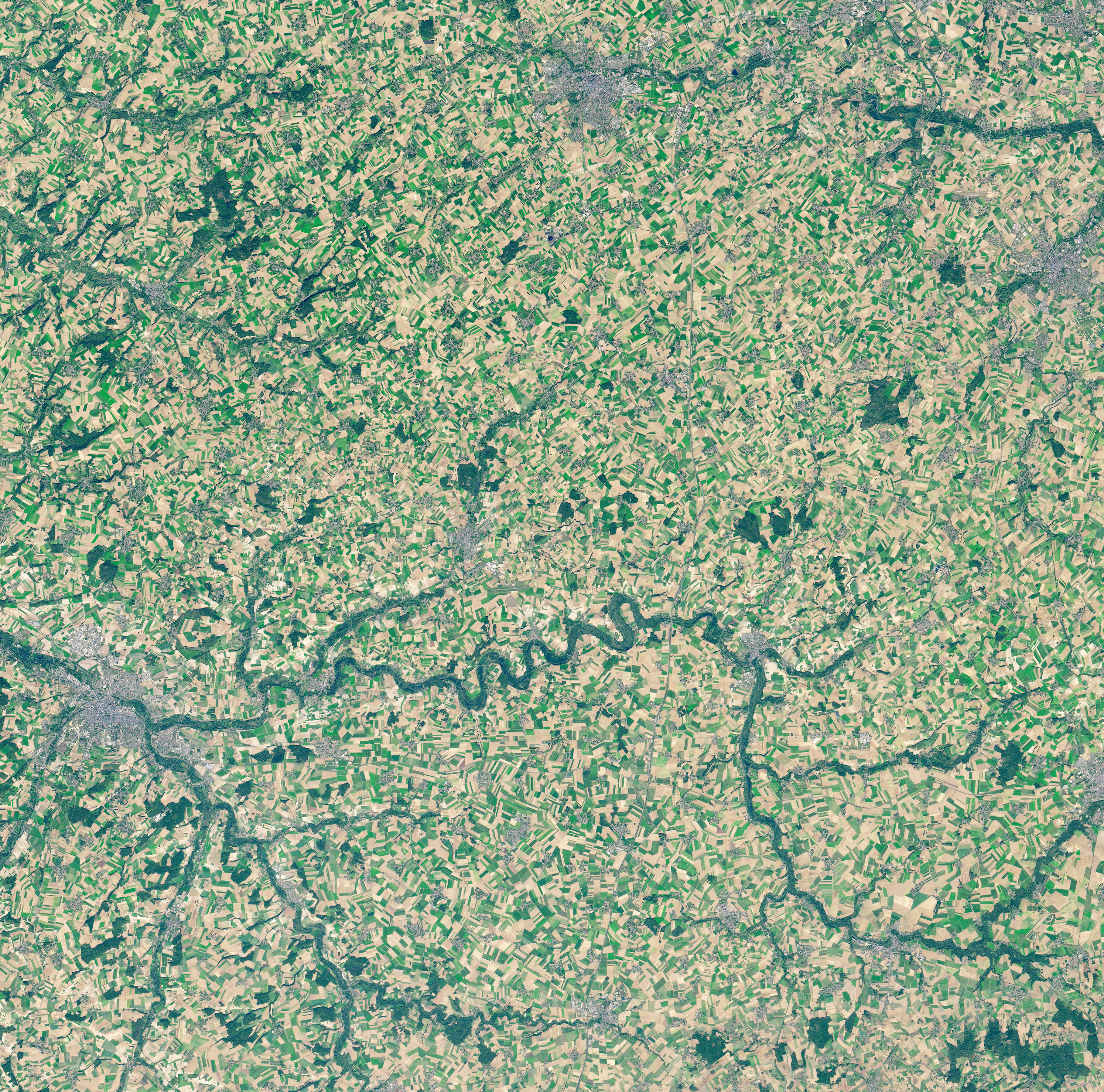
The Somme River winds through an idyllic rural landscape of northern France. Even the name “Somme” comes from a Celtic word meaning “tranquility.” But between July and November 1916, the area around this river was anything but tranquil, as British and French armies fought German armies in the First World War’s Battle of the Somme. With more than a million casualties, it remains one of the bloodiest battles in history.
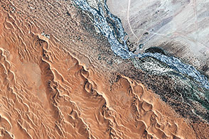
This image, acquired on October 21, 2018, with the Operational Land Imager on Landsat 8, shows part of the area around the Somme and Ancre rivers where the historic battle took place. It has been 100 years since the end of the war and Armistice Day (now Veteran’s Day in the United States), but the countryside’s landscape still carries visible reminders of the battle.
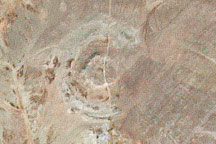
The battle was fought from lines of trenches dug into the ground. Some of the trenches, as well as the craters from explosives, are still visible from the air. One such crater—Lochnagar Crater—is even large enough to be visible from space, appearing in this image as a tiny dot near the town of Albert. The crater is the result of explosives packed into a long tunnel in the ground, detonated on July 1, 1916, by British forces. The explosion produced a crater that measured 100 meters wide and 21 meters deep.
The violent battle is not forgotten. One artist produced 19,240 shrouded figures—the number killed on the first day of the Battle of the Somme—to be on display in a London park this year.
NASA Earth Observatory image by Lauren Dauphin, using Landsat data from the U.S. Geological Survey. Story by Kathryn Hansen.