Editor’s note: The following is a first-hand account of ARISE survey flights by one of the mission’s researchers.
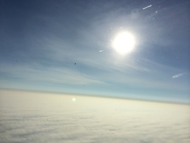
Above the clouds on NASA’s C-130 during an ARISE survey flight. Credit: NASA / Michal Segal Rozenhaimer
Day 1 (Sep-11-2014)
My first ARISE day started early in the morning after a late arrival into Fairbanks on the night before. This important mission’s goal is to map the sea ice and understand the relation between the complex cloud scene over the Arctic, the sea ice and Earth’s radiation budget,the balance between incoming and outgoing sunlight and infrared.
After arriving on base and seeing our instrument (4STAR) on the plane, I am ready to go out there, realizing again that since I am with NASA I get this great opportunity not only to analyze data as many scientists do, but to actually take part in generating this important dataset.
Peering down through a thin cloud layer. Credit: NASA / Michal Segal Rozenhaimer
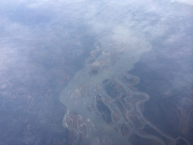
After initial preparations like getting used to the noise on the planeand figuring out how to buckle myself in (none of my degrees were proven useful in this case) we took off to the northern parts of our planet. From this big bird’s view, cutting through various cloud deck formations, seeing land cover, ocean and ice I suddenly grasp the immense variability of this region and how we, as a mobile platform, can bridge satellites and ground measurements by going above, in and below clouds. Yes, as is probably obvious from my text and images, I am interested in clouds!
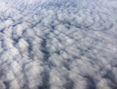
Another view of clouds. Credit: NASA / Michal Segal Rozenhaimer
The 4STAR instrument can measure clouds from below, and can also look at the sun and characterize the thin cloud wisps surrounding the sun in this third image. Harmless as they seem, these cirrus (which means a curling lock of hair in Latin) clouds are hard to detect from space and have a large effect on warming/cooling of our planet.
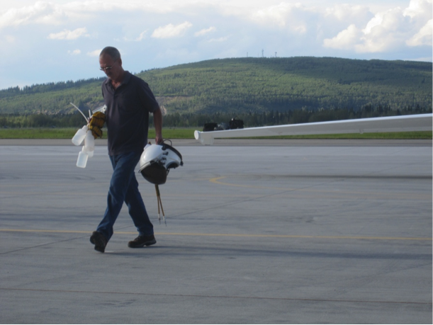
After a seven hour flight it is time to land and think about the next flight.
Day 2 (Sep-13-2014)
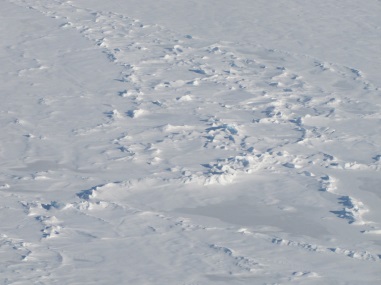
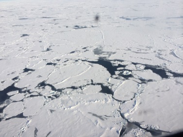
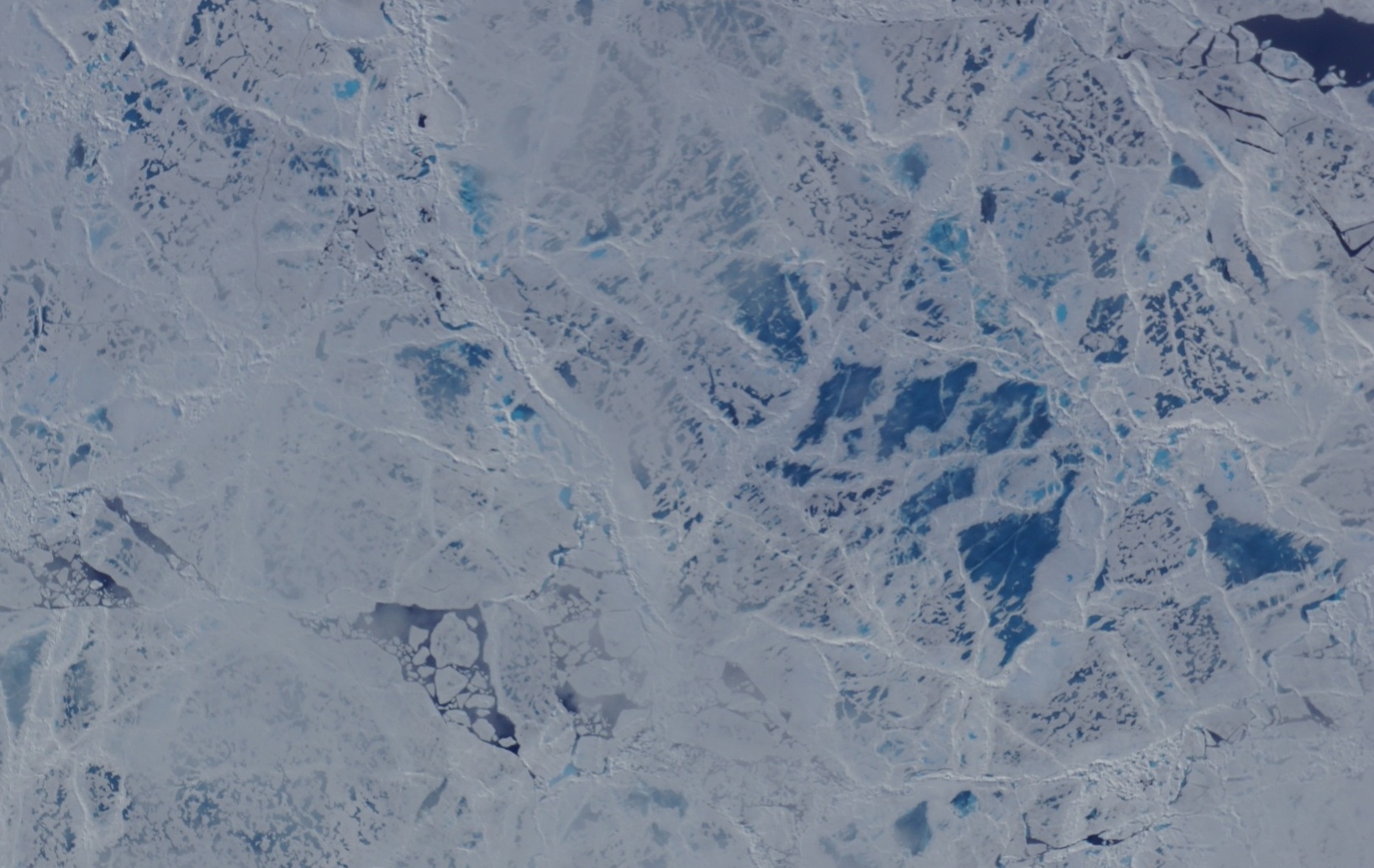
Solid sea ice seen during an ARISE survey flight. Credit: NASA / Michal Segal Rozenhaimer
My second ARISE flight day started with lots of adrenaline and excitement. We would fly low over the sea-ice sheets!
Some regions are broken, with small water lakes in between and some are rock-solid.
Flying so low over the sea-ice makes me wonder whether I’ll be able to detect a polar bear out there.
The views are so awe-inspiring that I am practically out of words or breathe. After eight hours above these amazing surfaces, with some roller-coaster ups and downs, we are back on the ground, and I am with a big smile that will last for many more hours after that.
Broken sea ice seen during an ARISE survey flight. Credit: NASA / Michal Segal Rozenhaimer
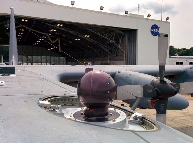
The Spectrometer for Sky-Scanning, Sun-Tracking Atmospheric Research (4STAR) mounted on top of NASA’s C-130 research aircraft.
Credit: NASA
The Spectrometer for Sky-Scanning, Sun-Tracking Atmospheric Research, or 4STAR, is an airborne instrument that measures aerosols (small particles suspended in the atmosphere), gases (ozone for example), and a variety of cloud properties. Currently it is being deployed on the NASA C-130 aircraft on its quest to measure aerosol and cloud properties in the Arctic, helping to answer some of the most difficult questions of climate change: what is the link between sea ice changes, clouds and global warming?
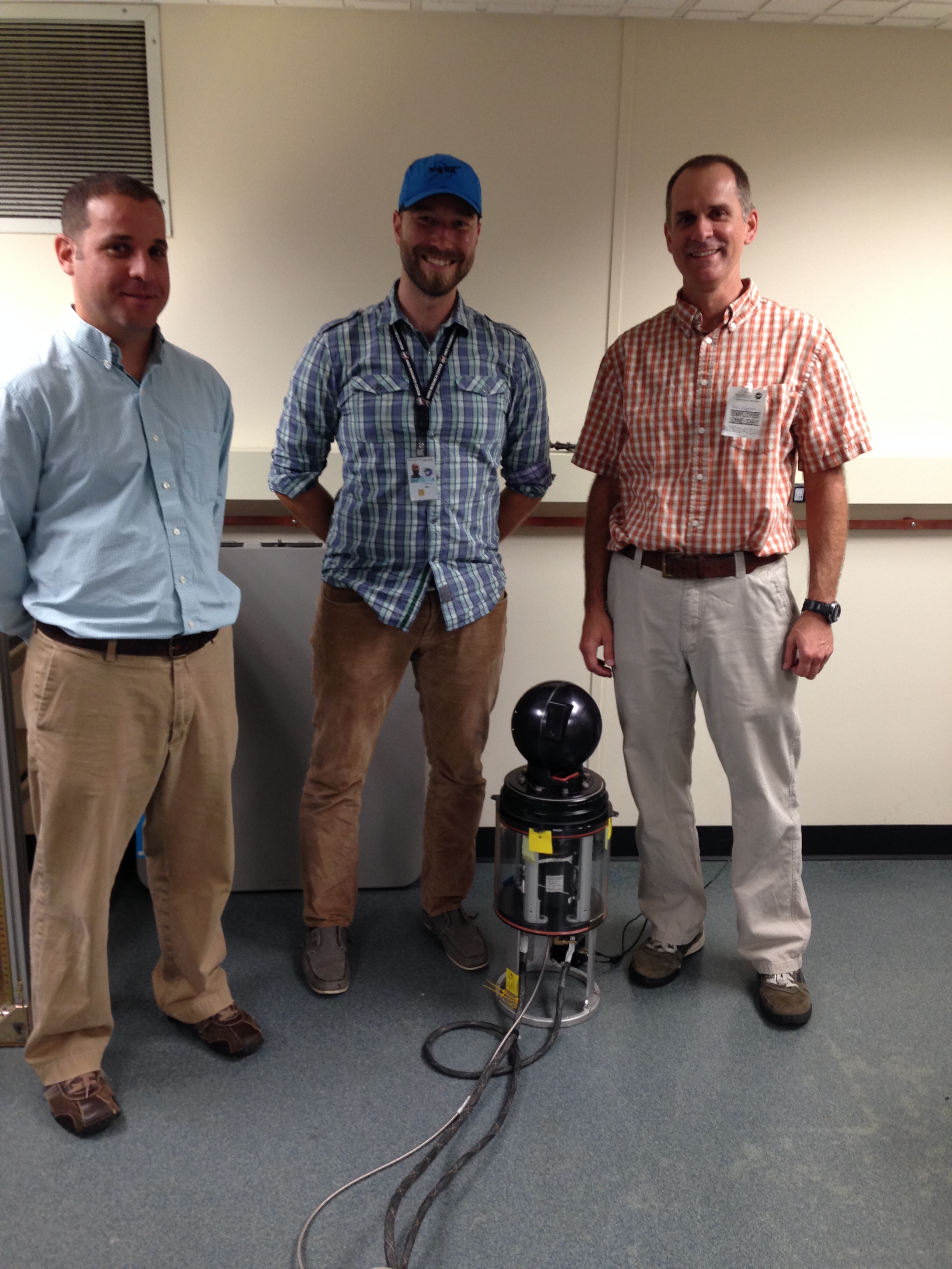
NASA Wallops aircraft office engineer Martin Nowicki (left), and Samual LeBlanc and Roy Johnson of the 4-STAR instrument team pose for a photo during 4-STAR instrument calibration.
Credit: NASA / Christy Hansen
How does it work?
The 4STAR instrument has three different modes. The first of these, and the instrument’s main mode, is Sun-Tracking. This is where the instrument tracks the sun’s location in the sky, staring at it to measure the light transmitted from the sun to the instrument as it travels through the atmosphere. If the atmosphere is clean, we would measure the sun’s intensity. But because the atmosphere contains aerosols, gases and cirrus clouds, which are high, thin clouds made of ice crystals, we measure the amount of light that makes it through instead of being scattered and absorbed by these components of the atmosphere. By comparing measured light through the atmosphere to what we would have seen with no atmosphere we can deduce the amount of aerosol and gases in the air.
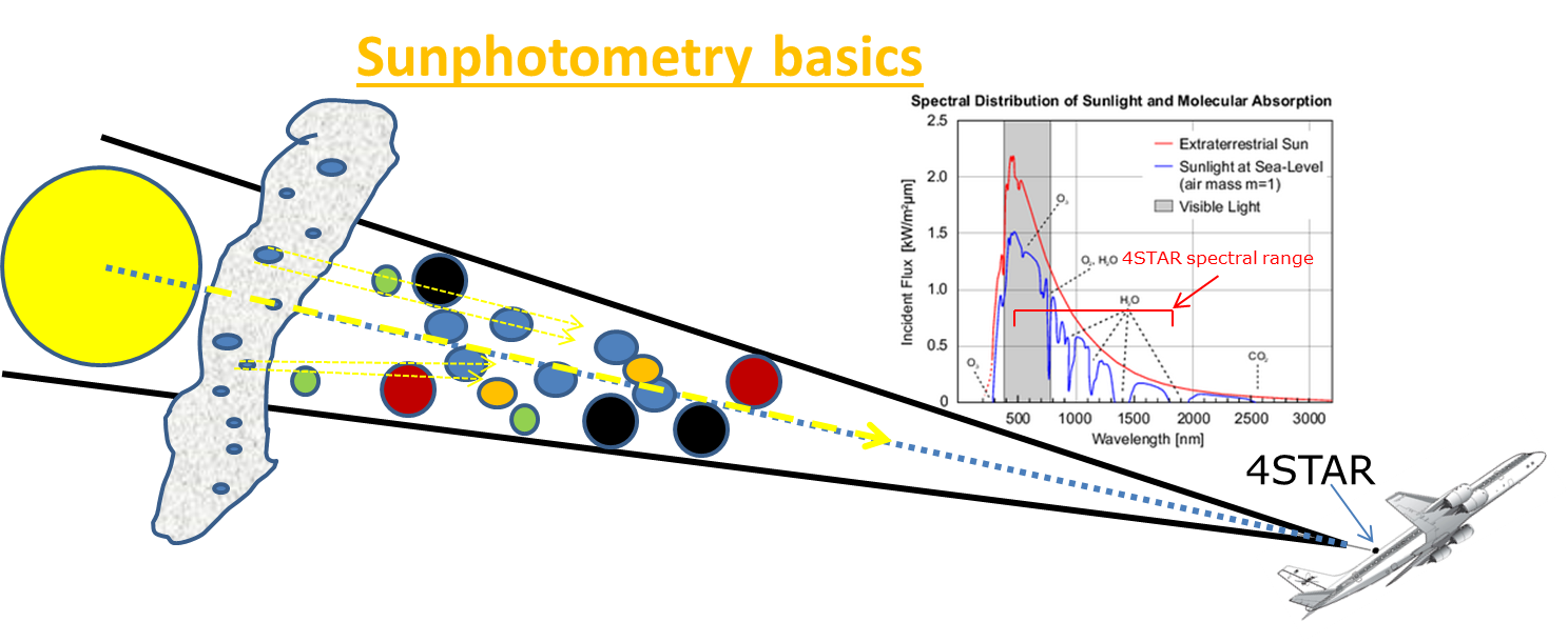
A diagram showing 4STAR’s sun-tracking mode. The instrument locks on to the sun and measures the amount of light that makes it through clouds, gases and aerosols. Comparing this with what would be seen in clear air lets researchers calculate the amount of aerosols and gases in the atmosphere.
Credit: NASA
Another operating mode, which will be used heavily during ARISE, would be the zenith (or upward) viewing mode. Here, we look upward to the sky and measure the diffused radiation that originated from the sun, but now is scattered due to aerosols and clouds. We use this measurement, along with assumptions on ground surface properties, cloud height, and the surrounding atmospheric composition to derive cloud properties such as optical depth (how much light gets through the cloud) and the size of water droplets in the cloud.
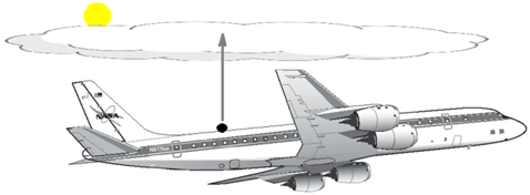
Diagram of how 4STAR measures cloud properties above the aircraft in zenith mode. In this mode, researchers can derive cloud water droplet size and how much light is transmitted through the cloud, or its optical depth.
Credit: NASA
The last and most involved measurement mode we have is the Sky-Scanning mode. Here we measure the diffused sun radiation, that is light not coming directly from the sun, at different distinct angles from the sun (remember that we know where the sun is because we are tracking its location). This radiation is the result of scattered light from aerosols in the atmosphere. The amount of light at the different angles can tell us something about these aerosol particles, such as how well they absorb sunlight (and heat the earth), their shape (sphere or irregular), and their size.
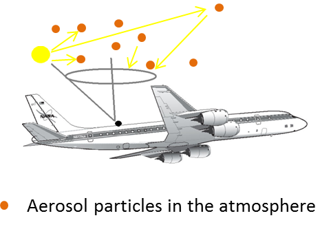
Diagram showing 4STAR’s sky-scanning mode. The instrument scans the sky above the aircraft to measure how light is scattered by aerosol particles in the air.
Credit: NASA
A new NASA airborne campaign known as ARISE, or the Arctic Radiation – IceBridge Sea and Ice Experiment, will take measurements intended to help researchers better understand the role that clouds play in Arctic warming as sea ice conditions change. From Sep. 3 to Oct. 3, researchers flying aboard NASA’s C-130 research aircraft will measure incoming and reflected sunlight, thermal infrared radiation, ice surface elevation and various cloud properties to gain a better understanding of changes to the Arctic climate.

NASA’s C-130 research aircraft sitting in the hangar at Wallops Flight Facility as it is being prepared for the ARISE field campaign. Credit: NASA / Christy Hansen
For the past few weeks, aircraft technicians and instrument experts have been preparing the C-130 for its upcoming trip to the Arctic. A large part of this process was installing and testing the scientific gear that the ARISE team will use to collect data on clouds and ice.

Land, Vegetation and Ice Sensor (LVIS) instrument and control racks aboard the NASA C-130 research aircraft seen during instrument integration at Wallops Flight Facility in Virginia. LVIS is a laser altimeter that will be used to measure land and sea ice elevation during NASA’s ARISE campaign.
Credit: NASA / David Rabine
Once the instruments are installed and tested on the ground, the ARISE team carried out a pair of check flights – one to make sure the C-130 is flying in peak condition and one to verify that the mission’s various instruments are working properly.
A view of NASA’s C-130 research aircraft seen from the T-34 chase plane during the ARISE engineering check flight on August 24, 2014.
Credit: NASA / Dennis Rieke and Mark Russell
For the next few weeks, the ARISE team will fly out of Eielson Air Force Base, Alaska, to collect data on Arctic ice and clouds.
For more than 65 hours this month, NASA’s high-altitude ER-2 aircraft flew from Fairbanks over melting sea ice, glaciers, forests, permafrost, lakes, volcanoes and more. It zigged and zagged over the Beaufort Sea, and soared straight over the Bagley Ice Field.
The goal: to use a laser altimeter called MABEL to take elevation measurements over specific points and paths of land, sea and ice. To hit these marks, scientists and pilots painstakingly designed and refined flight routes. And then they adjusted those routes again to capture cloud-free views – a tricky proposition in a giant state with mountains creating complex weather systems.
A camera on the MABEL instrument captured pictures of cracked sea ice, dotted with melt ponds, during a flight to the North Pole. (Credit: NASA)
“We have targets to the north, targets to the south, and mountain ranges blocking both,” said Kelly Brunt, a research scientist at NASA’s Goddard Space Flight Center who was MABEL’s science flight planner.
Scientists studying forests, glaciers, water and more are using MABEL data to develop software programs for the upcoming ICESat-2 satellite mission, and sent Brunt lists of what they would like to be included in the Alaska campaign.
“We get everybody’s input, and start to put it on a map,” she said. She drafts routes with targets in similar weather patterns, so that if one is clear the others are likely to be as well. However, often targets are removed from a route, based on the weather assessment from the morning of the flight. During the deployment, routes are also constructed to target specific sites that were missed during previous flights for either weather or aircraft reasons. Lots of the work goes into straightening the flight line, Brunt said, since when the aircraft banks at 65,000 feet, the laser instruments swivel off their ground track and the scientists can lose miles worth of measurements.

The MABEL campaign’s July 24 flight route covered glaciers, ice fields, forests, the Gulf of Alaska and more. (Credit: NASA)
One flight to measure sea ice was pretty direct – it took the pilot straight to the North Pole over one longitude line, circled around and came back on another. A second route involved a zig-zag pattern over the Arctic. But both routes were designed to capture a range of summer ice conditions, including melt ponds, large stretches of open water, and small openings in the sea ice, known as leads.
Flights over Alaska itself were often mapped to pass over glaciers, lakes, ocean moorings or even tide gauges that others have measured before, to compare with the data MABEL collected. Students from the Juneau Icefield Research Program (JIRP) assisted MABEL researchers by providing ground-based GPS validation for a mission that flew over the upper Taku Glacier, close to a JIRP camp. And the MABEL team collaborated with NASA Goddard scientists flying a different instrument, called Goddard’s LiDAR, Hyperspectral and Thermal (G-LiHT) Airborne Imager – the two campaigns flew some of the same paths over interior Alaskan forests.
NASA ER-2 pilot Denis Steele, in a pressurized flight suit, before a July 16 flight over Alaska’s glaciers. (Credit: Kate Ramsayer/NASA)
From Fairbanks, Brunt worked with the campaign’s two pilots, Tim Williams and Denis Steele, to ensure the routes would work with the ER-2’s capabilities; and with weather forecasters to determine where to best focus efforts the following day.
In all, the campaign flew 7 flights out of Fairbanks. And today, the ER-2 – with MABEL aboard – flies back to California, collecting even more data about the elevation of the landscape along the way.
As the ER-2 pilot got ready for his first flight out of Fairbanks, I wondered what it’s like piloting the aircraft, all by himself, 65,000 feet up.

Denis Steele sets up a video camera in the cockpit of the ER-2, 65,000 feet over Alaskan mountains and glaciers. (Credit: Denis Steele/NASA)
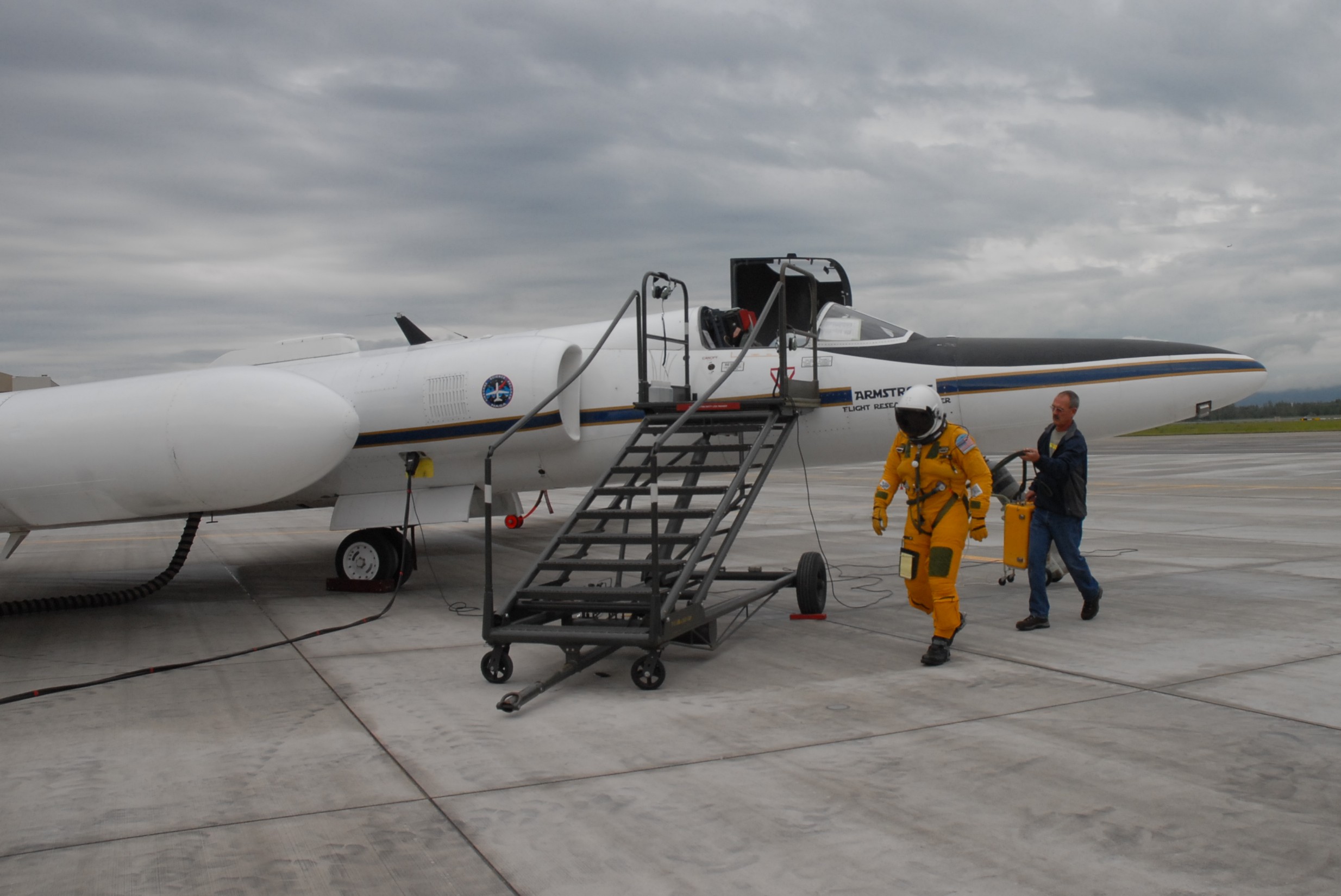
The NASA ER-2 pilots for this campaign, Tim Williams and Denis Steele, are flying the MABEL instrument to study the glaciers and ice sheets. Before they fly, they have to get suited up. It’s quite a process. Because the altitude is so high, they need to wear pressure suits. I talked with expert NASA engineer technicians Raul Cortes and Ryan Ragsdale, who are veterans in testing equipment and prepping pilots before a flight to ensure safety.
The involved process starts the day before a flight, when Cortes and Ragsdale prepare the pressure suit. They check the pressure and make sure there are no leaks in the gloves, body suit, and helmet. They put the whole system together and inflate it, like a giant balloon character, to test that the suit will properly pressurize.
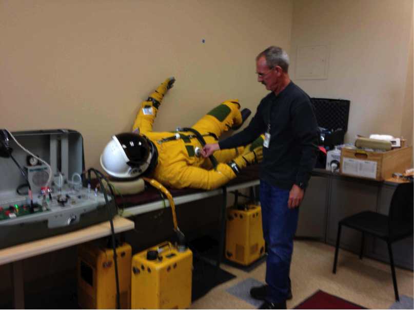
Engineer Technician Ryan Ragsdale of NASA Dryden inflates the pressure suit the day before to make sure there are no leaks. (No, there is not a real person in there!). (Credit: Valerie Casasanto/NASA)
When a pilot puts on the suit, it’s bulky and stiff, so it’s difficult to work in. And it’s difficult to eat in. During the long flights, pilots eat and drink out of a straw.
The food is the consistency of pudding, and the straw feeds through a small hole in the helmet of their pressure suit. I asked what was on the menu for one flight. They have a choice that includes beef stroganoff, pears, caffeinated chocolate pudding (which happens to be Cortes’ and ER-2 crew member Luis Rios’ favorite). I was curious about this chocolate pudding, but given a free sample of the “pears” — which tasted like part baby food, part applesauce, with a pear afternote.
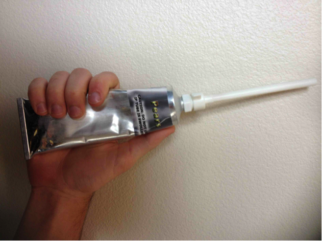
Pears in a tube. (Credit: Valerie Casasanto/NASA)
The caffeinated chocolate pudding used to be Williams’ favorite until he switched to the caffeinated apple pie. Mmmm, wonder if there are crusts in there too. When Steele first started flying, he ate the tube food. But sometimes it would get messy. One time a pilot was heating up a “sloppy joe” tube and it accidentally squirted out all over the cockpit. Now Steele just drinks water. You can easily dehydrate up there since you are breathing pure oxygen.
I thought it must be pretty confining in that suit with not much room to move, so talked with the Steele and Williams to see what the space is like for their 8-hour journey. The cockpit seemed to be about the size of half of a bob sled. Or, according to Steele, “if you throw a blanket over your head and body and lift your arms out a little, it’s that area between you and the blanket.” Just a little bit of room to move around, and a bit of leg room (unless a pilot is really tall). However, it doesn’t feel claustrophobic, Williams said, because they have good visibility.
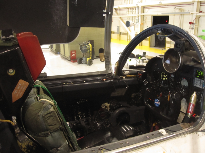
The ER-2’s cockpit, with little room for movement. Credit: Valerie Casasanto/NASA
When they’re up in the stratosphere, pilots keep a close watch on the plane’s instruments, Steele said. “You are always thinking – watching the instruments, doing science, mental math, calculations, thinking about what you would do in an emergency situation.”
They even do puzzles. On one flight last week Williams did Sudoku to keep entertained. You can also plug in to play music, although there are stories of colleagues playing tricks on the pilots, and programing in Disney music prior to flight.
Long flights at high altitudes do have effects, Steele said, and pilots need to be careful and not exercise too much after they land.
Ryan Ragsdale carries empty water bottles and pilot’s helmet back to hangar after a long day’s flight. (Credit: Valerie Casasanto/NASA)
“Being at 60,000 ft. does drain you, especially if you are working hard,” he said. “The time you are working hardest is when you take off and land. The pilot does a lot of movements to keep the plane stable at low altitudes. It wears you out. But you get used to it, it’s like driving a car!”
