By Ryan Walker

Our second day of installing equipment was on November 21. After a cloudy day off, we had perfect sunny weather.
We began by installing our two tilt meters at Comein Glacier, which flows into the Nansen Ice Shelf through a small inlet just north of the much larger Reeves Glacier. Most of an ice shelf floats freely up and down with the ocean tides, and the ice only flexes in a relatively narrow band between the floating ice shelf and the grounded glaciers that flow into the shelf. We chose this location (about 35 miles upstream of the ice shelf front) because the flexure zone is particularly wide (over three miles) and there is a broad strip of over 900 yards of ice that floats at high tide and rests on the ground at low tide. (We know this thanks to satellites that measure the height of the ice surface using lasers or radar, and to comparisons between satellite radar images that detect ice motion.) As it turned out, this area is the most spectacular place we’ve yet visited, surrounded by gleaming white snow- and ice-covered peaks.
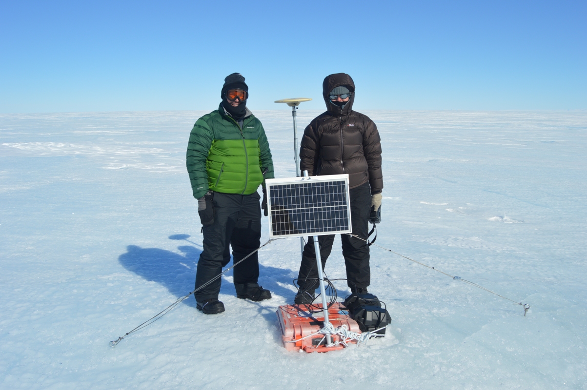
Installing tilt meters is rather tricky, since the instrument has to be almost perfectly level. After two Korea Polar Research Institute safety guides checked the area for crevasses (large cracks in the ice), we dug through about two feet of snow before finding solid ice. To keep the tilt meter level, we constructed a table from a piece of plywood supported by three aluminum pipes drilled into the ice. The pipes passed through holes drilled in the plywood, which rested on hose clamps fastened around the pipes. By adjusting the hose clamps, we leveled the plywood before placing the plastic case containing the tilt meter on top of the table. The tilt meter itself has a triangular base with three adjustable screws so it can be leveled on top of a flat plate at the bottom of the case. To do this, I had to attach a cable from the tilt meter to my computer to get readouts of the angles while Christine very carefully adjusted the screws. Once we were satisfied that the instrument was level, we hooked up a solar panel and battery for power, just as we did for the GPS stations. Finally, we buried the case and table in the snow to prevent any melting of the ice supporting the table, which could put the instrument out of level.
After sandwiches and coffee in beautiful sunny weather (certainly the most scenic picnic lunch I’ve ever had), we took some time for a school outreach project that Christine will tell you about. Then we flew back out onto the Nansen Ice Shelf (which is much windier) and installed our two remaining GPS stations with no trouble (other than a chilly half hour waiting for the helicopter to return) to complete a successful day in the field. Now we need to wait about two weeks before collecting data, so that we can see what happens to the shelf as the ocean tides go through a full cycle from spring (largest difference between high and low tide) to neap (lowest difference).

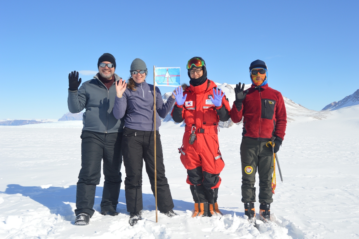
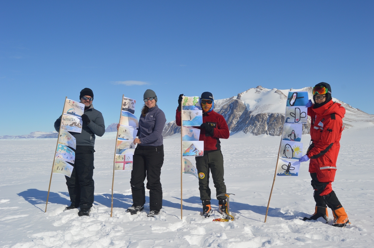
Christine says: I’m involved in a program coordinated by the United Kingdom Polar Network called “The Antarctica Day Flags Initiative”. School classes design flags for Antarctica Day (which is December 1, the anniversary of the signing of the Antarctic Treaty in 1959) and then scientists and researchers take them to the Antarctic and take photos of them out in the field. I had 21 flags from two schools (Yardley Hastings and Northrepps Primary) so we attached these to poles and took some pictures in front of some beautiful icy cliffs with our Korean colleagues.
By Brian Walker
November 19th — After the final cargo flight on November 17th, we finally had all our equipment and could prepare for installation. This wasn’t without some drama, as we initially received only four batteries and various pipes, but none of the actual instruments. After a few tense hours of emailing, we found that the rest of our gear had accidentally been sent to the Italian Mario Zucchelli Station, so we would be fine. (Zucchelli and Jang Bogo are within sight of each other, about six miles apart on opposite sides of a bay which is currently frozen over, so the Italians and Koreans share flights.) Christine joined a group taking a tractor drive over to Zucchelli the next day and retrieved the misplaced equipment. After a long day of testing our GPS units outside in high winds and organizing the equipment in a slightly cramped laboratory building, we were ready to go the next morning.
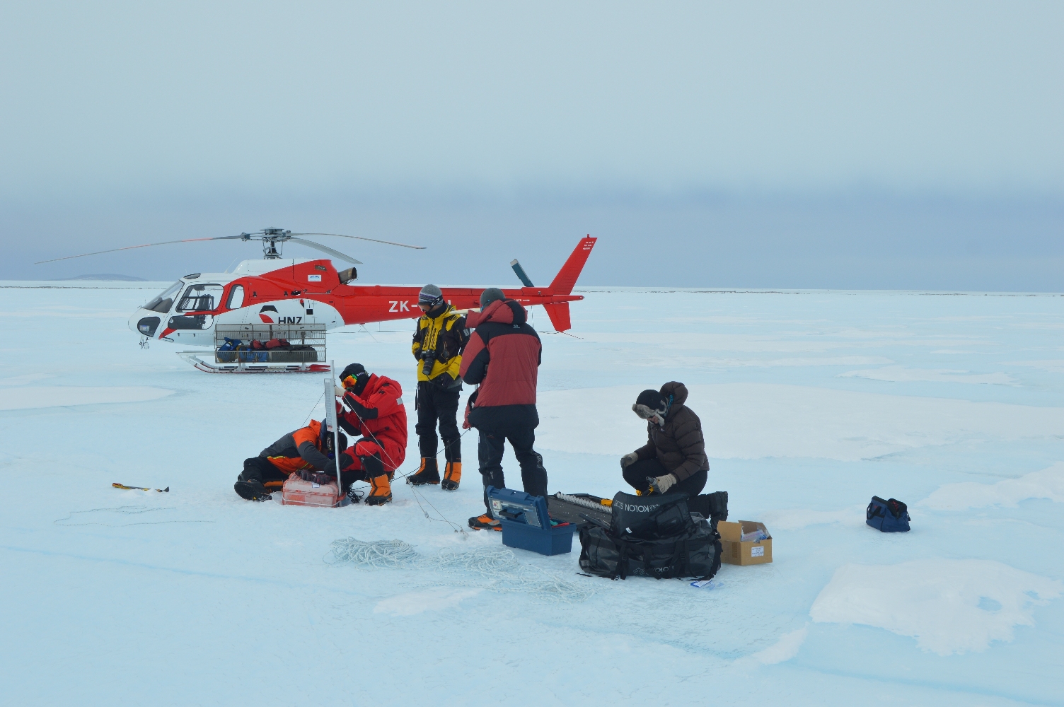
We were fortunate to begin the day with good weather, and due to a slow schedule, we had both helicopters. This allowed four Korea Polar Research Institute (KOPRI) personnel, including a safety guide, to join us. With their help, we were able to install the GPS stations much more quickly (sometimes in as little as half an hour) than we would have been able to manage by ourselves.
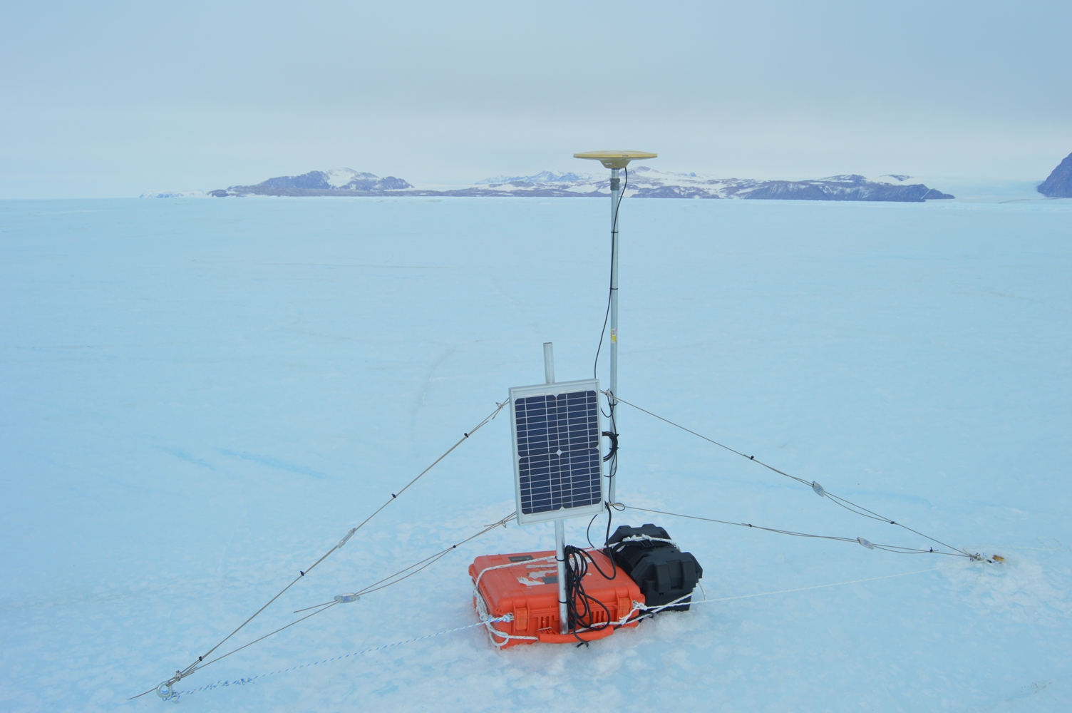
Our GPS systems include a disk-shaped antenna that receives satellite signals and a computerized unit that processes and records data. With good processing after the stations are retrieved, we should get positions accurate to about half an inch, which will allow us to study the vertical and horizontal motion of the ice shelf, especially the effect of ocean tides. The stations also include a solar panel and a 12-volt battery (essentially a car battery) for power. To install a station, we wire the receiver (the computer), which stays inside a weatherproof plastic box the size of a carry-on suitcase, to the antenna, solar panel, and battery. The antenna is mounted about five feet off the ground on the end of an eight-foot steel pole sunk into a three-foot drilled hole. The solar panel is mounted on a shorter pole that also passes through the carrying handle of the plastic receiver box, so that it’s much harder for the receiver to blow away — a constant threat with a slippery ice surface and high winds. Wires attached to anchors drilled into the ice secure the solar panel, and the battery is firmly strapped to the receiver box. Where necessary, we used ice axes to chop roughly six-inch deep holes for the receiver box and battery to rest in. For the poles and anchors, the final step was to pour water into their holes, which instantly froze and locked them into place.
We had planned on installing two GPS stations, then returning to Jang Bogo to reload the helicopters and installing the remaining three in the afternoon. However, heavy cloud cover started to blow in as we installed the first station of the afternoon. Clouds diffuse sunlight and create an effect called “flat light”, in which depth perception of white snow and ice surfaces becomes difficult. This obviously isn’t good for flying helicopters, so we returned to the station early to be safe. It was still a good day, with three GPS stations successfully installed. Two GPS stations and two tilt meters remain to be installed when weather and flight schedules permit.
By Ryan Walker
On our first full day at Jang Bogo, we weren’t expecting very much to happen. The majority of our equipment wouldn’t be arriving for another three days, so we thought we would settle in and learn about the basic amenities of the station — food, showers, laundry, wifi, espresso machine. (I’m not joking, there really is an espresso machine. You can learn all sorts of unexpected skills living in Antarctica.) But then the day turned out to be sunny and clear, perfect for flying, and one of our collaborators, Dr. Hyeon Jae Yoo, came and told us that he had reserved a helicopter for that afternoon to scout out our field sites.
Choosing field sites can be rather tricky. We had spent quite a while looking at satellite images and computer model output in order to estimate where the processes we wanted to study would likely be strongest. For GPS measurements of ocean tides causing ice motion, we wanted to be more in the middle of the ice shelf, away from the islands and rocky outcrops that pin its margins in place. For tilt meter measurements of ice shelf flexure, we would need to be near the landward edge of the shelf — most of an ice shelf floats freely up and down on the tides, and the bending happens in a narrow strip (maybe a few kilometers wide) between the floating ice and the ice resting on the land. Field site selection is then a balance between finding the ideal place to collect data and finding places where you actually can collect data. Crevasses (large cracks in the ice), very uneven ground, and ponds formed by melting of the ice surface can all prevent setting up instruments. In the end, it’s essential to get an in person look at your sites, preferably before you’ve dragged all your equipment there.
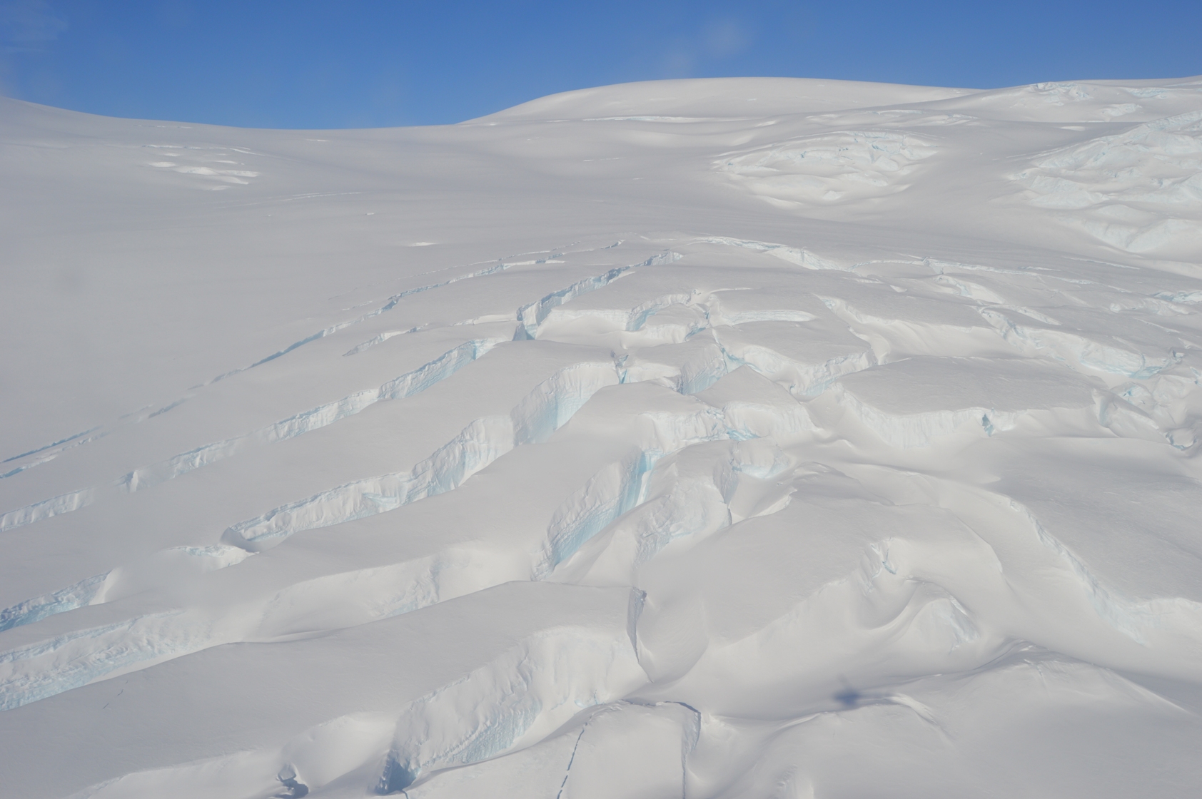
Large crevasses in the ice.
This was my first helicopter flight, and since it was my birthday (what a celebration!) Hyeon Jae and Christine insisted I should sit up front. Taking off is sort of like riding in a glass elevator. Flying in a helicopter is very different from flying in an airplane. Being able to go low and slow (or hover) gives great views. We were able to circle our GPS sites at about 10 feet off the ground, and touch down briefly (with the rotors going) at our tilt meter sites to test the firmness of the snow. Our GPS sites are all on blue ice, with no snow cover, and look favorable for installing the instruments. We’ll just have to shift a few of them a short distance so they’re on ridges rather than hollows — although the ice is pretty flat, this matters when the ice surface starts to melt later in the summer and the water flows downhill. Our tilt meter sites are on a snow-covered area, so we will have to dig down to ice (or at least very firm snow) to get a solid base so we can install the instruments level. This is really important because the ice only bends a little, so the tilt meters measure angles less than half a degree. (That’s a little less than 1 foot up per 100 feet across.)
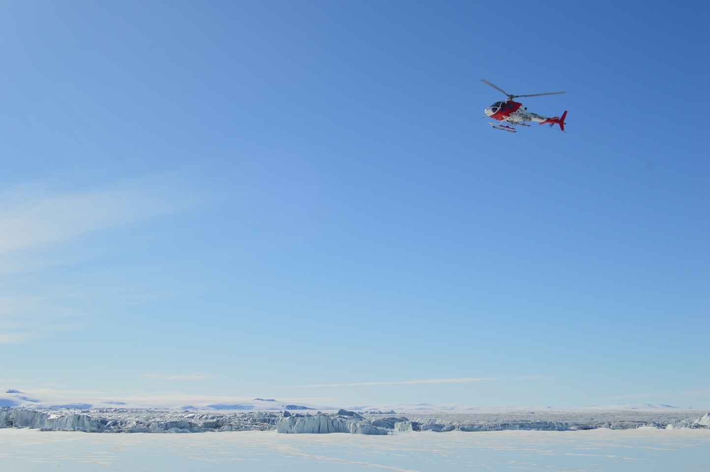
Overall, we were very happy with the results of this flight. Our field areas look good, and we got truly spectacular views of the ice shelf and the rocky hills surrounding it. I shot video with a NASA-provided GoPro, and it came out great, even though all I had to do was point the camera at the windscreen and try to hold it still. The files are too large to post from Antarctica, but the best scenes should be part of the final video that Goddard will produce when we’re back home. Thanks to our pilot, Dominic of Helicopters New Zealand, for a smooth and safe flight.
By Christine Dow

Christine Dow and Ryan Walker, setting foot in Antarctica.
We made it to Antarctica in one piece! After a delightful 3 am start, we boarded the Safair plane that was to take us to the Antarctic along with Korean, Italian and French scientists. What followed was a somewhat chilly, noisy, cramped 7-hour flight. However, the views out our tiny window as we approached and then flew over Antarctica made it all worthwhile. We landed on a sea ice runway in front of the Italian Zucchelli station, with an impressively long run in, and then stepped out into bright sunshine and a “refreshing” breeze. The Antarctic! What a spectacular place. We were surrounded by mountains and ice and sea ice as far as you can see. Ryan traveled the 7 kilometers to Jang Bogo in a “Piston Bully” tractor, but I was lucky enough to get driven over in a specially adapted Kia SUV with heated seats. What luxury! On the way over, we drove past some basking Weddell seals and seal pups enjoying the sunshine.
Jang Bogo from the outside looks like a space ship and the inside does not dispel this imagery. It was only built in the last couple of years and has all the mod cons. There’s a greenhouse, hospital area, small gym with climbing wall, espresso machine, wi-fi throughout, and even humidifiers in each room. An intercom announces meals with cheery music (including breakfast at 6:50 am, which is a slightly disconcerting way to wake up if you’re not expecting it). The best thing by far is the view from the window. I can see an impressive iceberg, some more seals and the terminus of Campbell glacier. Flags from the countries representing the people staying at the base are flying outside including Korea, Japan, New Zealand, the US and the UK.
We were only able to bring one GPS and one tiltmeter with us because of weight restrictions on the plane. The rest of our equipment will arrive next week. In the mean time, we are going to have to examine the planned field sites so we are expecting a helicopter flight soon. More on it later!
By Ryan Walker
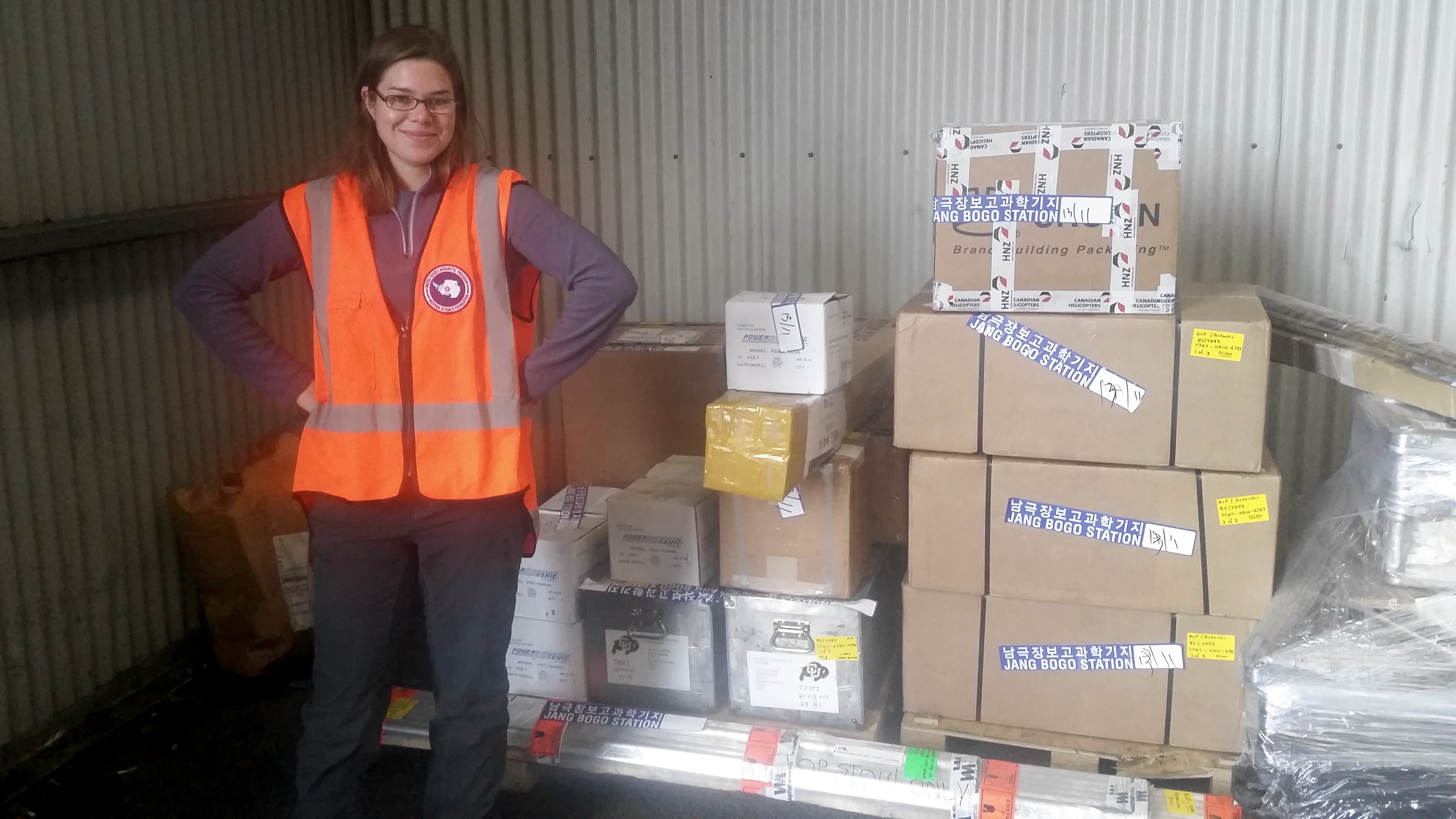
Christine stands near to our instruments and equipment, ready to be shipped to Antarctica.
We arrived safely in Christchurch, New Zealand. On Wednesday morning we went over to the International Antarctic Centre to check up on our instruments and equipment. We have five GPS receivers for measuring horizontal ice motion, and two tilt meters for measuring the angle of the ice shelf as it flexes with ocean tides. (We borrowed these instruments from Sridhar Anandakrishnan of Penn State, and will collaborate with him to analyze the data.) Each GPS or tilt meter fits in a plastic case about the size of a carry on suitcase. However, for powering the instruments, we also need solar panels and car batteries (which weigh over 30 pounds each). There are also tools (such as an ice drill — thanks to Bob Hawley of Dartmouth) and over 125 feet of metal pipes that we will use to mount the solar panels and satellite antennas for the GPS. All together, it’s close to 600 pounds of equipment — some shipped from Goddard, and some ordered in New Zealand — so it was a huge relief to see everything in good shape and in the right place.
We found that the batteries had a slightly different type of terminal than we had expected. In order to make a firm connection between the batteries and instruments, which is critical because the stations will be deployed for roughly three months, we had to find specific size bolts and nuts and other wiring components. We spent the rest of the morning visiting a hardware store (twice), an automotive store, and a computer store before successfully finding the parts we needed. Not terribly exciting, but necessary, and handling this sort of issue is a big reason why we arrived in Christchurch a few days before our flight. We did manage to have some fun in the afternoon by visiting the Canterbury Museum, which has historical, cultural, and scientific exhibits and is adjacent to a large and beautiful botanical garden.
Tomorrow afternoon, we’ll be back at the International Antarctic Centre to meet up with the Italian Antarctic program for about an hour’s worth of basic preflight safety training. (Because their stations are nearby, the Korean and Italian programs share flights.) We’ll find out tomorrow exactly what time our flight leaves, but we already know it will be quite early in the morning. It’s a roughly 6 hour flight down to the ice runway at Italy’s Stazione Mario Zucchelli, and we’ll need to wear full Antarctic clothing the whole time. (Fortunately, it’s been fairly cool in Christchurch — highs in the 50’s F — so this shouldn’t be all that uncomfortable.) We haven’t heard yet how we will travel to Jang Bogo Station — it could be by ground vehicles or by helicopter — but we expect this to provide us with our first good photo opportunities before we settle down to work.
