
The town of Minamitane welcomes its temporary NASA residents. Credit: NASA / Michael Starobin
Steering wheel on the right side of the car, my windshield wiper slaps back and forth every time I try to signal a turn at an intersection. The controls are opposite their placement in The States, and deeply wired muscle memory is a tough thing to reprogram. I regard each and every moment at an intersection like brain surgery, with one false move potentially causing irreparable damage.
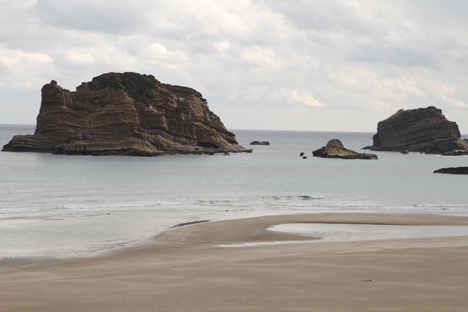
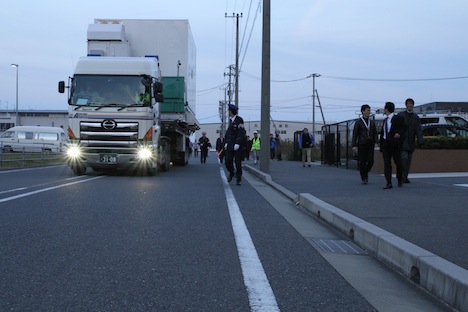
Driving on Tanegashima Island to the eponymously named Space Center presents a visitor with powerful reminders that Japan is an intentional, motivated nation. With a land area smaller than California, the country boasts a world-class space center, carved into a rugged stretch of Pacific beach. Tectonic activity through the ages aggressively defined the formation of the terrain, with huge cliffs towering over deeply folded valleys. Ancient upheavals of Earth’s suboceanic crust sent sandstone spires rising, the sedimentary stone establishing rugged rules for hearty inhabitants while occasional outcroppings of harder, volcanic matter remind visitors that they’re squarely in the Ring of Fire. The intensely sculpted geography forced road builders to draw inspiration from bowls of udon noodles; wild twists and turns test drivers concentration every single kilometer. It’s over these roads that NASA must gingerly truck the Global Precipitation Measurement satellite from the Shimama Port, a few kilometers distant as the crow flies, but a substantially longer drive across tangled, winding roads.
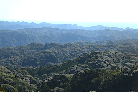
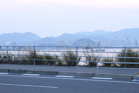
The view from a park in Minamitane with a view of the launch site. Tanegashima’s landscape is folded mountains and the ocean on the horizon. Credit: NASA / Michael Starobin
Tanegashima Island is broken into three sections. Most of the NASA crowd lives in a warren of small hotels in the southern section called Minamitane. It’s an unassuming town, clearly a bedroom community for the nearby space center and its support services. School kids in brown uniforms and smart black backpacks scamper on the narrow sidewalks each morning, running to school. Far from the blazing neon and sodium glare of downtown Tokyo, Minamitane flickers while the great capitol city to the north blazes. But like small towns everywhere around the world, the affairs of distant places matters little compared to day-to-day realities of making a living. Hotel and restaurant workers realize an unusually large crowd of jet-lagged and hungry Americans are in town, and it’s clear that beyond a short term business opportunity, there’s a genuine local enthusiasm to be part of this extraordinary multinational effort.
Minamitane shows signs of the hardscrabble existence that must attend its remote location. Few lights glow after the sun goes down and restaurants are best found with a good plan before setting out and a map in hand. Many buildings need paint. Outdoor commercial signs– fewer than a visitor might initially expect to see –have clearly weathered many seasons. But despite its apparently weathered presentation, Minamitane has clearly tried to show it’s best face. Yellow banners welcoming NASA flutter along streets and not a scrap of trash appears anywhere.
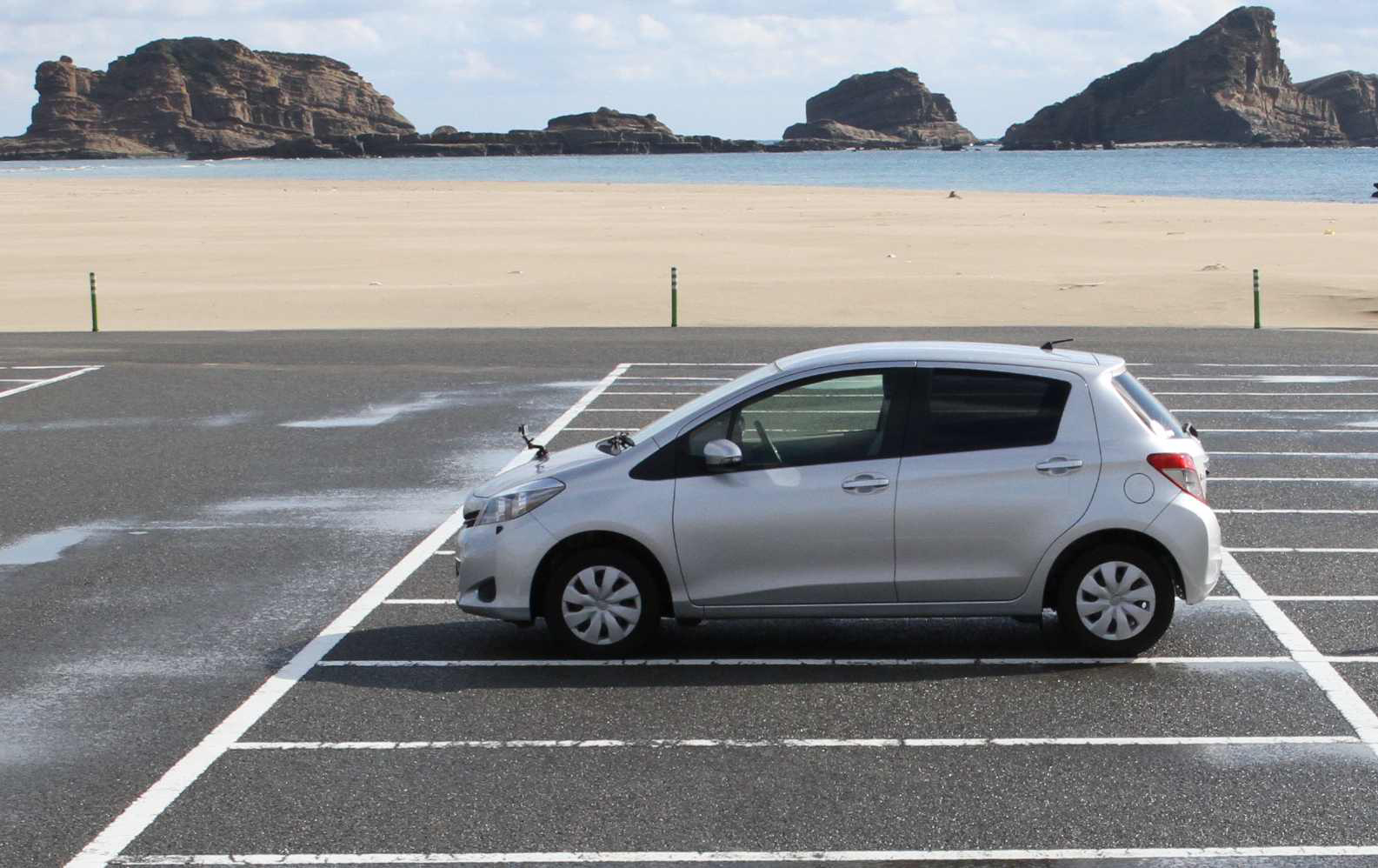
One of the ubiquitous silver Toyotas rented out to the NASA team. Credit: NASA / Michael Starobin
It cannot be overstated: this is a profoundly intentional nation. To support the army of American staff who have descended like starlings, a flock of matching silver Toyotas have been shipped from the larger island Kyushu. Each morning that flock flits at forty KPH across circuitous roads until it punctures the Space Center’s security perimeter, alighting outside a building humbly called STA-2.
If the Japanese Aerospace Exploration Agency, or JAXA, is the soul of Tanegashima Space Center, it’s clear that Mitsubishi Heavy Industries is the brains. Mitsubishi manufacturers the HII-A rocket on which the satellite will fly to space, and Mitsubishi runs the operations on site. But the cosmetic polish of the austere, white building where we work has long since faded. There are no markings, insignia, logos, or even lights on its outside, and signs of weary use suggest that the decades of Japan’s storied economic power continue to recede into the past. Rust mottles the metal front door, while discolored institutional tiles line the completely featureless hallways.
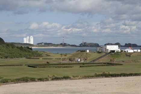
View of the launch pad from the observation deck at Tanegashima Space Center. Credit: NASA / Michael Starobin
Tanegashima Space Center is on the east coast of the island, right on the water. Sea rocks dot the nearby shore. Credit: NASA / Michael Starobin
NASA staff occupies emotionally vacant third floor offices, with metal desks of 20th century vintage pushed together to make rows of work tables. On the first floor, teams of engineers have comandeered air conditioned rooms and installed racks of computers and electronics and other vital equipment. A small room for donning “bunny” suits leads through an airlock into the cavernous brightly lit clean room. Through this portal a visitor who makes the transition realizes in a heartbeat that the tumbledown trappings outside have nothing to do with the most fundamental characteristic of the place and the culture. Like the town that support operations at the nearby Space Center, like the exceedingly polite nation that graciously hosts a horde of loud, blue-shirted foreigners, this is a profoundly intentional room, maintained by a focused, intentional company, working for a deeply focused agency. Inside the cleanroom a twenty-first century space program hums vigorously. The gleaming GPM satellite reflects lights from around the room like a great jewel hewn from the surrounding mountains. Inside this aging relic of an industrial giant, there is still majesty and promise of great things to come.
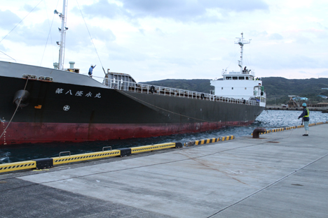
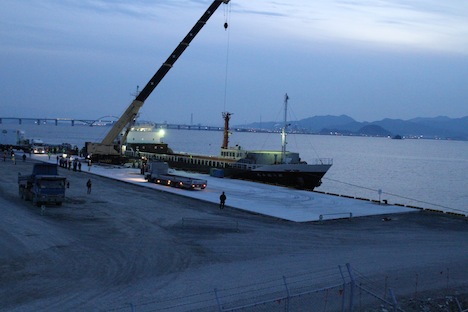
The barge with GPM arrived at Tanegashima’s Shimama Port on Tuesday Nov, 26. Credit: NASA / Michael Starobin
Finally! Michael Starobin and I had barely settled into the Global Precipitation Measurement mission offices at the Spacecraft Test and Assembly building at Tanegashima Space Center on Tuesday, Nov. 26, when we were grabbing cameras and bags and running out the door again. The barge carrying GPM was coming in and we had to get to the other side of the island to greet it.
The Shimama Port on the southern end of Tanegashima is where all the big heavy space stuff comes in — satellites and rocket boosters. It’s about a 40 minute drive to the western coast, about 15 kilometers or 9 miles, and as we arrived, the giant black hulled barge was coming in.
The barge left Kitakyushu around 8:30 p.m. on Sunday, Nov. 24, and had to anchor at Saiki for most of Monday due to rough seas. Bobbing around in 3 meter swells with a spacecraft is the last thing the transport team wanted to do. Four members of the GPM crew were aboard to monitor the spacecraft, Neil Patel, Mike Miller, Larry Morgan, and Larry Dorsey. Neil said afterward that the day delay was pretty boring, especially since they couldn’t get off the boat. For the most part they slept in shifts on wooden bunks with no mattresses.
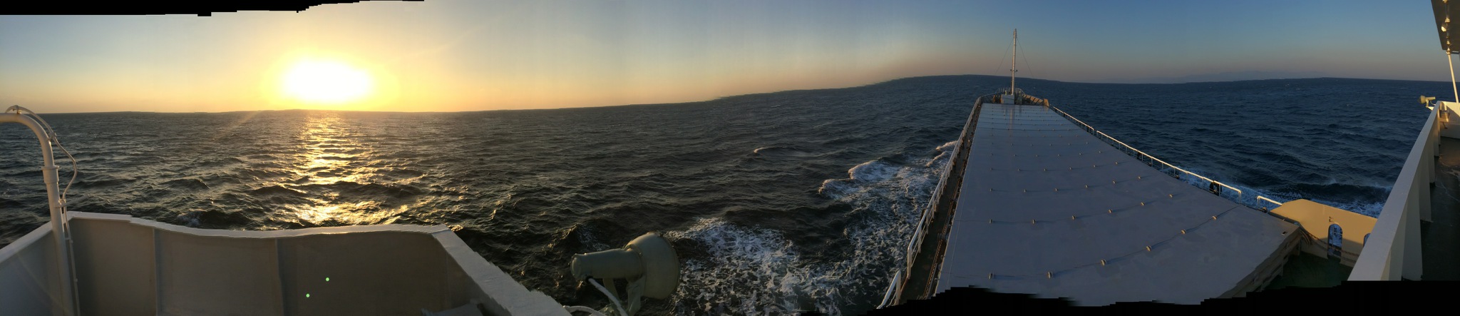
Despite the cramp conditions on board, the small GPM team on the barge saw a beautiful sunrise and stitched together this panorama. On the right, metal plates cover the hold and keep the satellite container below dry. Credit: NASA
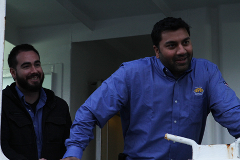
Engineers Mike Miller (left) and Neil Patel (right) on board the barge speak with project Manager Art Azarbarzin (not shown) as the boat is secured at the dock. Credit: NASA / Michael Starobin
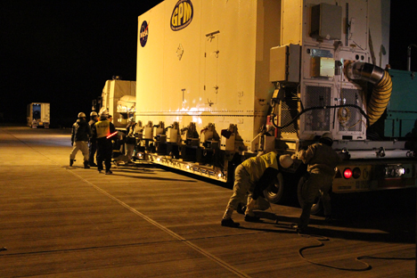
The Japanese crew pulled the barge right up alongside the dock to a watching crowd of GPM and JAXA team members. As the sun set, the crew got to work rolling back the metal plates that covered the hold. First off the boat were the blue shipping container with the batteries and equipment, then the FlipRight and the sling to actually get the GPM shipping container off the boat.
It was a happy crowd when it emerged, slowly rising, turning around, and finally descending to rest on the bed of another truck that would take it on its final leg of this week-long journey.
GPM on its last truck. On the back of the shipping container sit the Environmental Control Unit (left) and the generator (green on the right) that keeps it running. The ECU has heaters and air conditioners the regulate the temperature and humidity as well as filters on the air vents to keep out any contaminants. Credit: NASA / Michael Starobin
But first the satellite had to wait. Specifically, it had to wait five hours until midnight, when no one was on the narrow, windy roads that wended up and down the hills that separated the port from the space center.
At exactly 12:00 a.m. Wednesday, Nov. 27, the truck rumbled to life. Preceded by a police escort and two other cars, one with blue lights, one with green, the truck with the shipping container pulled out. Behind, like beads on string, trailed a dozen silver Toyota rental cars with JAXA personnel, the GPM transport team with a wireless stream from the container sensors, GPM quality assurance, and others.
They traveled at a glacial 10 to 15 miles per hour, and stopped periodically to check that the chains holding the container to the truck bed still held fast. It took two and a half hours to cross those last nine or so miles. But then they passed through the security gates outside of the satellite processing building. Slowly, the truck team guided the driver as he backed up to the door of the airlock, the room outside the clean room where the container would sit overnight.
The high bay doors opened, and in she went.
A round of applause went up when the door closed. Jean Manall, GPM’s logistics coordinator who was in charge of this long, complicated trip, raised her arms in the air and did a little dance. Project manager Art Azarbarzin, grinned from ear to ear. “I can finally sleep,” he said. At least, he added, until the next time the satellite is lifted, when it finally sees the light of day in the clean room.
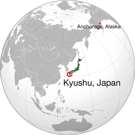
World map showing Kyushu, Japan and our layover location in Anchorage, Alaska. Source map: Wikipedia commons
We landed in Kitakyushu, Japan, on Sunday, Nov. 24, and as soon as Global Precipitation Measurement satellite’s shipping container was loaded onto the barge that would take it to Tanegashima Island, those of us who flew on the C-5 and the unloading team that met us at the airport had to travel a different, more people friendly route to the island.
When I first heard the names Tanegashima and Kitakyushu, I had no idea where they were on a map. Even Tokyo, the only Japanese city I was familiar with, was a vague dot on the elbow of Honshu in my mind.
Japan is an archipelago, made up of 6,582 small islands and four big ones. We landed on the southernmost of the big four, Kyushu. Kitakyushu literally means “north Kyushu,” and the airport is a partially man-made island in the Inland Sea to the east of the city. On the Pacific Ring of Fire, the islands are volcanic in origin, and it was easy to see in the landscape. Across the bay from the airport mountains rose steeply from the sea, their silhouettes looking painted against the sky.
The view of mainland Kyushu from the Kitakyushu airport road near sunset, Nov. 24. Credit: NASA / Michael Starobin
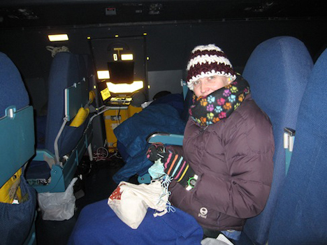
After collapsing in our hotel for the night, our group of thirty or so, led by GPM’s interpreter Suja Lee, got up bright and early on Nov. 25 to take the bullet train from Kitakyushu to Kagoshima, a major city on the south side of Kyushu. The train was sleek and smooth, like something out of science fiction on the outside, but comfortable inside. It was an hour and a half ride so I broke out my knitting and watched the countryside of farm fields and densely forested mountains go by.
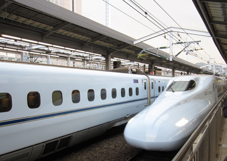
Our train comes in. Credit: NASA / Ellen Gray
At Kagoshima, we hopped in taxis to get to the ferry station for the ride to Tanegashima. We had a little while to wait before shipping out, and I had my first experience ordering food from what looked like a vending machine for a sit-down meal. Step one, look at the picture menu. Step two, feed in your money. Step three, match the price and the Japanese letters to the button on the machine. The waitress was very helpful, despite the language barrier, and took the ticket the machine spit out to put the order in. I couldn’t tell from the picture what the meat was that came with my curry rice — it turned out to be chicken, and the whole meal was quite tasty.
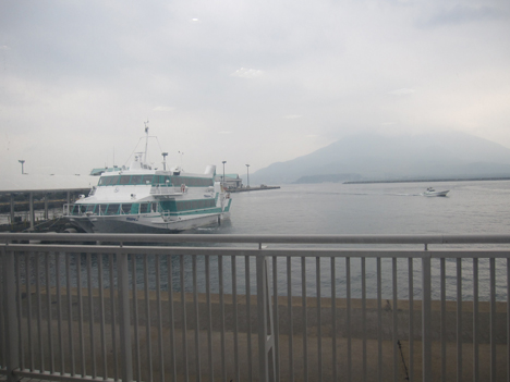
The view outside the ferry station of Mt. Sakurajima, an active volcano across the bay. Credit: NASA / Ellen Gray
Tanegashima Island is 62 nautical miles south of Kagoshima. The ferry took about an hour and forty minutes in slightly rough water. The type of boat we were on, a hydrofoil, kept us above the water and avoided the worst of the waves.
Three meter waves and gale force winds had passed through the night before, and the barge that was carrying GPM actually had to anchor at Saiki at the mouth of the Inland Sea to wait for the seas to settle before going out into the open ocean. They would be a day behind us to Tanegashima.
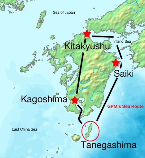
Map of Kyushu showing the route to Tanegashima taken by the GPM shipping container by sea (right) and the route taken by the majority of the GPM team by train and ferry (left). Source map: Wikimedia commons
Tanegashima is part of a cluster of islands south of Kyushu. Long and skinny, we made landfall in the blustery northern port of Nishinoomote. Tanegashima Space Center is located on the southern tip of the island, so we piled into cars and headed south for Minamitane, the town where we were staying.
Tired and hungry after the long day, checking into our hotel I introduced myself in the little Japanese I learned for this trip, and I smiled and nodded as our host broke down her instructions into the handful of English words she had. That was where the fact that we were in Japan really settled in. We were on the other side of the world, joining forces with another country to launch a global mission into the sky. All we needed now was the satellite.
Getting up before the sun on a November morning in Alaska may not be an honest way to represent a person’s effort. The sun doesn’t make much of an appearance at this latitude. The Global Precipitation Measurement mission team traveling to Japan takes that as a charge: we’re not planning to hang around too long, either.
Back on the icy tarmac, we leave our steamy bus for the gelid confines of our twilight passenger cabin, up, up, up the precarious metal ladder to the top of the C5. Then we wait.
And wait.
And wait.
Turns out that the plane is fine. It’s the runway that’s too slick with ice.
Engines idling, bellies rumble. Breakfast never happens. The catering we’d expected in the second half of the trip didn’t survive the days of our unexpected Alaskan idyll. People crack a few jokes–how could the overnight quartet of engineers assigned to babysit the satellite have eaten everyone’s pancakes!– but nobody complains. As soon as the Air Force clears us for take off, we’re heading west at full throttle.
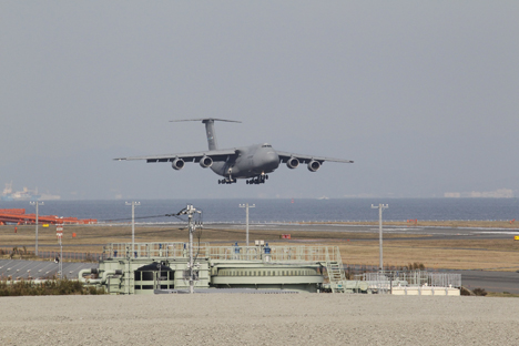
The C-5 landed at Kitakyushu Airport, Japan, at 12:30 p.m. local JST on Nov. 24. Credit: JAXA
Nine hours above the Pacific, the team settles into zenlike repose. Conversations are minimal due to the ferocious airplane noise and requisite earplugs. Movement slows. Time expands.
Then, after an eternity, we’re on approach. Human dynamos spin up. People run through mental checklists and stretch for action.
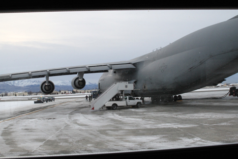
Minutes after the wheels stop beneath the gray airplane, people move like springs released. The advance team meets us on the ground with no greater ceremony than high fives and back slaps. In minutes the Japanese and NASA ground teams are rolling at full speed. The C5 nose and tail pops open, and it isn’t long before our truck trailer gets pulled out the plane. Not far behind, the great white box holding the satellite rolls out smoothly, only to be bolted down to the waiting truck bed.
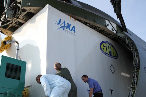
When launched GPM will be the largest Earth Science satellite ever. In its shipping container the school-bus sized vehicle cleared the ceiling of its cargo plane with just an inch of clearance. Credit: NASA / Michael Starobin
From a distance the scene looks like the epitome of an ant colony. Dozens of people with well- coordinated roles clamber and labor over objects many times their individual size, yet collectively manage to make short work of huge jobs. The American team coordinates care and feeding of their spacecraft; the Japanese ground team coordinates movement of heavy objects and extensive runway logistics. A handful of US Air Force crew provide essential assistance working in and around the airplane.
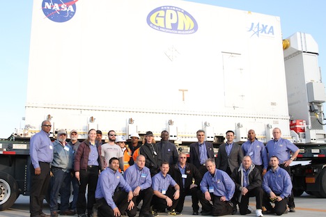
The NASA GPM transport team in Kitakyushu, Japan, Nov 24. Credit: NASA / Michael Starobin
In a little less than three hours, the plane is unloaded, sealed up, and gone. With the satellite now loaded onto the truck, a motley foot parade walks alongside, heading a mile distant for a freshly paved section of sea port, retrofitted specially for this enterprise.
A slow-motion convoy of cars, one big truck, and lots of pedestrians walked alongside the GPM satellite about a mile from the runway at Kitakyushu Airport to the dock area. Credit: NASA / Michael Starobin
The Japanese ground crew performs like Cirque du Soleil; onlookers can only marvel at the display of technical acumen. They make it look easy. The truck pulls up like a demonstration of precision driving. A massive crane, already waiting, hoists a special I-beam into place. Working side by side, NASA mechanics and Japanese ground teams unbolt the satellite, hook lifting chains to the sides, and prepare. As the shades of night stretch shadows long, crews wheel in small, powerful outdoor lamps, turning the scene into an outtake from Close Encounters.
Recent improvements to the Kitakyushu airport in Japan facilitated the transportation of the GPM satellite. A freshly paved concrete staging area supported a massive crane as it lifted the satellite into the cargo hold of an ocean barge. Credit: NASA / Michael Starobin
Then: it rises. The great white box containing the largest Earth science research satellite ever floats above the scene. Gracefully it swings over the edge of a great cargo ship, waiting at port. Then slowly it descends into the hold, disappearing beneath the railing. Another quartet of NASA engineers boards the ship, where together with a Japanese crew they’ll sail for Tanegashima Island. First by air, now by sea, the satellite inches it’s way to space.
Michael Starobin is the Senior Producer at NASA’s Goddard Space Flight Center. Generally in charge of producing “special projects”, Michael’s history with GPM goes back to 2000, when the mission was little more than a stack of formulation sketches. His two short movies about the project are called THE PROMISE OF RAIN and WATER FOR TEA. His latest movie about the mission, WATER FALLS, is scheduled to open on Science On a Sphere screens in January, 2014. (gpm.nasa.gov/waterfalls) Follow him on Twitter @michaelstarobin
Science writer Ellen Gray bundled up on the C-5. Credit: NASA / Michael Starobin
Thursday, November 21
When they told us to dress in layers for the flight, they weren’t kidding. At altitude, the C-5 transporting the Global Precipitation Measurement satellite is cold. After waking up from my exhausted sleep that passed the first five hours, my feet were blocks of ice from the draft along the floor. I was wearing three shirts and a sweater under my jacket, long underwear and pants, and winter hat, gloves and scarf.
Others were starting to get up and move around. The project brought all our own food for the trip, and the passenger area had a small galley with small ovens to heat it up. Tin foil dishes of crab cakes, chicken wings, roast beef and vegetables; sandwiches and chips; and pancakes and eggs for breakfast.

Flying Air Force is Bring Your Own Food. Credit: NASA / Michael Starobin
After eating, I moved to the back of the passenger section where there was a free double seat, so Michael Starobin, the video producer joining me documenting the trip, could stretch out on the row we shared. The best thing about the back rows? They’re warmer than up front.
Cozy with my two blankets, I was almost asleep again when project manager Art Azarbarzin came by. “Did you hear?” he asked loudly over the engine noise and the ear plugs. I shook my head. “We’re going to have to land. The headwinds are eating up too much fuel.”
The C5 was originally supposed to be refueled in the air, en route, making the flight about 15 hours long from Andrews on the U.S. East Coast to Kitakyushu, Japan. Fighting upstream, as it were, against the headwinds meant the calculations for our expected fuel usage, even with the in-air refuel, wouldn’t be enough to get us all the way to Japan.
“We’re landing in Alaska,” Dani Alvardo told me after we got more information from the Air Force crew. Specifically, we were landing at Elmendorf Air Force Base near Anchorage. “The refuel should take two to three hours. Hopefully. More than that and it might be one or two days before we get to Kitakyushu,” he said.
Two hours or two days? It all depended on staying inside the time waiver granted to the C5 flight crew to fly for an extended period of time before they had to go on mandatory rest, and whether or not the tiny Kitakyushu Airport would let us land on Saturday, the same day they had a 747 flying in. Everyone was crossing their fingers that we could get down, get fueled, and get gone before the clock ran out.
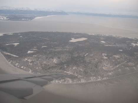
Descending toward Elmendorf Air Force Base, near Anchorage, Alaska. Credit: NASA / Michael Starobin
I’d never been to Alaska before and my first view of it was actually a picture Michael Starobin took out the emergency exit window. Anchorage is on the water, and bare trees and snow already covered the landscape. When we deplaned, we were hit with bitingly cold air. I thought Maryland was cold at 37 degrees F when we were standing outside at Andrews. At Elmendorf it was 7 degrees F. Was I ever glad that dressing for the C-5 meant breaking out the winter gear.
Fortunately the Air Force loaded us onto a heated bus where we waited next to the plane. I listened in as project manager Art Azarbarzin checked in with Mike Miller who was monitoring the g-forces inside the container as we landed. One g is the force of gravity that holds us to Earth’s surface. GPM felt less than one g from the deceleration of the plane, which is very good for the spacecraft — it didn’t jostle around. The temperature inside the container held steady in the high 60s F with the help of the heater on the Environmental Control Unit, and the dry Alaska air helped the unit with keeping the relative humidity below 60 percent. The satellite was in good shape.
While we waited, breathing diesel fumes and watching F22s take off, the joke went around that we should have taken the Hawaii route (short answer, flying over Hawaii is a longer route to Japan). But after about two hours we were boarding the C-5 again, and forty minutes later, we were taxiing down the runaway. We sat and waited again for our turn to take off.
Then we got the announcement. We were grounded. The crew was on 17 hours of mandatory rest. They were two minutes over their waiver deadline.
The C-5 on the ground at Elmendorf Air Force Base near Anchorage, Alaska. Credit: NASA / Michael Starobin
Friday, November 22
Nine a.m. in Alaska at this time of year is still full dark. But out we went to the bus that shuttled us from the Air Force Inns to the air field. It was raining. Worse, it was 25 degrees F outside so it was freezing rain.
Jean Manall, the logistic coordinator for GPM’s shipment, said as we walked out the door, “We’ve got to be optimistic.” But optimism won’t beat bad weather. We waited by the airfield for an hour before getting back on the bus to the Air Force Inns. The base had closed the airfield.
Our new departure time was Saturday morning, for a Sunday arrival in Kitakyushu, Japan. The good news was, we don’t have a time limit at Kitakyushu Airport like we did for Saturday because of the 747. The bad news was, we couldn’t take any more delays. While we were waiting to check back into our rooms, Jean came up to Art and told him our permits to close the road and drive the spacecraft from the airport to the boat for the next leg of its journey expired on Sunday.
Art laughed, resigned, as he pulled out his phone to call JAXA to update them on the schedule and warn them we might need an extension if the weather didn’t let up. “It’s more complex getting to the launch site than building the satellite,” he joked.
