
By Ryan Walker

Our second day of installing equipment was on November 21. After a cloudy day off, we had perfect sunny weather.
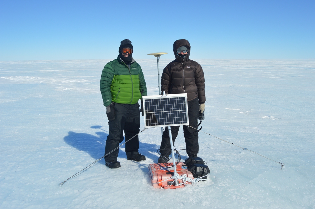
We began by installing our two tilt meters at Comein Glacier, which flows into the Nansen Ice Shelf through a small inlet just north of the much larger Reeves Glacier. Most of an ice shelf floats freely up and down with the ocean tides, and the ice only flexes in a relatively narrow band between the floating ice shelf and the grounded glaciers that flow into the shelf. We chose this location (about 35 miles upstream of the ice shelf front) because the flexure zone is particularly wide (over three miles) and there is a broad strip of over 900 yards of ice that floats at high tide and rests on the ground at low tide. (We know this thanks to satellites that measure the height of the ice surface using lasers or radar, and to comparisons between satellite radar images that detect ice motion.) As it turned out, this area is the most spectacular place we’ve yet visited, surrounded by gleaming white snow- and ice-covered peaks.
Installing tilt meters is rather tricky, since the instrument has to be almost perfectly level. After two Korea Polar Research Institute safety guides checked the area for crevasses (large cracks in the ice), we dug through about two feet of snow before finding solid ice. To keep the tilt meter level, we constructed a table from a piece of plywood supported by three aluminum pipes drilled into the ice. The pipes passed through holes drilled in the plywood, which rested on hose clamps fastened around the pipes. By adjusting the hose clamps, we leveled the plywood before placing the plastic case containing the tilt meter on top of the table. The tilt meter itself has a triangular base with three adjustable screws so it can be leveled on top of a flat plate at the bottom of the case. To do this, I had to attach a cable from the tilt meter to my computer to get readouts of the angles while Christine very carefully adjusted the screws. Once we were satisfied that the instrument was level, we hooked up a solar panel and battery for power, just as we did for the GPS stations. Finally, we buried the case and table in the snow to prevent any melting of the ice supporting the table, which could put the instrument out of level.
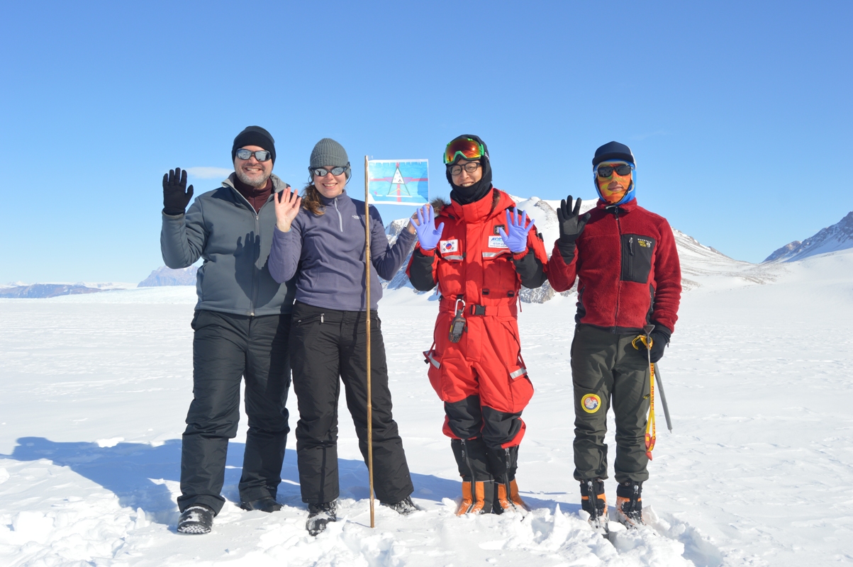
After sandwiches and coffee in beautiful sunny weather (certainly the most scenic picnic lunch I’ve ever had), we took some time for a school outreach project that Christine will tell you about. Then we flew back out onto the Nansen Ice Shelf (which is much windier) and installed our two remaining GPS stations with no trouble (other than a chilly half hour waiting for the helicopter to return) to complete a successful day in the field. Now we need to wait about two weeks before collecting data, so that we can see what happens to the shelf as the ocean tides go through a full cycle from spring (largest difference between high and low tide) to neap (lowest difference).

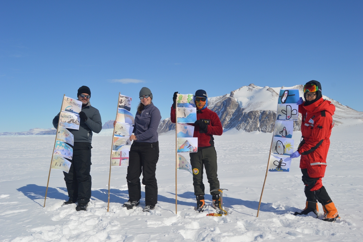
Christine says: I’m involved in a program coordinated by the United Kingdom Polar Network called “The Antarctica Day Flags Initiative”. School classes design flags for Antarctica Day (which is December 1, the anniversary of the signing of the Antarctic Treaty in 1959) and then scientists and researchers take them to the Antarctic and take photos of them out in the field. I had 21 flags from two schools (Yardley Hastings and Northrepps Primary) so we attached these to poles and took some pictures in front of some beautiful icy cliffs with our Korean colleagues.
Tags: Antarctica, cryosphere, GPS, ice, NASA, polar
Good story. Enjoy yourselves. Thanks for insights into your world.