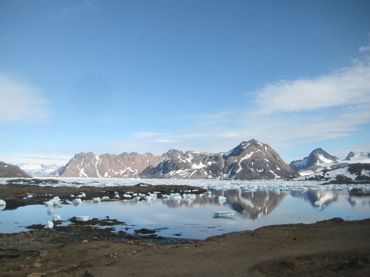
The view from Hotel Kulusuk, looking at tefnow-free mountains.
Welcome back to our blog! We’re here for one more season of field work on the Greenland ice sheet to study the firn aquifer. Surface meltwater percolates through the upper layers of compacting snow, or firn, and pools inside the air space between sow grains, forming a large reservoir of liquid water within the ice sheet. We’re trying to figure out how much water is in the aquifer, how fast the water flows, and if and where it is leaving the ice sheet to potentially flow into the ocean. We need to learn more about the firn aquifer because it is a huge reservoir of meltwater in the ice that was only discovered in 2011, and it could have big impacts on how the ice sheet melts and causes sea level rise. This is one of the most exciting parts of science – new discoveries are always being made!
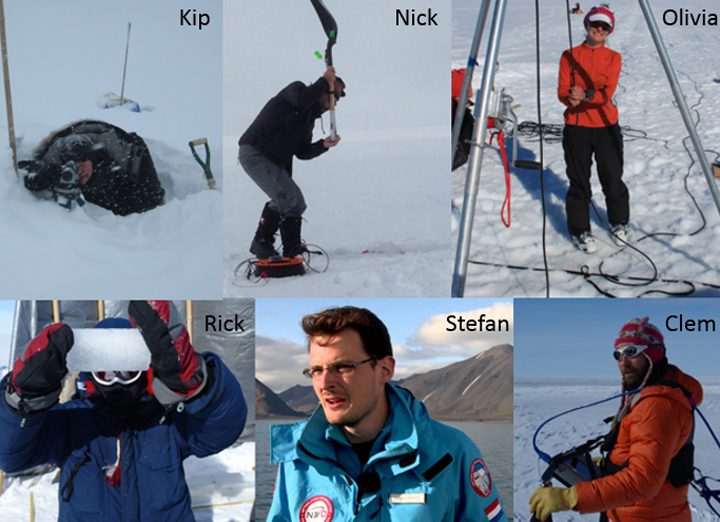
Our team this year consists of Rick Forster, Kip Solomon, Clement Miege, and Olivia Miller from the University of Utah, Nick Schmerr from the University of Maryland, and, our newest member, Stefan Ligtenberg from the University of Utrecht.
We plan to do some similar experiments as last year (see our past blog posts) but in new locations to see how the aquifer changes in different places, and we also have a few new experiments up our sleeves to try to fill in some knowledge gaps that we discovered following the two field campaigns last year. That is another fun thing about science – through your work, you discover new information you need, and then you get to design new ways to get that information.
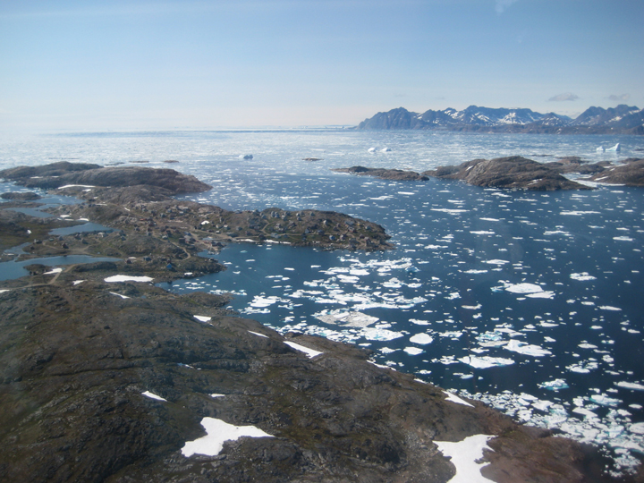
View of Kulusuk from the air.
We will spend a few days in Kulusuk getting our equipment ready for the helicopter flights out to the ice sheet. When we get to the ice sheet, we will set up camp, and then get to work. We plan to spend 3 weeks on the ice.
Our science plan for this year includes:
This year we have a new, exciting partnership with a research project called STEM Ambassadors. The STEM Ambassadors team is trying to learn about ways to improve science outreach, and so I have volunteered to try some new outreach activities out for them. I wrote a short children’s book about our field work for the school in Kulusuk, and had it translated into West Greenlandic and Danish. This was a very new type of writing for me, but I had a lot of fun! I’ll pass the book along to the teachers in Kulusuk so they can share it with their students when school begins in the fall. If you want to see the book, you can find it here. Any feedback is welcome!
We’ll update the blog regularly over the next few weeks, and look forward to learning more about this unique feature of the Greenland ice sheet! Also, please feel free to leave us a note at the bottom of the page.
Hi there,
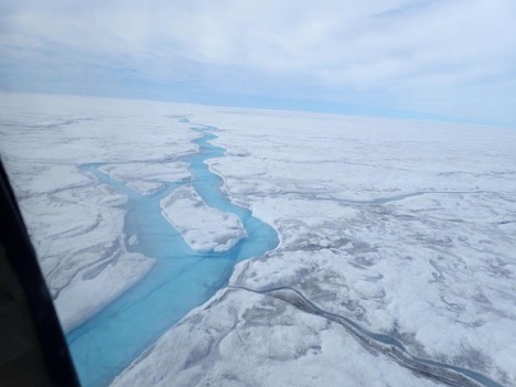
After an early breakfast, our team is getting ready to put in our ice camp. We met with the pilots around 8:30am for a departure at 9 am. The flight to the ice camp was quick, about 20 minutes. Beautiful views of the fjords leaving Kangerlussuaq and then on our climb onto the ice sheet we saw the first supraglacial rivers flowing over the ice sheet. After arriving at our camp location, a team of two got back in the helicopter to be ferried to the other side of the river. The plan was to anchor a Tyrolian line across the river to suspend an Acoustic Doppler Current Profiler (ADPC) on the river and collect data. In the meantime, the team members set up tents, and outhouse, a kitchen tent and organized the camp. In the afternoon, the team of two was picked up from the other side of the river and brought to camp.
We got to spend our first night on the ice sheet, nice, quiet and not too cold!
See below a few photos taken that first day.
First views of the rivers sitting on the ice sheets. Photo by Brandon Overstreet.
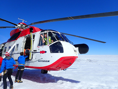
Unloading the helicopter shortly after arriving at ice camp location. Flemming, our helicopter pilot says hello! Photo by Lincoln Pitcher.
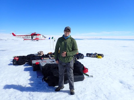
Brandon posing in front of the gear and the helicopter at the background. Photo by Lincoln Pitcher.
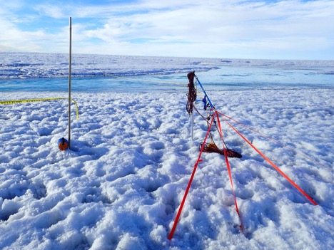
Rigging up the tyrolean system to move gear across the river. Photo by Brandon Overstreet.
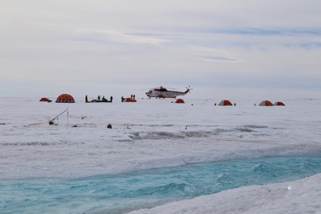
Caption: View of ice camp and helicopter. Photo by Lincoln.
We will send new updates once we are back from the ice camp around July 14.
Best wishes from our ice camp!
Clém
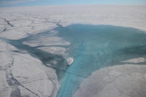
Lake and Rio Behar views from the helicopter. Photo by Clément Miège.
This summer, we have the chance to be part of a team of researchers studying the efficiency of the drainage system over the ablation zone of the Greenland ice sheet. This NASA Cryosphere program funded project, titled “Drainage Efficiency of the Greenland Ice Sheet” is studying the production, transport and export of Greenland Ice Sheet meltwater and its importance for global sea level rise. Each summer, a complex yet poorly studied system of thermally eroded meltwater streams forms across the surface of the Greenland Ice Sheet and transports meltwater into the ice sheet via moulins. Meltwater then exits the Greenland Ice Sheet and makes its way to the global ocean via land-based proglacial rivers and buoyant sediment rich plumes. This project intensively maps, monitors and measures both supraglacial and proglacial rivers to improve estimates of Greenland Ice Sheet surface mass balance and its impacts on global sea level rise.
To achieve these objectives this project will:
To do this work, we will be located in the ablation zone of Greenland ice sheet, at about 80 km from Kangerlussuaq (the closest town) and 1200 m elevation. Our study site is located right next to a lake and a river called the Rio Behar. As you can see from the photo above, this part of the ice sheet is covered by lakes and rivers that are transporting meltwater away from the ice sheet throughout this connected system.
To study this area, we have researchers from different universities coming in with different background, therefore bringing various expertise and skills to ensure success of this expeditions. The two main institutions responsible for this work are UCLA (Project PI Larry Smith, and his students Lincoln Pitcher, Matt Cooper, Sarah Cooley) and Rutgers University (Project Co-I Asa Rennermalm, and her students Rohi Muthyala and Sasha Leidman. They were also able to invite a few additional researchers to complete the field team. Brandon Overstreet comes from the University of Wyoming and will be in charge of the river work to measure river flow and discharge. Johnny Ryan is at Aberystwyth University in the UK and will be flying over the entire catchment area with a fixed-wing drone. Charlie Kershner is based at George Mason University and will lead terrestrial lidar scanner (TLS) measurements to get high-resolution surface topography and deduce melting rates. Finally, Clem Miege is at the University of Utah and will be leading ground-penetrating radar measurements to look at the weathering crust and any englacial features.
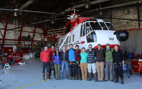
Team posing in front of the helicopter that will take us to our ice camp. From left to right we have: Johnny, Charlie, Rohi, Asa, Matt, Clem, Sarah, Larry, Sacha, Brandon, and Lincoln.
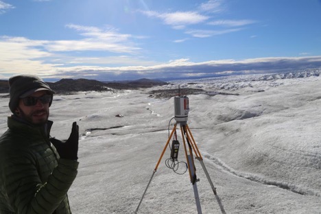
To complement, the ice camp work which will take place between July 4 and July 14, a few team members will also monitor proglacial rivers and streams near the glacier edge. Matt, Sacha, Sarah and Rohi are leading this effort and invited Charlie and Clem to come over and test their equipment on the ice edge. This test day was great, as you can see from the few photos below.
Charlie is testing his Lidar system at the edge of the ice sheet. Photo by Lincoln Pitcher.
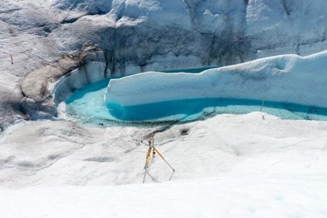
Charlie’s Lidar in action at the river bend. Photo by Charlie Kershner.
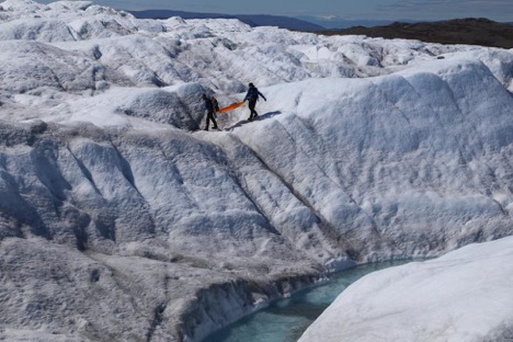
Charlie and Clem are carrying the ground-penetrating radar over the glacier, the surface roughness made it difficult for the radar to operate. Photo by Lincoln Pitcher.
That is about it for now as we are finishing sorting through our equipment before getting to our ice camp.
In the coming posts, we will send updates on how the work is going on the ice sheet and also describe the different components of this multi-disciplinary work in more details. I hope you will enjoy reading about this exciting research project.
Thanks and best wishes,
Clem and Lincoln
