Editor’s note: In fall 2013, researchers aboard a NASA C-130 traveled to Greenland to study changes in the ice sheet and sea ice following the summer melt season. Other airborne campaigns, like NASA’s Operation IceBridge, study changes on an annual basis and this is the first large-scale airborne survey of seasonal change. The C-130, equipped with a pair of Land, Vegetation and Ice Sensor (LVIS) laser altimeters, will carry out surveys of land and sea ice from Oct. 31 to mid-November and will resurvey many of the same areas flown by IceBridge during its 2013 Arctic campaign.
In late August, David Rabine and I headed down to Wallops Flight Facility in Virginia to start LVIS instrument installation for NASA’s Greenland airborne campaign.
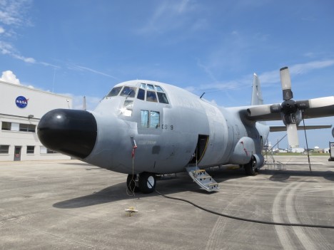
It was my first time at Wallops and I was thoroughly impressed with the amount of airborne activity that takes place there. It seems like every 15 minutes there is a plane taking off or landing! Once there we saw the C-130 that will carry our two LVIS instruments. It looks like a great platform for scientific measurement. It has a huge cargo door in the back that allowed us to literally roll the pallet with all the equipment and the two instruments on board.

NASA’s C-130 aircraft on the tarmac at Wallops Flight Facility in Virginia. Members of the LVIS instrument team are installing equipment in preparation for the upcoming IceBridge Greenland campaign.

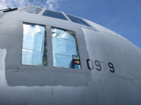
: The C-130 also had a sticker with major credit card logos on one of its windows. Perhaps this means they accept them for the in-flight entertainment.
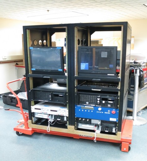
Another benefit of the C-130 is the space available inside, which allows us to use four equipment racks without having to worry about space, and put the two LVIS instruments side-by-side. This will let us build a great data product. We spent a week populating our equipment racks, and by the end of it we had most of the equipment for the regular LVIS instrument mounted into its appropriate rack. Next came the equipment for the Global Hawk version and after finishing the equipment racks, we installed the two LVIS instruments onto a custom built platform that holds them in place.
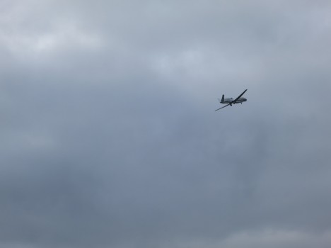
We were very fortunate that our trip to Wallops lined up with a test flight of one of NASA’s Global Hawks, an uninhabited aerial vehicle that’s taking part in another NASA mission, the Hurricanes and Severe Storms Sentinel, or HS3, mission, and which the smaller version of LVIS has flown on before. As luck would have it, on the morning of Aug. 20 the Global Hawk took off on the runway that was closest to our airplane hangar. We were able to get a front seat view of the takeoff.


Love it! Thanks for the narrative on what promises to be a most telling saga of ice decay in one of our most sensitive areas. I appreciate the narrative written by the author… thanks Greg. What a job you have sir! I wish this had been started 5 years ago, and suspect that you did too. However, there’s never a better time to establish accurate scientific data points than the present. Good luck on your venture, and thank-you for advancing science!
M.J. Orcas Island, Wa.
Dear Explorers,
Thank you so much for your efforts. I hope that raw data can be fed to the general public as soon as you get it. If so where can we access it? best of luck.
Sincerely,
LC
Austin, Tx.
All of the data collected will be processed and in a few months will be available to the public for free on the National Snow and Ice Data Center’s website (nsidc.org). Previous data products for this instrument can be found by searching for keyword LVIS.
Have been watching your flights on the MTS portal at my school…
Looks to be an exciting mission with the new aircraft…
Was wondering, is the picture of the instrument rack in the article showing the LVIS and the LVIS-GH together or is it just for one? Also are you using one system to test the other one before installing it in another aircraft?
The instrument rack shows the computers and other control equipment for just one of the instruments. Because of how much room there is in the C-130 researchers could spread equipment out a bit more.
The LVIS-GH instrument has already been tested and previously flew on one of NASA’s Global Hawk uninhabited aerial vehicles. Of course having two instruments means you can compare their readings to verify the measurements are accurate, but the real advantage of having two of them is that you can measure a wider area of the ice.