
Vijay Mishra and I went to do a maintenance check yesterday on one of the 4 X-band radars that the University of Iowa is contributing to the IFloodS field campaign. Below is a photo of the radar, located at a topographical high point near Elkader, Iowa.
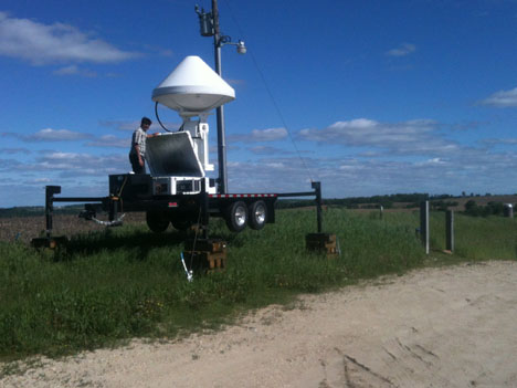
Vijay Mishra performs maintenance on the X-Band radar in the Turkey River basin. Credit: Matt Schwaller/ NASA
The X-band radar has a panoramic view of part of the Turkey River basin. Another University of Iowa X-band radar is located about 20 kilometers away and has a similar view of the watershed, although from a different perspective, of course.
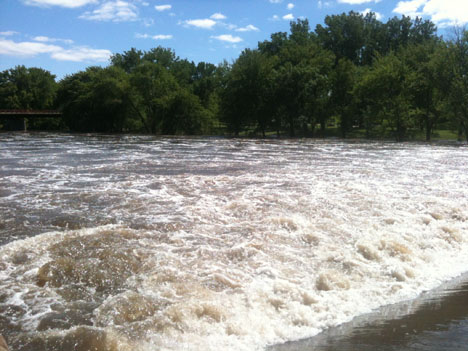
The Turkey River in northeastern Iowa. Credit: Matt Schwaller/ NASA
A significant amount of rain has fallen during the IFloodS campaign, some areas within the campaign area received more than 11 inches of rain since May 1. The Turkey River is now and at or above flood stage.
Matt Schwaller is the GPM Ground Validation project manager with responsibilities for coordinating the development and operations of GPM GV in the pre- and post-launch phases of the GPM mission. He also occasionally takes the role of a field campaign mission scientist.