
During every minute of the day, every day, a volcano is erupting somewhere on Earth. Actually, it’s more like a dozen. Or two. Satellites capture much of this activity, and we try to highlight as many eruptions as possible, but for one reason or another (like clouds) some of them fall through the cracks. Here are a handful from the past few weeks:
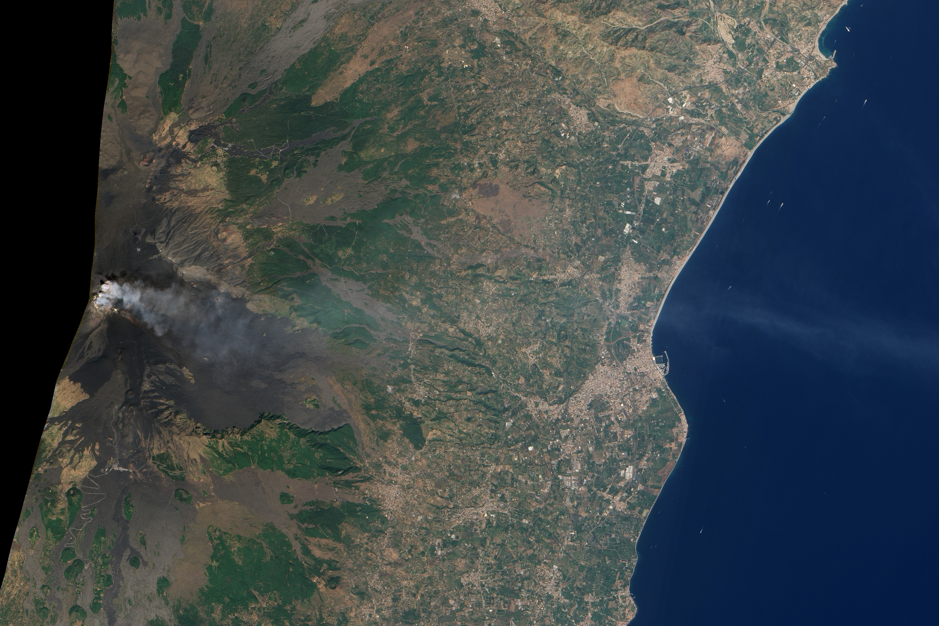
Natural-color satellite image of Mount Etna, Italy; acquired on September 18, 2011, by the Advanced Land Imager (ALI). Credit: NASA Earth Observatory/EO-1 Science Team.
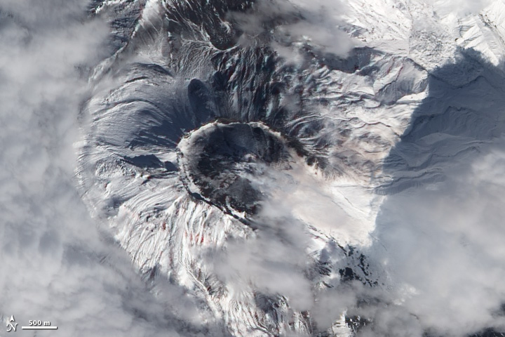
Natural-color satellite image of Bezymianny Volcano, Russia; acquired on September 20, 2011 by the Advanced Land Imager (ALI). Credit: NASA Earth Observatory/EO-1 Science Team.
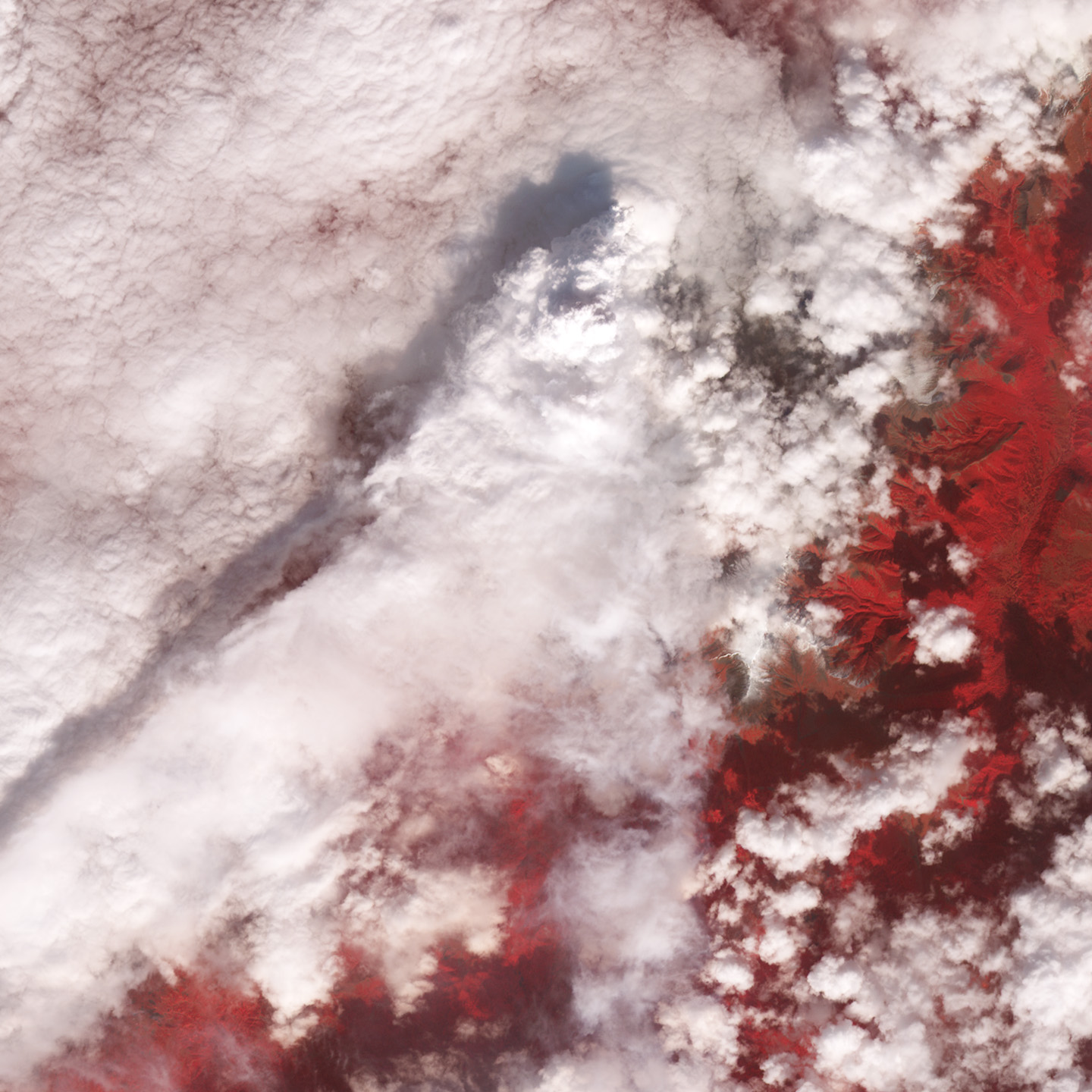
False-color satellite image of Kizimen Volcano, Russia; acquired on September 21, 2011, by the Advanced Spaceborne Thermal Reflection and Emission Radiometer (ASTER). Credit: NASA Earth Observatory and the NASA/GSFC/METI/ERSDAC/JAROS, and U.S./Japan ASTER Science Team.
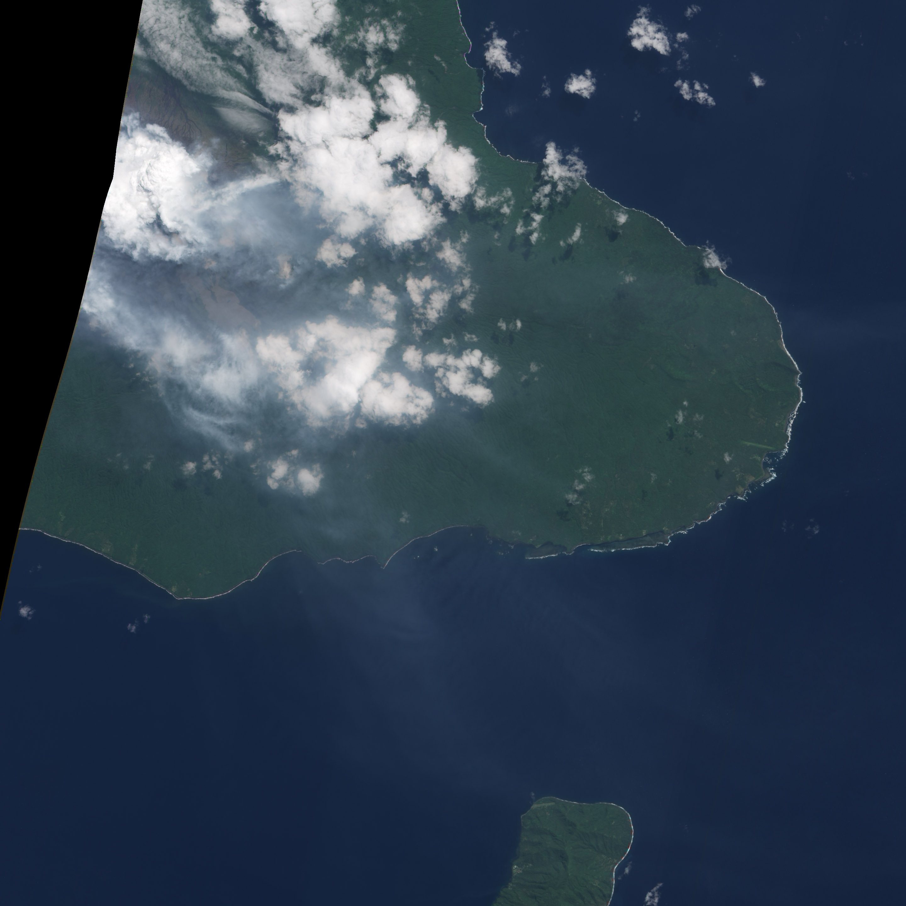
Natural-color satellite image of Ambrym Volcano, Vanuatu; acquired on September 23, 2011, by the Advanced Land Imager (ALI). Credit: NASA Earth Observatory/EO-1 Science Team.
The incredible global maps EO provides probably take a lot of effort to create, but I was wondering whether it would be possible to make an annual (or monthly?) global chart of volcanic and seismic activity. This could be compared with previous years, simply to highlight where these different geodynamic phenomena occur, perhaps as an animated sequence illustrating chronological order of events. The usually static maps of earth quake don’t reveal the order in which the often numerous aftershocks occur.
Do volcanic chains ever erupt in a sequence i.e. one triggering another? Could such a sequence be highlighted over a larger timespan by animation? Just wondering as I drink the images and information this truly remarkable site shares out.
Warm regards
Robert S.
Robert: Thanks for your comment. Plotting global earthquakes and volcanoes is a great idea, but we’re unlikely to be able to do it anytime soon. NASA isn’t directly involved in measuring seismicity, so it’s a little bit outside our area of expertise, and we’d like to avoid stepping on the toes of the organizations that do map earthquakes (like the USGS). For volcanoes, there’s no good source of comprehensive global data. The closest is the Smithsonian/USGS Global Volcanism Program. There’s satellite data of hotspots—areas that may indicate activity, but in most cases you need local observations to confirm an eruption.
I’m not a volcanologist, but it’s my understanding that most volcanic eruptions are isolated events. Every volcano has separate channels for magma to move from within the Earth to the surface. There’s at least one instance of an earthquake triggering an eruption (Chile’s Puyehue Cordón-Caulle in 1960), but that’s an extraordinarily rare event.
Robert(s): You might enjoy yesterday’s (Wed) xkcd. It shows what can happen when one organization, the American Psychological Association in this case, usurps another’s (National Hurricane Center) area of expertise. Hilarity ensues.
That Mt. Etna picture is quite a shot, thanks. rb
arby: Etna’s a photogenic mountain, isn’t it? Here’s my all-time favorite image of Etna: http://earthobservatory.nasa.gov/IOTD/view.php?id=2923
Hi Robert/Folks at NASA,
Thanks for posting these images and the blogs. I really enjoy reading them and they are great for showing my GEO101 classes. As for the question about volcanoes triggering other volcanoes, that hasn’t been documented in the literature. However, there is some pretty good evidence to suggest that large mega-thrust earthquakes (like the one in Chile in 2010 and 1960) could potentially trigger eruptions. Indeed there are papers on the 1960 Chile earthquake potentially triggering an eruption at Puyehue Cordon-Caulle.
Again, thanks!
Sincerely,
Dawn Ruth
Great Work Robert Et al,
Actually I too would like to know whether the volcanic activities on our earth are increasing or it is the same as usual.
Thanks & warm regards
Hello NASA,
I have read that Volcanoes have actually caused more Global warming than man has, and I was wondering if this is true/false?
Thank you for the wonderful images.
K.Cartmell
K.: False. Humans release more than 100 times as much carbon dioxide into the atmosphere each year as volcanoes do, and there’s no evidence volcanoes are emitting more carbon dioxide now than in the recent geologic past.
Here’s more info from the Eruptions Blog: Why volcanism isn’t the source of increasing carbon dioxide emissions, the United States Geological Survey: Volcanic Gases and Climate Change Overview, and our own Carbon Cycle fact sheet.
Gracias por tan bellas imágenes!!!!!!
Thanks for posting these images and the blogs. I really enjoy reading them and they are great for showing my GEO101 classes.