For more than 20 years, astronauts have been shooting photographs of Earth from the International Space Station. Before that, they looked down from Mercury, Gemini, Apollo, Skylab, the Space Shuttles, and MIR. They have brought us unique views of our home planet in all of its wonder, beauty, and ferocity. They have also made some interesting and timely science observations along the way.
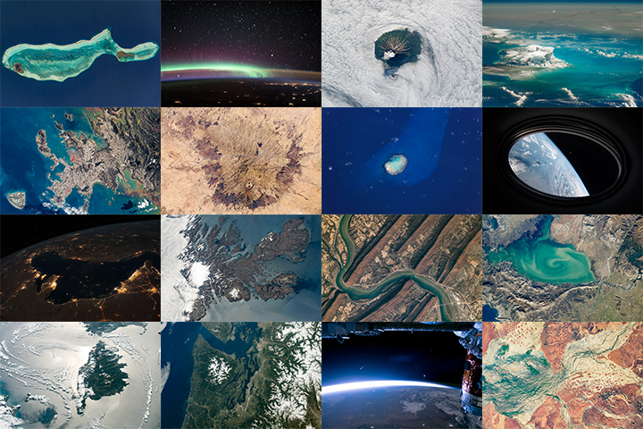
More than 1,000 of those photos have been published here on NASA Earth Observatory. We would like you to help us choose the best in our archives. In early March, we will launch Tournament Earth: Astronaut Photography, and we want you to be part of the selection committee.
From now through February 19, 2021, search our archives and point out the best photos shot by the astronauts. Post the URLs of your favorite photos in the comments section below.
Please choose images from these collections:
EO Astronaut Photography Collection
Visible Earth: Astronaut Photography
Please note that there are 30+ pages of images to scroll through — an internet rabbit hole of incredible beauty.
In March 2021, we will include some of your selections in Tournament Earth, a head-to-head contest to vote for the best of the best from our archives. Each week, readers will pick from pairs of images as we narrow down the field from 32 nominees to one champion. The Tournament Earth champion will be announced in early April.
So get browsing and get choosing. Then post your favorite URLs in the comments section by February 19.
If you want to learn more about how and why astronauts shoot photos of our planet — and the special training involved — check out our video series “Picturing Earth.”
Astronaut Photography in Focus
Watch out, master gardeners: There’s competition up above.
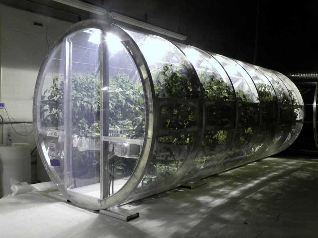
Scientists have made marked developments in growing vegetables in space this spring. Researchers based at Kennedy Space Center have been working with a team from the University of Arizona to create a prototype lunar/Mars greenhouse. The cylindrical, inflatable chamber measures 18 feet long and 8 feet in diameter. It recycles waste and water from astronauts, and uses carbon dioxide they exhale.
Growing edible plants in space will allow humans to venture farther beyond our home planet, said Ray Wheeler, lead scientist for Kennedy Advanced Life Support Research. “The greenhouses provide a more autonomous approach to long-term exploration on the Moon, Mars and beyond,” he said.

Image by University of Arizona.
In other space veggie tales…
Last month, perhaps the most-watched cabbage in the world—technically speaking, in Earth orbit—sprouted. Two tiny shoots of the Tokyo Bekana Chinese cabbage poked out of their specially-designed plant pillow. The pillow acts like a miniature plant bed, providing nutrients without the mess of dirt careening through space.
The cabbage is but the most recent crop on the ISS. The crew’s first harvest of space veggies from the Veg-01 experiment took place in 2015. However, flower-raising efforts have encountered a few more obstacles, including the formation of mold.
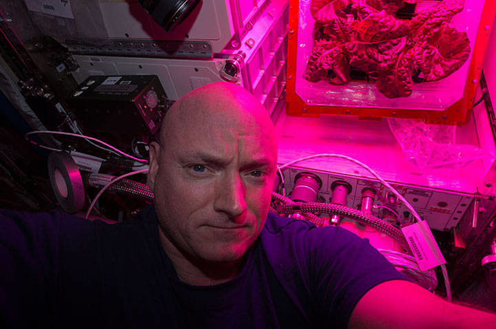
Scott Kelly with romaine lettuce. Image by NASA.
To learn more, check out this video, aptly titled “Lettuce Look at Veggie”:

After Hurricane Matthew ripped through Haiti, it blew through the Southeast. From above, NASA satellites, aircraft, and astronauts kept watch on the storm. The Earth Observatory published several images of the destructive storm (thumbnails above). The below includes a sampling of other notable images and maps related to the storm.
Soil Moisture
Matthew drenched the Carolinas, breaking records for single day rainfall in six places, The Washington Post reported. The Southeast received a total of 13.6 trillion gallons of water—that’s three-fourths the volume of the Chesapeake Bay. Hard-hit areas of North Carolina received 15 inches (38 centimeters) of rain.
That downpour saturated the area, causing values for soil moisture to increase substantially. The North American Land Data Assimilation System (NLDAS) mapped these values for October 1, 2016.
Even before the storm arrived, the ground in many areas was saturated. Eastern North Carolina and northeastern South Carolina have localized areas over the 98th percentile. That means that on October 1, the soil was wetter than it was on that date in 98 percent of previous years. The already-wet soils and heavy precipitation from Matthew led to significant flooding in these areas.

Image: NASA
Temperature and Precipitation
The Jet Propulsion Laboratory (JPL) HAMSR instrument flew above Hurricane Matthew on October 7, 2016, aboard a NASA Global Hawk aircraft. The image below shows atmospheric temperatures overlaid atop ground-based radar and satellite visible images, according to a JPL release. Reds tones show a lack of clouds, whereas blue tones show ice and heavy precipitation. At the top left is an image taken from the Global Hawk.

Image: JPL/NASA
Clouds Swirling from Above
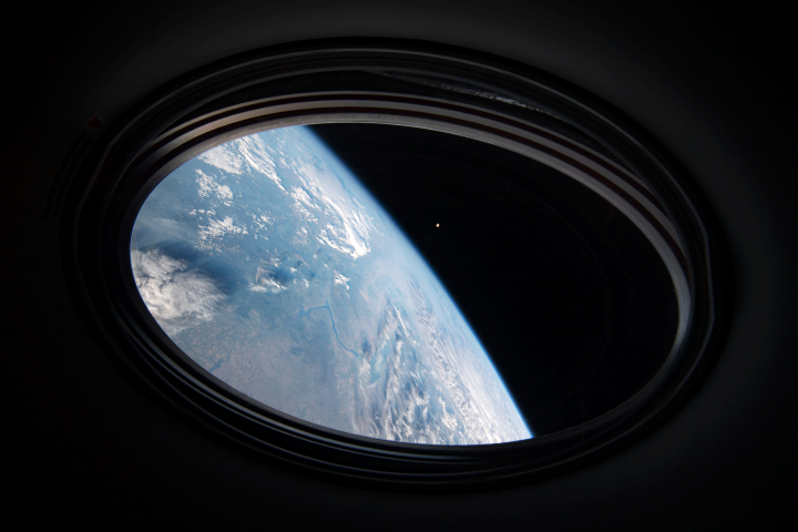
Expedition 49 astronaut Kate Rubins took the photograph below from the International Space Station at 21:05 Universal Time, on October 4, 2016, as the hurricane approached the Florida coast. Hurricane clouds fill the shot, which includes the station’s solar arrays.

Photo: NASA/Kate Rubins
