
On June 29, 2012, a long-lived, fast-moving windstorm blew over the eastern United States. The storm started in northwestern Indiana and, over the next 10 hours, traveled roughly 600 miles (1,000 kilometers) toward the East Coast. Wind speeds matched those of an EF-1 tornado in places. The storm uprooted trees, damaged homes, smashed cars, downed power lines, and left more than a million residents of the Washington, D.C. area without electricity.
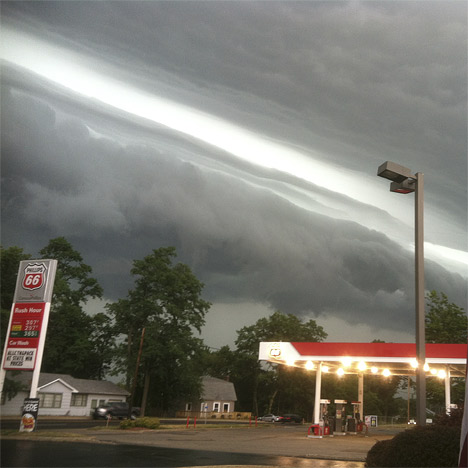
This photo shows an unusual cloud formation on the leading edge of the June 29 windstorm. Image courtesy Kevin Gould and NOAA.
Meteorologists classified the storm as a derecho—a windstorm associated with fast-moving thunderstorms. A derecho is not a new phenomenon; the term was coined in the late nineteenth century. These storms can rival tornadoes in terms of the damage they cause but, unlike tornadoes, derecho winds generally cause damage in one direction.
The derecho that struck on June 29, 2012, occurred along the boundary of a stable, dry air mass to the north, and a moist, unstable air mass to the south. Areas affected by the southern air mass were suffering a severe heat wave, including record-breaking temperatures in multiple locations. The high heat and humidity provided energy to the strong winds. The thunderstorms sucked up warm, moist air and subsequently returned it in downdrafts. Hitting the ground at tremendous speed, the downdrafts fanned out over the surface, sometimes picking up speed.
The U.S. National Oceanic and Atmospheric Administration (NOAA) provides a primer on derechos, and an overview of the June 29 event. The Capital Weather Gang also provides a summary of the event.