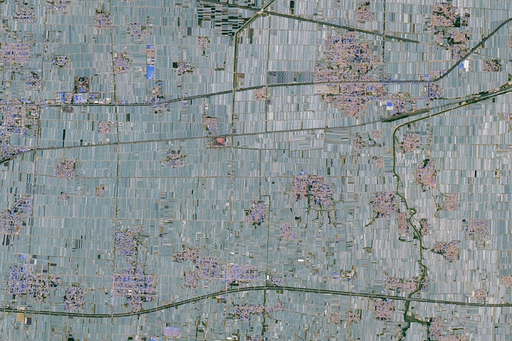
Update on June 4, 2024: This image shows greenhouses in eastern China. Congratulations to James Varghese for being the first to correctly identify the feature and its location. Read more about the area in “A Greenhouse Boom in China.”
How to answer. You can use a few words or several paragraphs. You might simply tell us the location, or you can dig deeper and offer details about what satellite and instrument produced the image, what spectral bands were used to create it, or what is compelling about some obscure feature. If you think something is interesting or noteworthy, tell us about it.
The prize. We cannot offer prize money or a trip on the International Space Station, but we can promise you credit and glory. Well, maybe just credit. Within a week after a puzzler image appears on this blog, we will post an annotated and captioned version as our Image of the Day. After we post the answer, we will acknowledge the first person to correctly identify the image at the bottom of this blog post. We also may recognize readers who offer the most interesting tidbits of information. Please include your preferred name or alias with your comment. If you work for or attend an institution that you would like to recognize, please mention that as well.
Recent winners. If you have won the puzzler in the past few months, or if you work in geospatial imaging, please hold your answer for at least a day to give less experienced readers a chance.
Releasing comments. Savvy readers have solved some puzzlers after a few minutes. To give more people a chance, we may wait 24 to 48 hours before posting comments. Good luck!


It looks like numerous smallholder’s farms in India during the harvest season. The brown areas show unused land.
*looks like
36⁰42’20.5″N 118⁰43’26.4″E
Qingzhou, Weifang, Shandong, China
This region is renowned for its extensive greenhouse farming.
The Shouguang area to the north is often called the “Vegetable Capital of China” and is known for its highly organized agricultural fields covered in plastic greenhouses, similar to those seen in the satellite image.
China…Rice Paddies…All Paddies are aligned perpendicular to the hill’s slope and all major roads are leading up or downhill.
CHINA HEBEI XIONG’AN
Hoogezand
Hoogezand
Rice fields of China together with blossoming cherry blossom trees
looking at urban with agriculture, so I think the climate condition will be good. as for why it is look interesting may be the align of agriculture and the view of the satellite image feels me great, but one sad thing is that I don’t know the place.
From the top the line drop ,at 50% to 30% below,there are two parts,it could be rice fields,the cash runaway is fast.
AI show the trough in the middle of the screen,the loss is 20%,this line rise up showing the future of productivity.
The height is half in the expectation of a rise,the span is double the height,this is a landing zone of heavy to floods with no barrier.
Simulation would show it can come from a river,may be in china,the red color is deposit which can be from the higher ground.
As it is a large region there are variations to the geo landscape which does not distribute evenly to the map,it could be irrigation to urban area and pipe from the south to the north where there is less rainfalls,the satellite TDRS leaks and can show only one moment,realtime info and margin would be more accurate.
If it is in china ,in the combat over the north the usaf was out of reach unless it used air fields in areas,the lack of suitable planes were a limiting factor to the target which the taiwan was assigned over the entire area of south china.