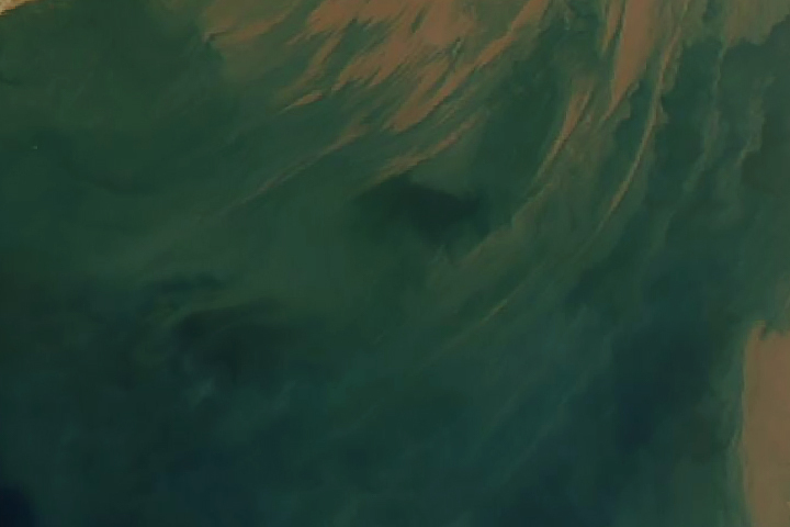
Every month on Earth Matters, we offer a puzzling satellite image. The January 2022 puzzler is shown above. Your challenge is to use the comments section to tell us where it is, what we are looking at, and why it is interesting.
How to answer. You can use a few words or several paragraphs. You might simply tell us the location, or you can dig deeper and offer details about what satellite and instrument produced the image, what spectral bands were used to create it, or what is compelling about some obscure feature. If you think something is interesting or noteworthy, tell us about it.
The prize. We cannot offer prize money or a trip on the International Space Station, but we can promise you credit and glory. Well, maybe just credit. Within a week after a puzzler image appears on this blog, we will post an annotated and captioned version as our Image of the Day. After we post the answer, we will acknowledge the first person to correctly identify the image at the bottom of this blog post. We also may recognize readers who offer the most interesting tidbits of information. Please include your preferred name or alias with your comment. If you work for or attend an institution that you would like to recognize, please mention that as well.
Recent winners. If you have won the puzzler in the past few months, or if you work in geospatial imaging, please hold your answer for at least a day to give less experienced readers a chance.
Releasing Comments. Savvy readers have solved some puzzlers after a few minutes. To give more people a chance, we may wait 24 to 48 hours before posting comments. Good luck!
February 1 update: The answer is suspended sediment in the Gulf of Khambhat, off the northwest coast of India. Congratulations to K Suraj, who correctly identified the Gujarat region of India and the Arabian Sea coast. Read more in this Image of the Day.
Tags: Earth, NASA, puzzler, satellites


I think, after going through, the article of NASA,
Arabian sea dust storm…. The image is from delta region
Of Gujarath, India you know the Arabian sea
At its lower coast.
Its interesting as it shows the sedimentation
And sea bed structure..
Ocean swashing sandy coast, black spots are turbulence
Is it the Soleway Firth in the UK? Not sure why it’s interesting? Neato sediment?
Tonga volcano eruption??
Sand blowing from Morocco over to the Canary Islands ??
Called “Calima” or “polvo en suspensión”
bermuda triangle with a nor’easter blowing up the coast
Arabian Sea dust storm
That was a wave of sea
A muddy sea joining another clear one or a very muddy river reaching the sea
A dust storm on Mars
Gulf of Khambhat sediment discharge from monsoon engorged rivers.