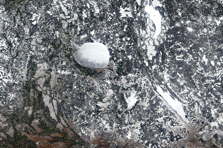
Every month on Earth Matters, we offer a puzzling satellite image. The March 2020 puzzler is above. Your challenge is to use the comments section to tell us what we are looking at, where it is, and why it is interesting.
How to answer. You can use a few words or several paragraphs. You might simply tell us the location, or you can dig deeper and explain what satellite and instrument produced the image, what spectral bands were used to create it, or what is compelling about some obscure feature. If you think something is interesting or noteworthy, tell us about it.
The prize. We cannot offer prize money or a trip to Mars, but we can promise you credit and glory. Well, maybe just credit. Roughly one week after a puzzler image appears on this blog, we will post an annotated and captioned version as our Image of the Day. After we post the answer, we will acknowledge the first person to correctly identify the image at the bottom of this blog post. We also may recognize readers who offer the most interesting tidbits of information about the geological, meteorological, or human processes that have shaped the landscape. Please include your preferred name or alias with your comment. If you work for or attend an institution that you would like to recognize, please mention that as well.
Recent winners. If you’ve won the puzzler in the past few months, or if you work in geospatial imaging, please hold your answer for at least a day to give less experienced readers a chance.
Releasing Comments. Savvy readers have solved some puzzlers after a few minutes. To give more people a chance, we may wait 24 to 48 hours before posting comments. Good luck!


It is a frozen lake
It’s the Lake Beloïe (White Lake) in Vologda Oblast, Russia.
A canal was built to bypass the Lake around the south west part of the lake. It open in 1846. This canal is a part of the Volga-Baltic sea waterway
It’s a large artificial (manmade) coverage consisting of a kind of web. It is maybe for scientific (as an artificial environment) or protective reasons (against frost). The landscape around the object is a lake landscape and the lakes have frozen surfaces.
Could be a frozen water body in a tundra-like area amidst plenty of other frozen ponds and little lakes. Perhaps in a permafrost area like the Arctic or in a subarctic region? Northern Siberia, northern Canada.
It is a frozen lake. The interesting feature is that the thickness of the ice varies giving the illusion that it is somehow a bubble above the land surface. To the North-east is patch of snow or ice(?) that resembles a sperm whale.
It is an Iceberg
Chernobyl nuclear plant
Lake Beloye in Russia!
Fun fact: the lake was once part of a canal system, but it was too treacherous in bad weather. Eventually the canal was rerouted around the southwestern edge of the lake instead.
Parasuit in sky
Parasuit or Weather balloon in sky
It’s a North Korea missile test, last week.
An abandoned quarry
Lake Baikal
Frozen lake Baikal in Siberia
It appears to be the Giant iceberg spotted just off the Avalon Pennisula of Newfoundland.
A cocoon on a rock.
A rock with an ice cube in the center
HI- SEAS Mars isolation project in Hawaii maybe?? Everyone has to self-isolate now, so it’s relevant??
Australia Bushfire’s
Is Seattle
It is a used N95 mask floating high in the atmosphere.
It’s a droplet on the camera lense
I believe it to be samples from Mars underground samples of frozen elements and Life organisms in the rock Derived from the
ice found. And is growing new Elemental life.
mars polar region
mars southern pole region
sigh