The striking patterns in northeastern Canada’s flood basalts tell a story of continental collisions that played out almost two billion years ago. The large-scale patterns are visible from space—a wide view that provides a sweeping perspective on the region’s steps and folds cut by faults. But look closer, and then closer again, and other patterns and details emerge.
Deanne van Rooyen, a geologist at Cape Breton University, and David Corrigan of the Geological Survey of Canada, have been doing field work in the region to better understand the details of how the flood basalts evolved. They provided the following photos as examples of some of the details that become visible when viewed close up.

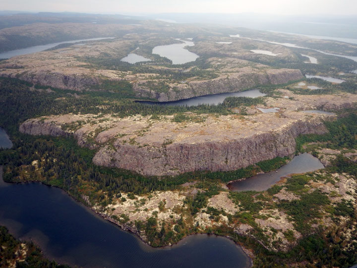
As described in detail in the Image of the Day, successive layers of flood basalt eroded and formed step-like features known as “traps.” The cliff face of each flow (or series of flows) represents a step, each standing about 50 to 70 meters (160 to 230 feet) tall. The steps were later folded as ancient, stable parts of Earth’s crust collided. The steps visible in the photograph above, shot from a helicopter, show some of these step-like features amid the central part of a folded structure.

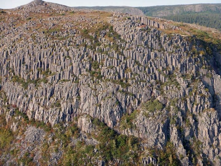
A closer look at the steps (above) reveals hexagonal columns in the flood basalts. These structures are known as “columnar jointing,” and form when layers of basalt cool and contract. They occur elsewhere around the planet too; a well-known example is the Giant’s Causeway in Northern Ireland.

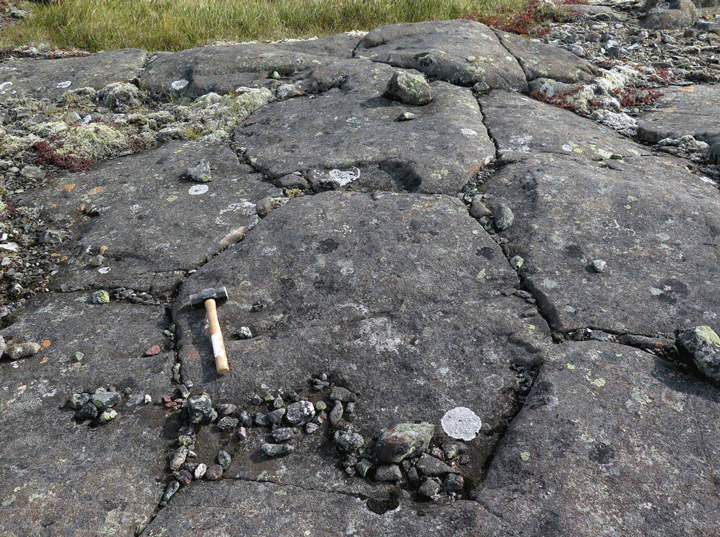
This photograph shows an even closer look at the column tops. Notice the hexagonal shape of the basalt. Corrigan and Van Rooyen are working on a detailed study of these basalts, which they refer to as the “Labrador Traps.”


