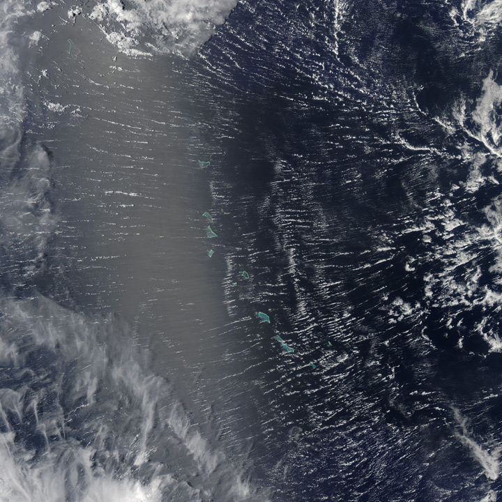
Every month on Earth Matters, we offer a puzzling satellite image. The April 2017 puzzler is above. The challenge this month, however, is slightly different. Use the comments section to tell us not only WHERE we are looking, but WHAT we are looking at. As usual, we welcome ideas about when the image was acquired, and why the scene is interesting.
How to answer. Your answer can be a few words or several paragraphs. (Try to keep it shorter than 200 words). You might simply tell us what part of the world an image shows. Or you can dig deeper and explain what satellite and instrument produced the image, what spectral bands were used to create it, or what is compelling about some obscure speck in the far corner of an image. If you think something is interesting or noteworthy, tell us about it.
The prize. We can’t offer prize money or a trip to Mars, but we can promise you credit and glory. Well, maybe just credit. Roughly one week after a puzzler image appears on this blog, we will post an annotated and captioned version as our Image of the Day. After we post the answer, we will acknowledge the person who was first to correctly ID the image at the bottom of this blog post. We may also recognize certain readers who offer the most interesting tidbits of information about the geological, meteorological, or human processes that have played a role in molding the landscape. Please include your preferred name or alias with your comment. If you work for or attend an institution that you want us to recognize, please mention that as well.
Recent winners. If you’ve won the puzzler in the last few months or work in geospatial imaging, please sit on your hands for at least a day to give others a chance to play.
Releasing Comments. Savvy readers have solved some of our puzzlers after only a few minutes or hours. To give more people a chance to play, we may wait between 24-48 hours before posting the answers we receive in the comment thread.
Good luck!


We are looking at Atols of French Polynesia. It is interesting, because a strong Passat wind is blowing, while it is summer.
Photo of the Gilbert Islands of Kiribati in the central Pacific Ocean which straddle the Equator and are on the extreme eastern edge of the eastern hemisphere.
Kiribati Gilbert Is.
Approaching cyclone
Looks like some tiny remote atolls in a big ocean – probably the Pacific. I imagine there are many such places so what is special about them? Maybe a site for historic nuclear tests?
Hello,
Where: The Bahamas from one of the satellites in the Cyclone Global Navigation Satellite System (“CYGNSS”)
What: Perhaps to see what the wind speed is on the Bahama islands.
NASA people are awesome!
Warm regards,
Jodi Shragge
Coordinates: 0° 9’28.33″S, 173°54’15.17″E
Title: Effects of Cyclone Cook in Kiribati
Description: We are looking at some of the atolls and reef islands in the Central Pacific Ocean. Officially these islands are part of the Republic of Kiribati. This place is near to the intersection of the International date line and the Equator. The satellite image was most probably taken around April 10 2017 with Visible Infrared Imaging Radiometer Suite (VIIRS) on the Suomi NPP satellite when Tropical Cyclone Cook was active. South west corner of the image shows clouds that are part of Cook’s spiralling flanks. In addition, thin streaks of clouds have aligned themselves in north-east south-west direction because of the effects of Cyclone Cook.
small group of islands likely puts picture in Western Pacific. Centre of circular structure generating wind-stress is to the east of the islands. Wind seems to be clockwise, so a high in N. Hemisphere, or low in southern hemisphere. Islands seem to be atolls. Therefore in tropics.
HawaiIan islands