
We do have a few Trekkies on staff, but we didn’t actually have a Star Trek communicator in mind when we selected the May Puzzler. Nor were we trying to puzzle you by showing something from under a microscope. However, we did intend for the May puzzler to be tough because last month it was solved in a matter of minutes.
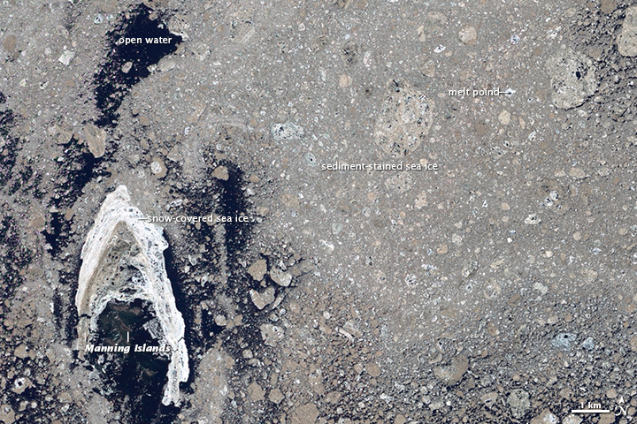
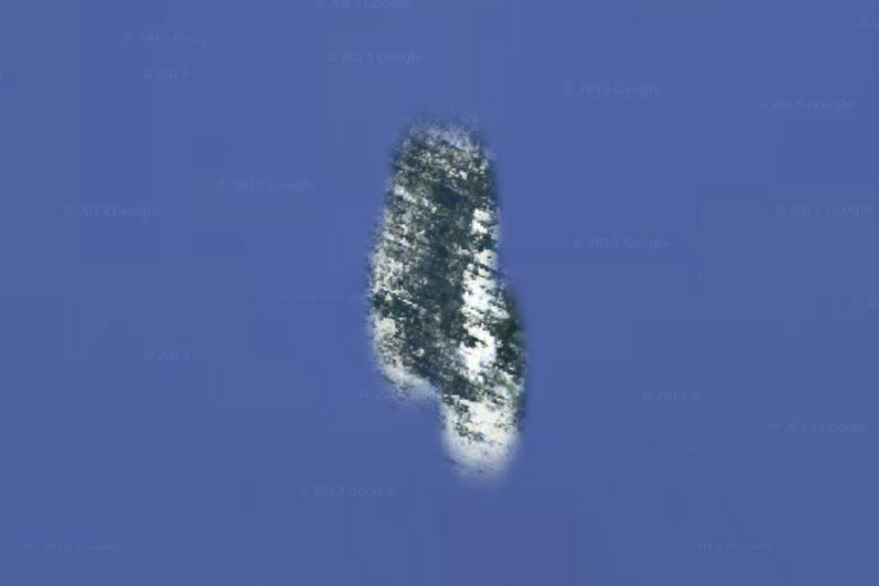
With that in mind, we choose an area that looks quite different on Google Maps than it does to NASA satellites. If you look carefully, you’ll notice that Google Maps imagery can be spotty in some areas, particularly in the high latitudes and over the oceans. For instance, compare how Nunavut’s Manning Islands—the answer to the puzzler—look on Google Maps (below) compared to the Advanced Land Imager (ALI) on July 26, 2012 (above).
Despite the hundreds of answers we received, nobody noticed that the Manning Islands were hidden away amidst all the sea ice. However, a few readers came close. On Facebook, Owen Anfinson hypothesized that the image showed pack ice in the Arctic during the summer, even pointing out that it was most likely sea ice near land because of all the sediment-covered ice. Meanwhile, Laura Yeo guessed that the image showed “rapid ice melt in the Northwest Passage in the summer of 2012.” Nice work, Owen and Laura. For more more details about the Manning Islands, read the Image of the Day we published on May 23, 2014.
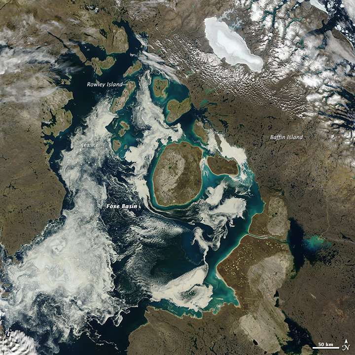
For some background about the satellite imagery on Google Earth, try this post from the Google Earth Blog. For more details about ALI, see the feature story we published in 2010. As a bonus for blog readers, you’ll find a broader view of Foxe Basin as seen by the Moderate Resolution Imaging Spectroradiometer (MODIS) on August 1, 2002, below.
darn I did not know the answer had been given already….well I was not too far off target. this is a fun feature, thanks for continuing to post these.