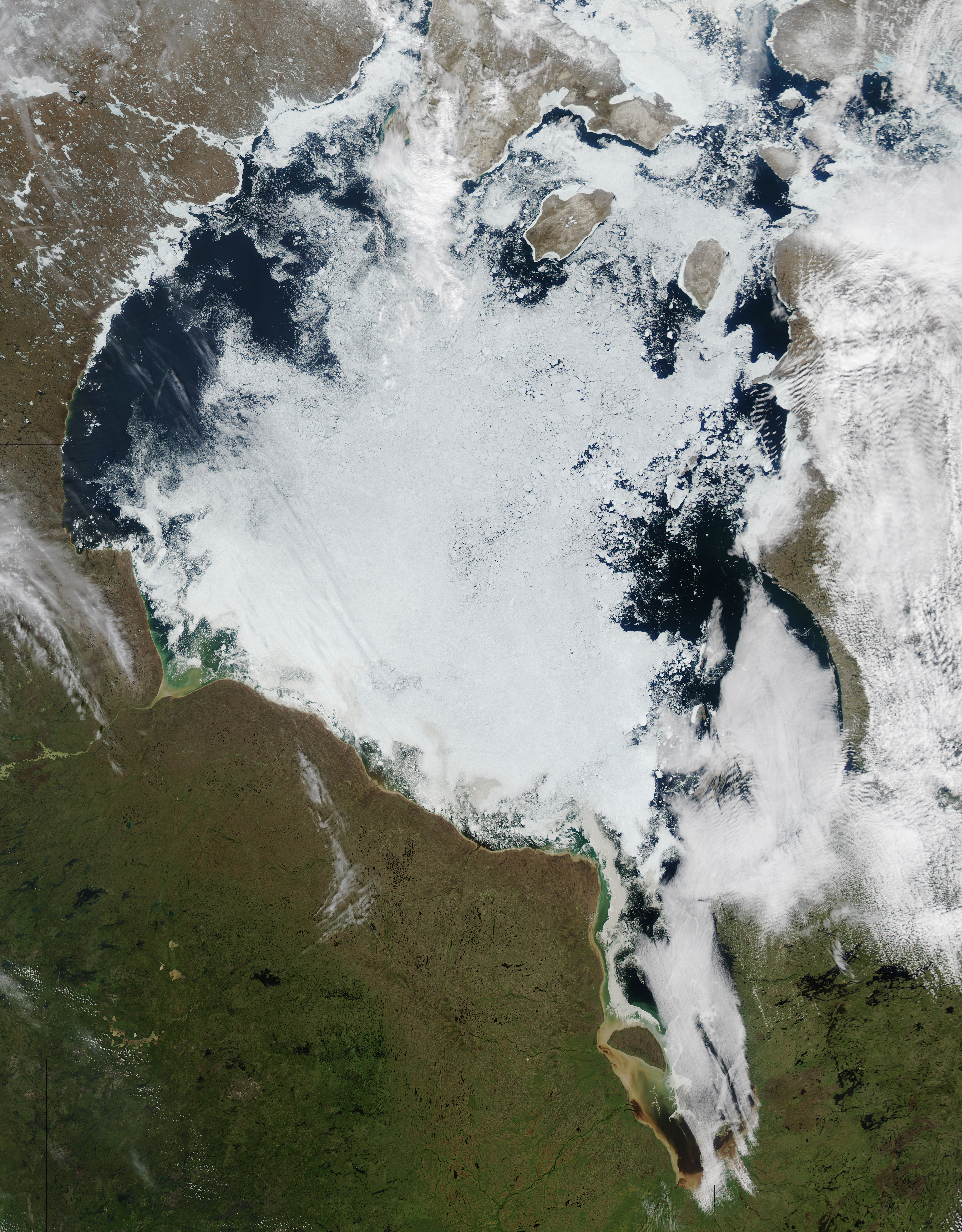
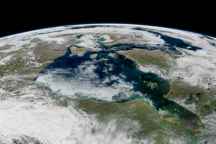
Every year, Hudson Bay cycles through periods dominated by ice and open water. Thick layers of sea ice cover most of the surface of the shallow inland sea during the winter. As longer and warmer days arrive in May and June, ice begins to thaw and break up. By August, Hudson Bay is usually ice-free. The cycle begins anew in October and November as temperatures drop.
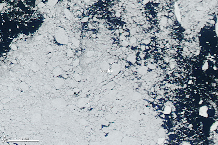
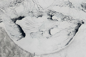
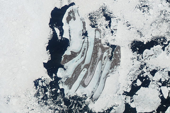
The Moderate Resolution Imaging Spectroradiometer (MODIS) on NASA’s Aqua satellite captured this view of ice breaking up on Hudson Bay on June 18, 2014. Sea ice appears white; open water is dark blue. The image below shows a patchwork of ice floes in the northeastern part of Hudson Bay near Mansel and Coats islands.
When MODIS acquired the image, ice covered about 45 percent of Hudson Bay, according to data from the Canadian Ice Service. That’s slightly less than normal for mid-June, though the pace of ice loss has been about average in the Arctic overall this summer. Ice generally clears from the eastern portion of Hudson Bay first. From there, open water spreads westward and southward.
Satellite observations suggest that the timing of ice breakup on Hudson Bay has changed since 1988, with it occurring nearly two weeks earlier now. The change may be associated with an increase in the strength of southwesterly winds during the first few weeks of June, British researchers argued in a study published in 2010. Global warming has also increased temperatures throughout the Arctic in recent decades, causing significant declines in sea ice extent throughout the region.
A modeling study published in 2011 projected that future warming in this region caused by climate change could bring further changes, reducing the duration of ice-covered conditions by seven to nine weeks per year. The authors concluded the greatest changes were likely to occur in southeastern Hudson Bay and James Bay.
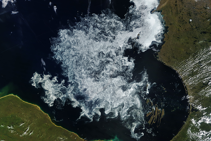
Narrow, repeating bands of clouds are also visible over the Ungava Peninsula northeast of the bay. Akin to the ripples that occur when a stone is thrown into a still pond, these atmospheric gravity waves appear when relatively stable and stratified air masses are disturbed by a vertical trigger from the underlying terrain, by thunderstorm updrafts, or other wind patterns.
NASA image courtesy Jeff Schmaltz, LANCE/EOSDIS MODIS Rapid Response Team at NASA GSFC. Caption by Adam Voiland.


