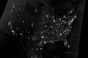
As millions of Americans are taking to the highways for the Thanksgiving holiday, a powerful winter storm is plowing across the nation. The storm is leaving snow, ice, and rain in its wake, creating hazardous travel conditions. By the time the storm is over, it will have brought wintery weather to 2.5 million square miles of the United States.
The storm is big news because it is disrupting travel during one of the busiest travel period of the year, but it's not otherwise all that unusual, says NASA research scientist Chris Kidd. “Large storms are expected a few times each winter, particularly at this time of the year,” says Kidd. Ocean waters in the Gulf of Mexico are still warm—around 80 degrees Fahrenheit—and they load the atmosphere with moisture. Meanwhile cold Arctic air is beginning to sweep down from the north. When that cold air clashes with warm, moist air from the south, it is the perfect recipe for a large storm system.
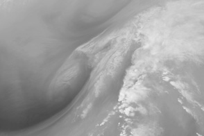
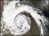
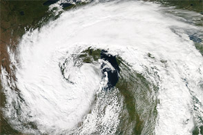
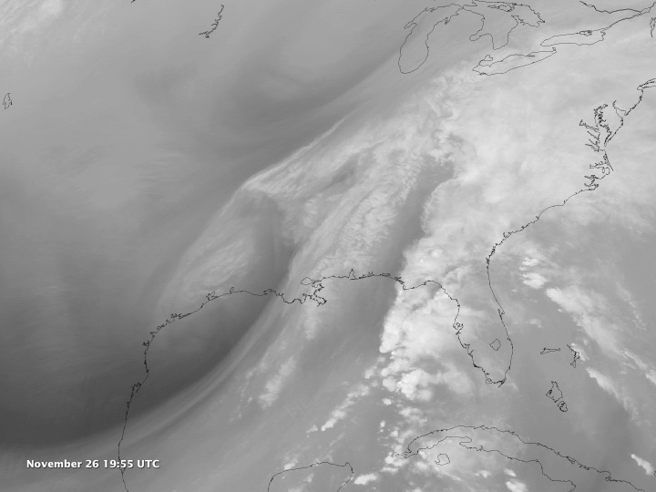
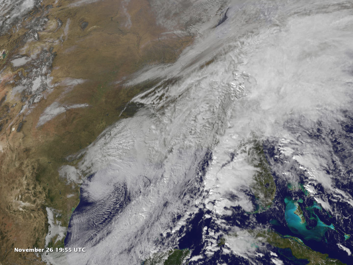
These images and animations show the storm system between November 24 and 26, 2013. The top image and associated animation show water vapor from the GOES East satellite, while the lower image and animation show clouds. The clouds offer a familiar view of the storm, but water vapor reveals the otherwise invisible clash between warm and cold air that is generating the storm.
“Water vapor imagery shows us the synoptic scale (large scale) weather patterns of the atmosphere,” says Marshall Shepherd, a research meteorologist at the University of Georgia and president of the American Meteorological Society. Water vapor absorbs very specific wavelengths of energy (6.7 microns). By measuring those wavelengths, we can find out how much water vapor there is in the middle and upper parts of the atmosphere, says Shepherd, so it’s useful for seeing weather features. In this image, light areas have high concentrations of water vapor, while darker areas are cooler, drier air.
The animation also shows warm, moist air from the Gulf being pulled into the system. The moist air is rising over cold, dense air near the surface. As the air rises, water condenses into rain. The storm is most intense in the stark visual boundary areas between light (cold, dry air) and dark (warm, moist air). Perhaps the most dramatic example of this is in the very bright line flowing north over western Florida. The turbulence in the boundary regions generates powerful thunderstorms, and in fact, tornado watches were announced for parts of the Florida panhandle.
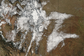
More broadly, cold air is moving in behind the storm. This section of the storm is likely to produce snow in many regions. The air is drier in the south, says Kidd, because it has traveled across the interior of the United States without access to large bodies of water. The stream of cold air visible in the north is a bit more moist because it has access to the Hudson Bay.
The storm system has already brought snow to the Southwest and Southern Plains, resulting in deadly road accidents. It was forecast to snow in the Appalachians and upper Northeast, while the rest of the Northeast and Mid-Atlantic expected a mix of rain, sleet, and ice.
Images courtesy NOAA-NASA GOES Project. NASA Earth Observatory animation by Robert Simmon. Caption by Holli Riebeek.