Have you ever wondered what it would be like to soar like a satellite, watching the world pass beneath you? The dream is elusive (except for a few astronauts), but through imagery from the Landsat Data Continuity Mission (LDCM), we can take a vicarious flight. And thanks to the Operational Land Imager (OLI), the view is crisper than what our own eyes would see.
After two months of testing and calibration in space, LDCM fired its propulsion system and ascended to its final orbit—705 kilometers (438 miles) above Earth’s surface—in mid-April 2013. One week later, the newest satellite in the Landsat family scanned a 185-kilometer (120-mile) wide swath of land from northern Russia to South Africa.
That flight path on April 19, 2013—depicted on a globe here—afforded us a chance to assemble a flyover view of what LDCM saw, including clouds, haze, and varying angles of sunlight. The full mosaic and animation stretches more than 9,000 kilometers (6,000 miles) and includes 56 adjoining, natural-color scenes stitched together into a seamless swath.
Orbiting at roughly 27,000 kilometers (17,000 miles) per hour, LDCM covered that distance in 20 minutes. Our full animation moves a bit faster, taking us 9,000 kilometers (6,000 miles) in 15 minutes. (Be sure to turn on the full-screen view.) Below you can watch some highlights of the flyover, or you can explore the swath at your own pace on our GigaPan and Google Earth versions.
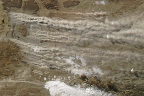
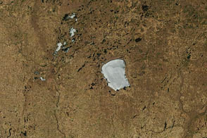
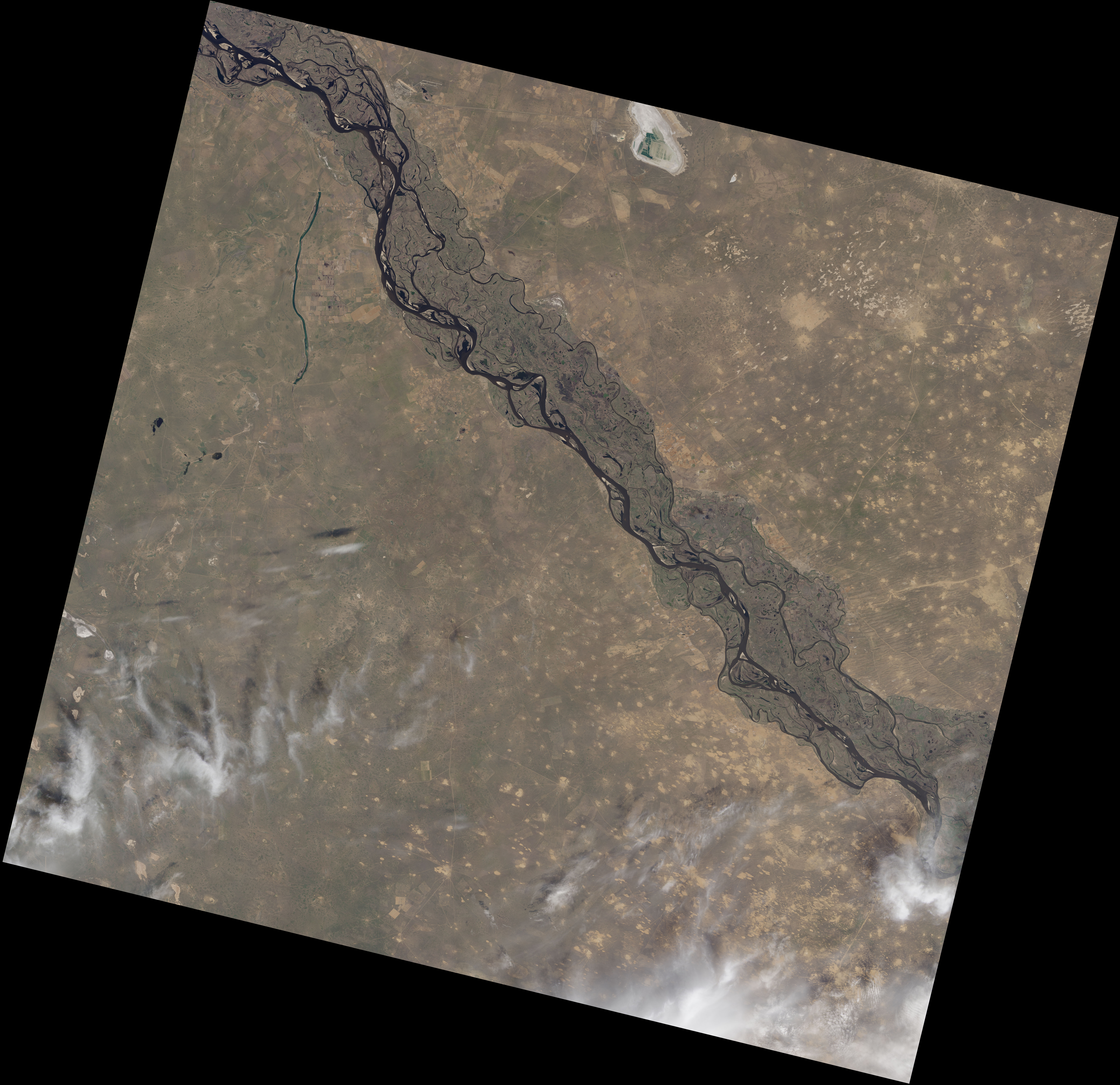
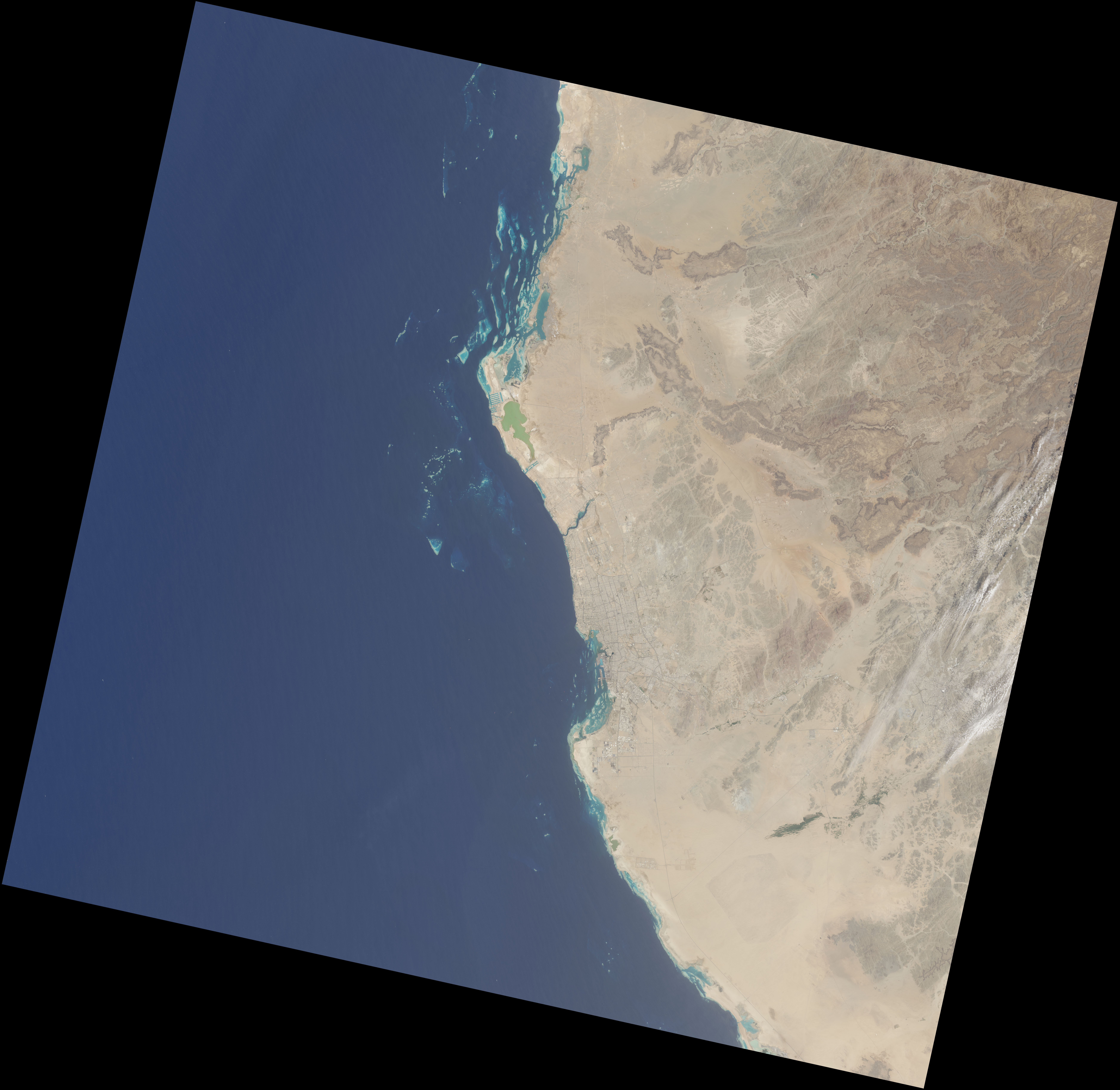
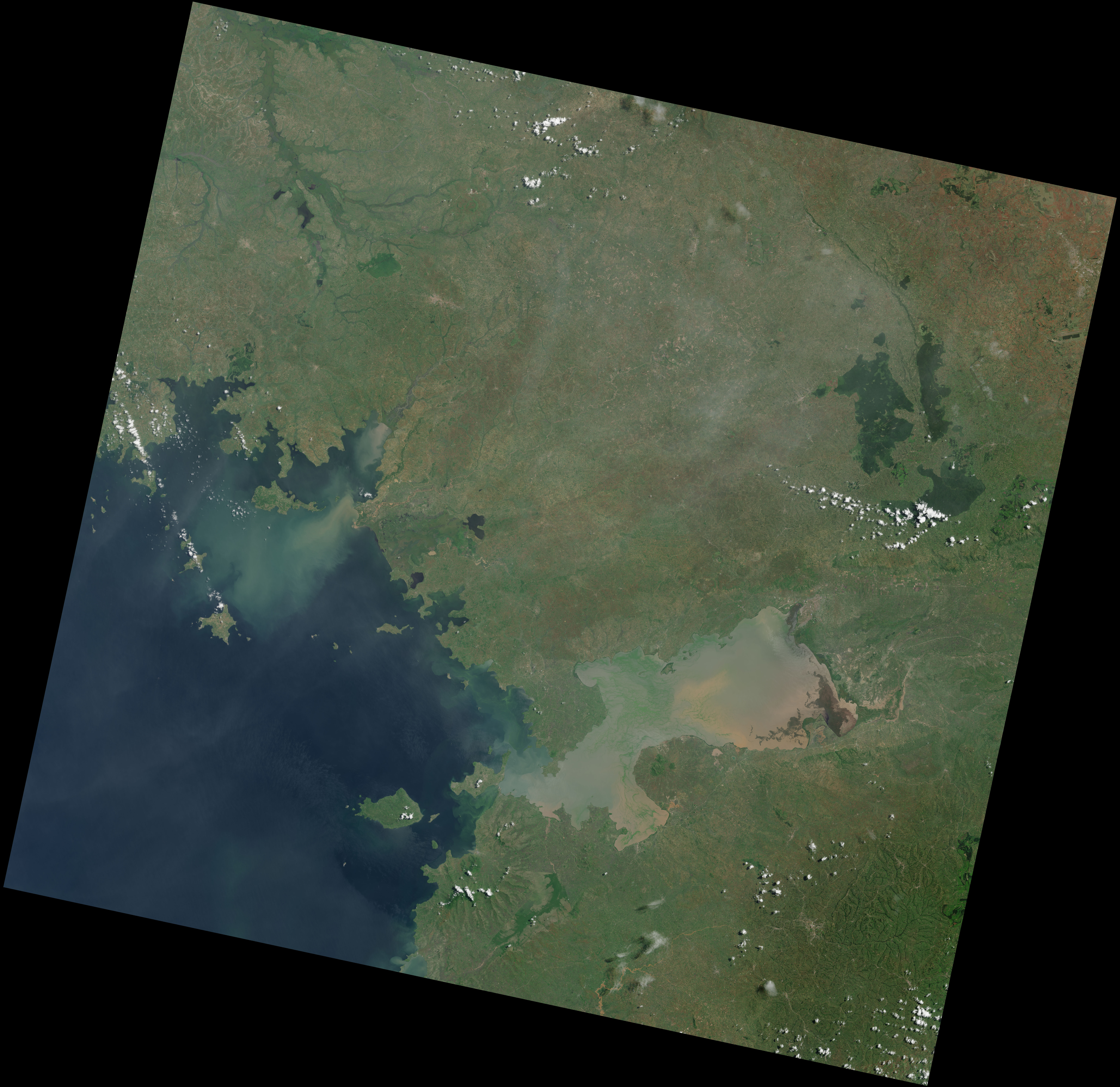
The image at the top of the page above is taken from the northern end of the flyover. Irregularly shaped fields and farms surround the braided channels of the Volga River in central Russia, an area with a long and rich history of agriculture. The middle image shows the Saudi Arabian city of Jeddah, along the coast of the Red Sea. The bottom image reveals the eastern shore of Africa’s largest lake, Lake Victoria. The shallow water is clouded with tan sediment and green plant growth.
Instruments on LDCM collect data in strips, or paths, which are divided into smaller scenes for cataloguing and storage at the Earth Resources and Observation Science Center of U.S. Geological Survey (USGS). The beginning, end, and center of those scenes are predetermined to correspond to scenes collected by Landsat 4, Landsat 5, and Landsat 7, and are catalogued in a path-row system called the Second World-wide Reference System.
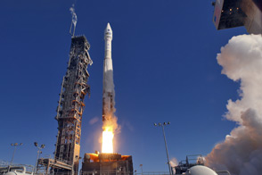
LDCM launched on February 11, 2013, as a joint mission of NASA and USGS. The satellite is still in its calibration and checkout phase, and the images shown here and in the mosaic are considered test data. In late May, the satellite will be handed over to USGS and renamed Landsat 8. After this point, the satellite will be operational and data will be available at no cost over the Internet.
Images by Robert Simmon and Jesse Allen, using data from the U.S. Geological Survey and NASA. Videos by Matt Radcliff. Caption by Holli Riebeek.