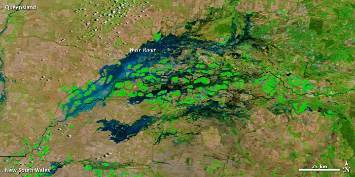
Roughly 300 kilometers (200 miles) inland from Australia’s east coast, a network of rivers runs along the border between Queensland and New South Wales. In early February 2013, after flooding affected other parts of Queensland, high waters reached this region, transforming the landscape in a matter of days.
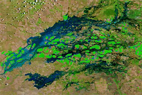
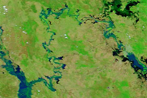
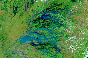
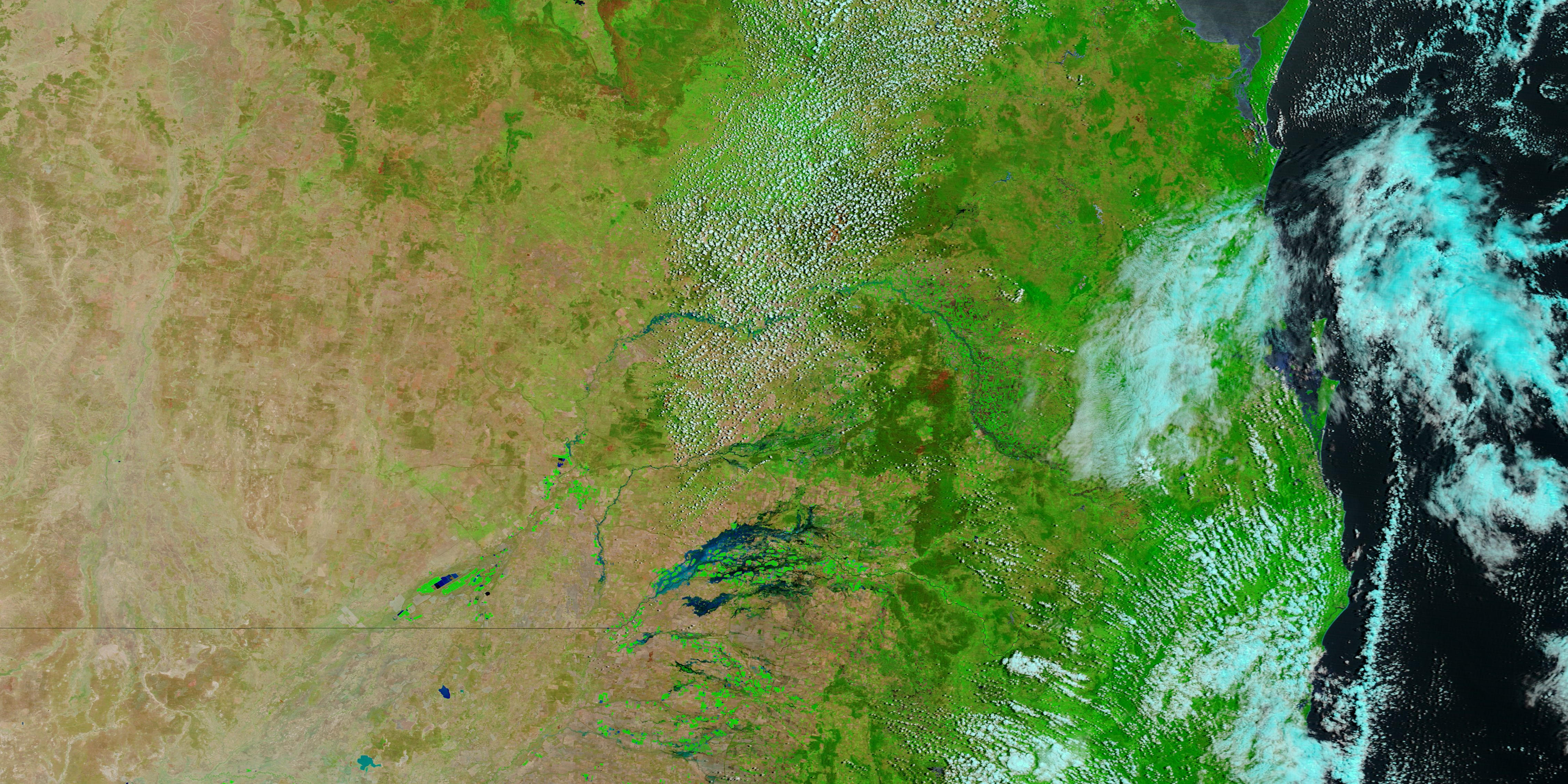
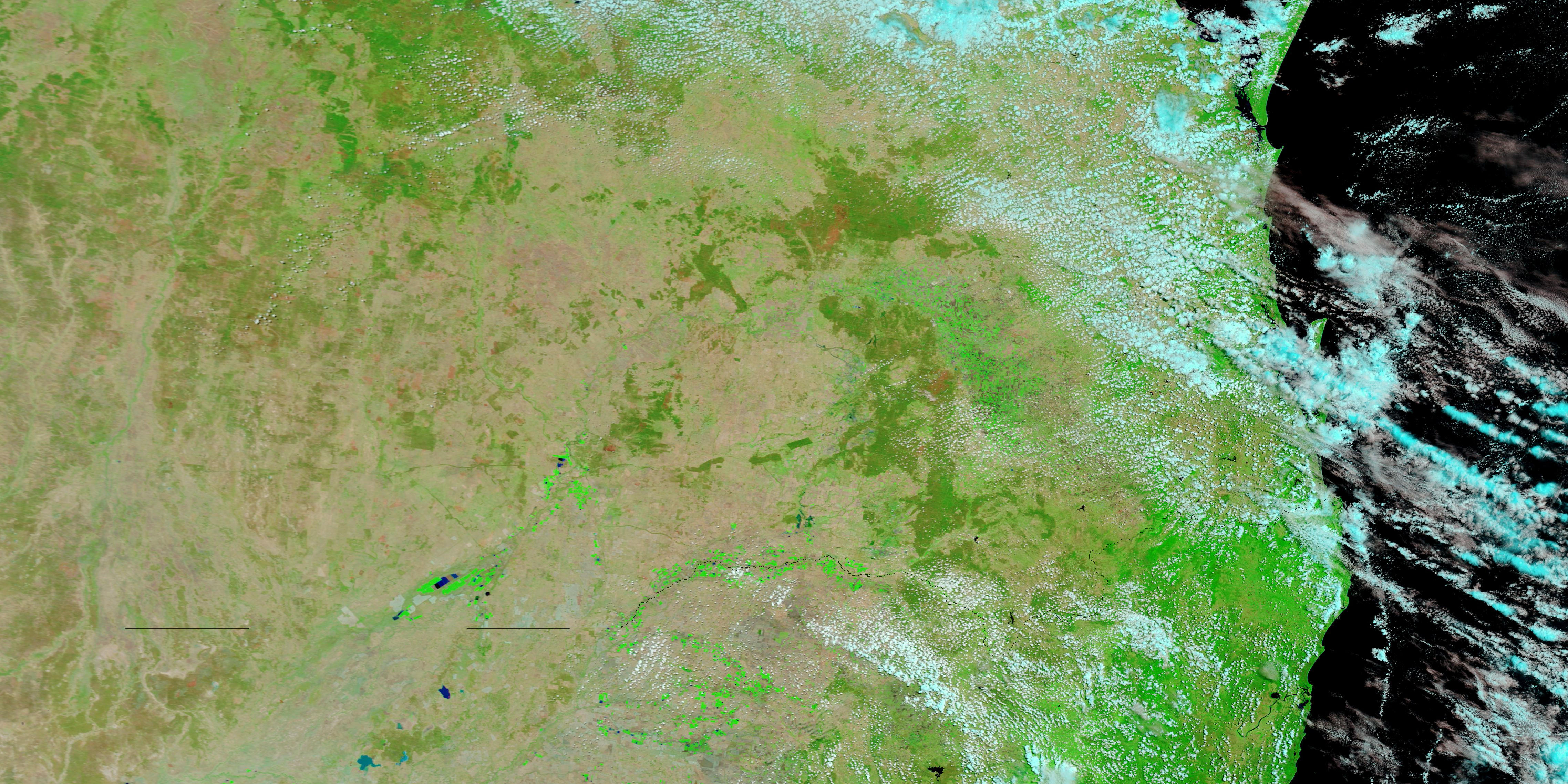
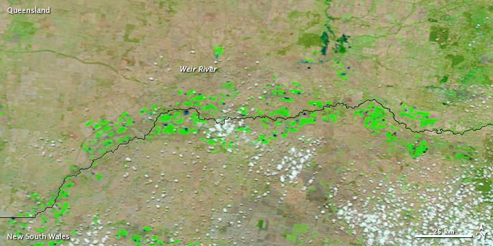
The Moderate Resolution Imaging Spectroradiometer (MODIS) on NASA’s Terra satellite captured the top image on February 4, 2013. For comparison, the bottom image shows relatively normal conditions observed on January 23, 2013.
These images use a combination of visible and infrared light to better distinguish between water and land. Water varies in color from electric blue to navy. Vegetation is bright green and bare ground is earth-toned. Clouds are pale blue-green. The overall lighter color in the January 23 image may reflect drier conditions, but might simply result from a different angle of the satellite sensor.
On January 23, the Weir River in southern Queensland was barely discernible. By February 4, the river had broken its banks and spread onto the surrounding floodplain, as had nearby rivers. The Australian Bureau of Meteorology warned of major river flooding in the region, including floods along the Weir and Macintyre Rivers.
NASA images courtesy LANCE MODIS Rapid Response. Caption by Michon Scott.