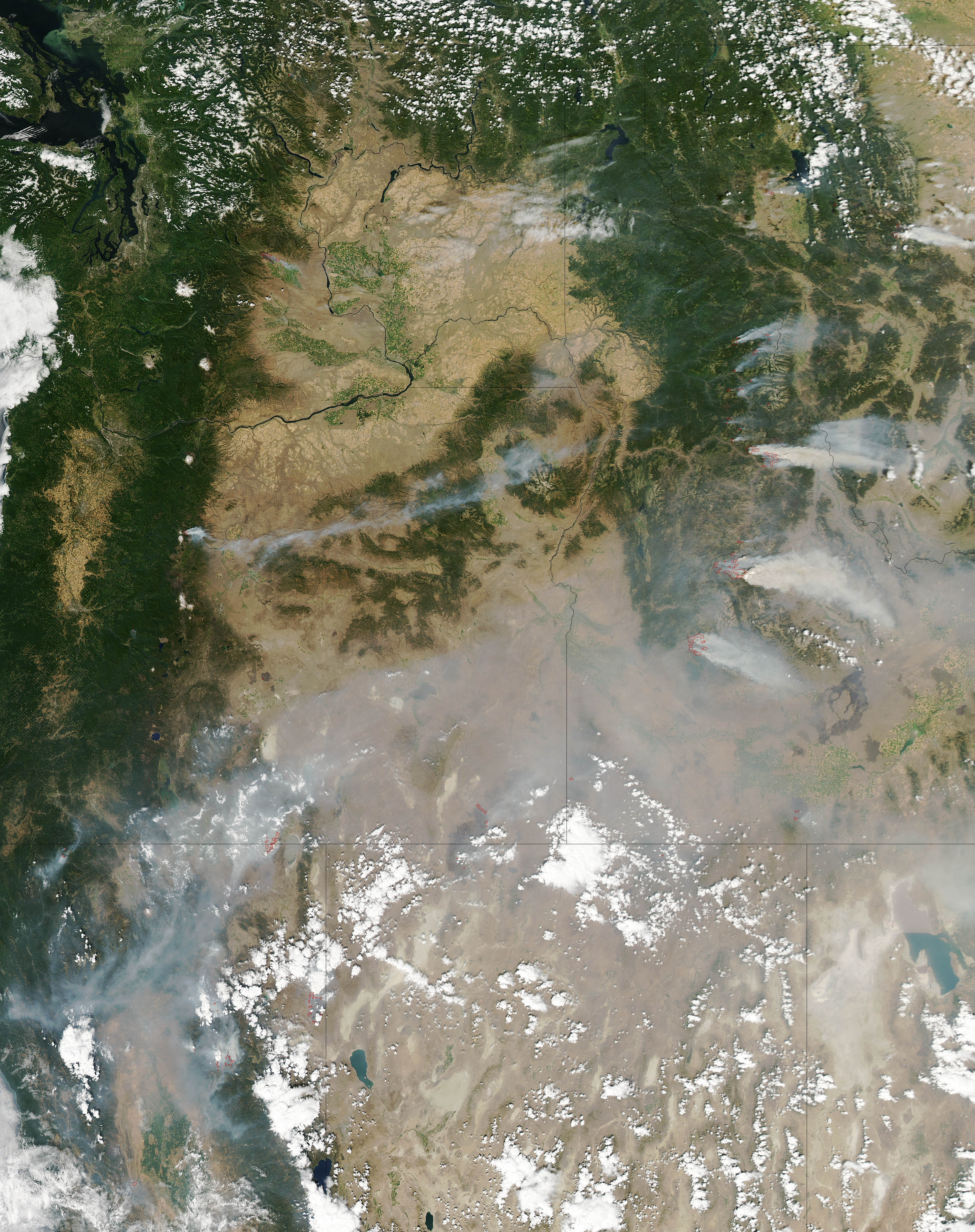
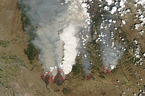
On August 16, 2012, numerous wildfires burned through coniferous forests in Idaho. Three of the largest were in central Idaho.
The Moderate Resolution Imaging Spectroradiometer (MODIS) on NASA’s Aqua satellite captured this image of the Idaho fires on Aug 14, 2012. Red outlines indicate hot spots where MODIS detected unusually the hot surface temperatures associated with fires. Thick smoke streamed east, contributing to a cloud of haze that covered much of Wyoming.
The Halstead fire was 3 percent contained and had charred more than 120 square miles (313 square kilometers) by August 16. Sparked by lightning in July, the fire burned through beetle-killed stands of lodgepole pine at times.
North of Halstead, a collection of wildfires known as the Mustang Complex had charred 134 square miles (346 square kilometers). Those fires were 5 percent contained. To the south, the Trinity Ridge fire burned 107 square miles (276 square miles) of Boise National Forest. Lightning ignited the Mustang Complex; human activity sparked the Trinity Ridge blaze, which was threatening the resort town of Featherville.
According to statistics maintained by the National Interagency Fire Center, a total of 548 wildfires had burned 790 square miles of land in Idaho through July 29, 2012.
NASA image courtesy Jeff Schmaltz, LANCE MODIS Rapid Response. Caption by Adam Voiland.


