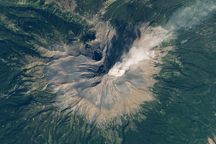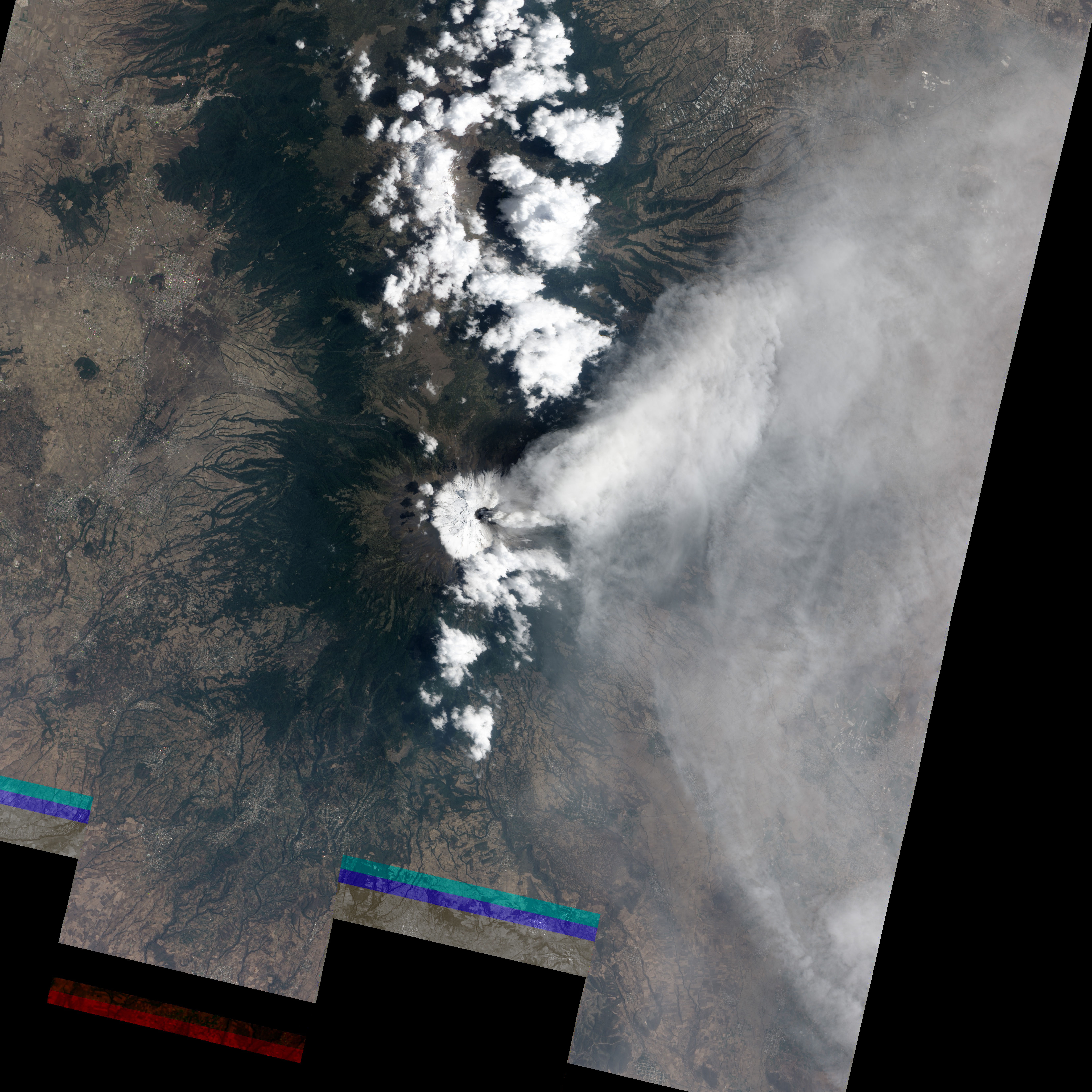
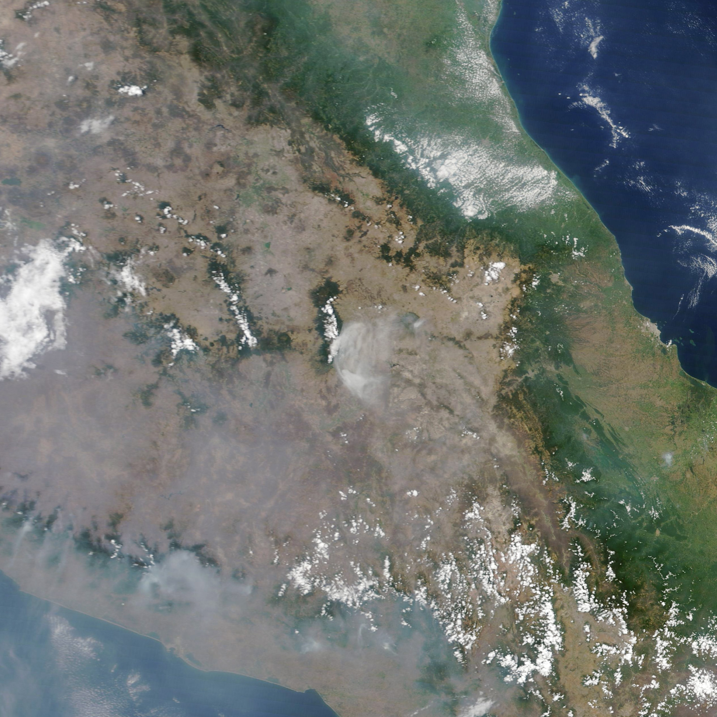
During the first week of May 2012, Mexico’s Popocatépetl Volcano maintained a high level of activity. Nearby seismographs recorded periods of harmonic tremor (long-lasting, low-frequency earthquakes that occur during some volcanic eruptions), along with occasional bursts of spasmodic tremor (shorter, higher frequency earthquakes). These tremors were accompanied by dozens of explosions each day, described as “exhalations” by the Centro Nacional de Prevención de Desastres (CENAPRED)—Mexico’s National Center for Prevention of Disasters. The explosions lofted gas and ash from the volcano, and small amounts of ash fell as far as suburban Mexico City, about 70 kilometers (40 miles) away.
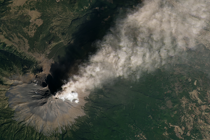
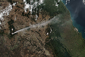
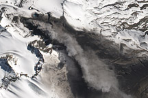
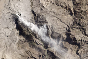
This pair of natural-color satellite images, collected on May 6, shows one of the larger exhalations. The top image, by the Advanced Land Imager (ALI) on Earth Observing-1 (EO-1), is a detailed view of the eruption plume rising from Popocatépetl’s snow-covered summit crater. The lower image, from the Moderate Resolution Imaging Spectroradiometer (MODIS) on Terra, shows the full extent of the plume as it stretched east and obscured the city of Puebla.
NASA images By Jesse Allen and Robert Simmon using EO-1 ALI data (top), and Jeff Schmaltz LANCE/EOSDIS MODIS Rapid Response Team, GSFC (lower). Caption by Robert Simmon.