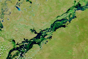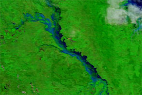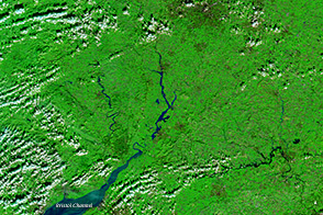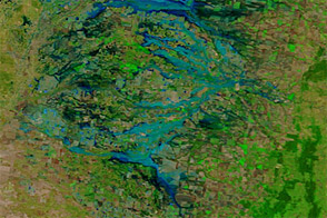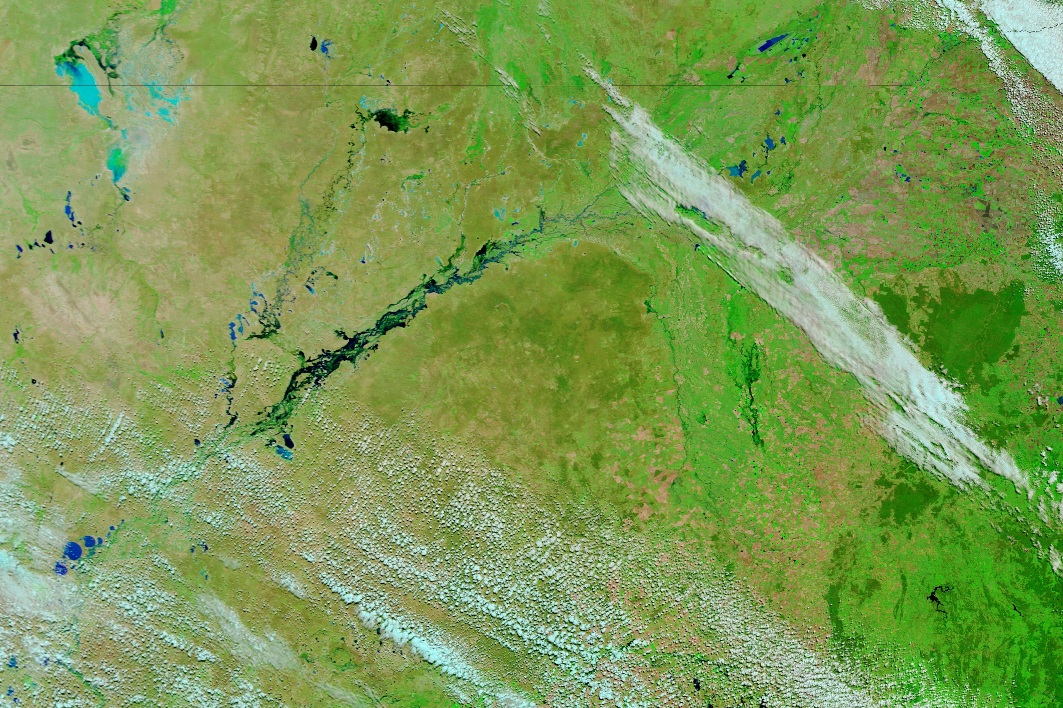
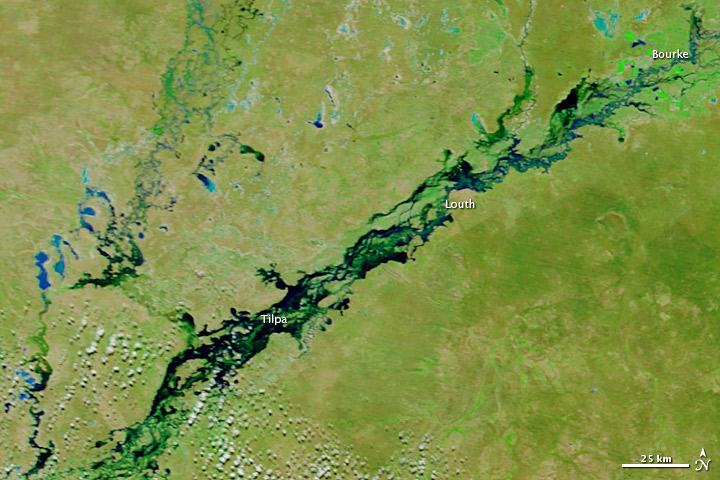
The Darling River—which flows roughly southwest across the Australian state of New South Wales—flooded in March 2012. On March 14, the State Emergency Service reported major flooding at Louth and warned of an expected floodwater peak at Tilpa over the coming days. Floods were receding at Bourke.
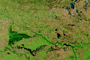
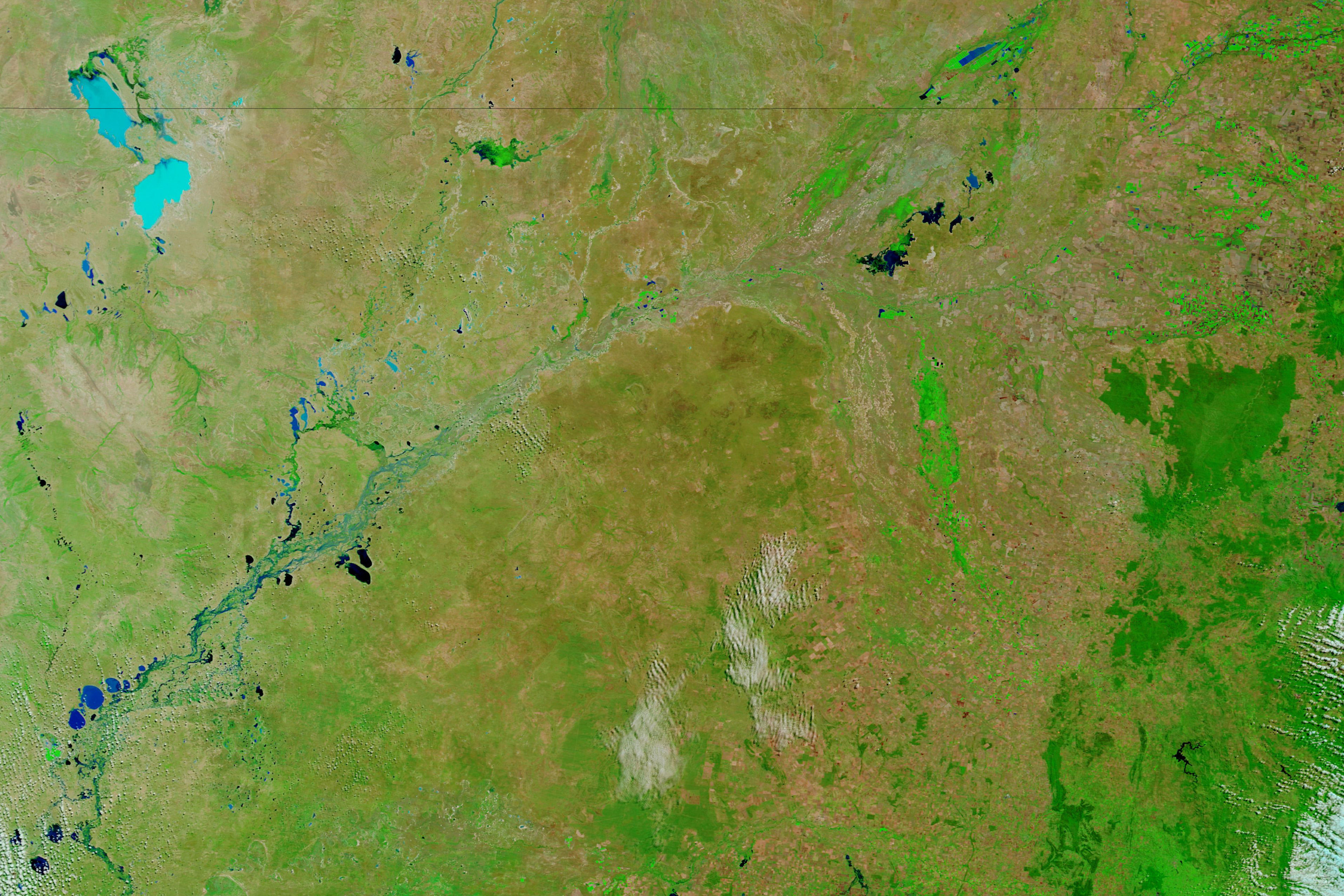
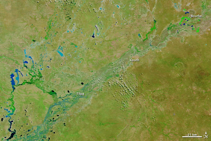
The Moderate Resolution Imaging Spectroradiometer (MODIS) on NASA’s Terra satellite captured the top image on March 23, 2012. For comparison, the bottom image shows the same region a year earlier, on March 26, 2011. These images use a combination of visible and infrared light to better distinguish between water and land. Water varies from electric blue to navy; vegetation is bright green; bare ground is earth-toned; and clouds are nearly white and cast shadows.
In February and March 2012, flooding affected large parts of southeastern Australia. By contrast, drought had affected the same general region from 1997 to 2011.
NASA images courtesy LANCE/EOSDIS MODIS Rapid Response Team at NASA GSFC. Caption by Michon Scott.