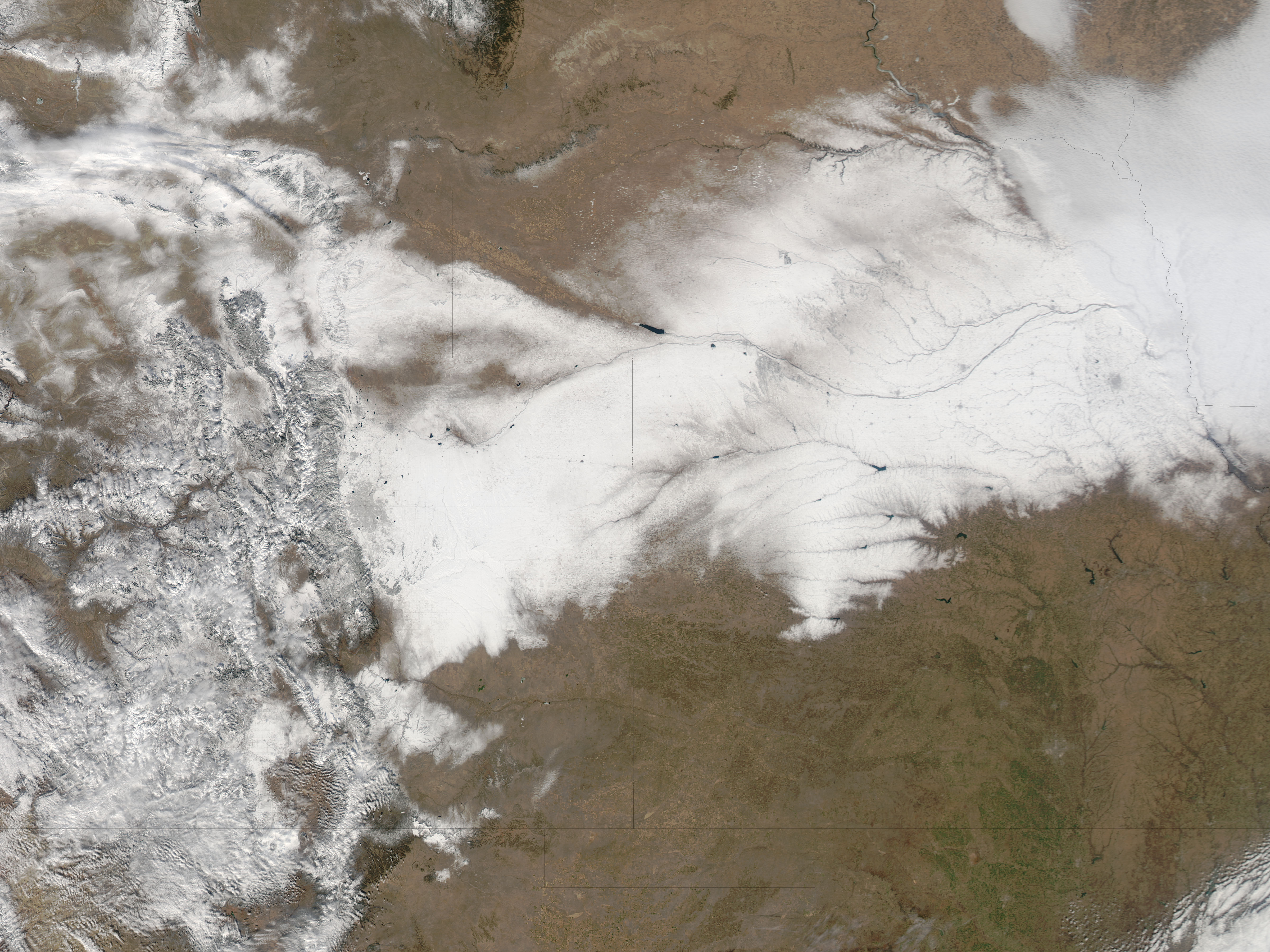
A record-breaking snowstorm struck Colorado in early February 2012, closing an interstate highway, grounding flights, and dropping more than a foot of snow on the Denver area. After moving out of northeastern Colorado, the storm left heavy snow across Nebraska.
The Moderate Resolution Imaging Spectroradiometer (MODIS) on NASA’s Aqua satellite captured this natural-color image on February 5, after skies had largely cleared over the region. Snow and mountain peaks create a mottled appearance in western Colorado. Elsewhere, the snow cover forms a wide, uneven track over Wyoming, Kansas, and Nebraska.
This snowfall did not break all-time records in Colorado, but it did break records for the month of February. The storm deposited 15.9 inches (40.4 centimeters) in Denver and 22.7 inches (57.7 centimeters) in Boulder. The National Weather Service also reported up to 18 inches (46 centimeters) of snow west of Omaha, Nebraska.
NWS meteorologists explained that northeastern Colorado generally experiences storms of this magnitude in March or April. This February storm showed some of the same characteristics of powerful spring storms, as a weather front from the Pacific Northwest converged with moisture from the Gulf of Mexico.
Colorado ski resorts welcomed the precipitation after suffering from below-normal snow cover for most of the 2011–2012 ski season. But the new snow raised the risk of avalanches. On February 6, the Colorado Avalanche Information Center reported “considerable” avalanche danger across much of the state.
NASA image courtesy Jeff Schmaltz, LANCE/EOSDIS MODIS Rapid Response Team at NASA GSFC. Caption by Michon Scott.