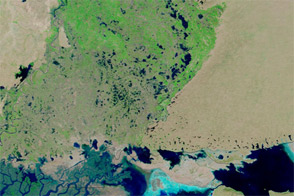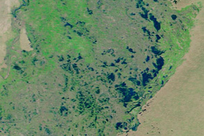
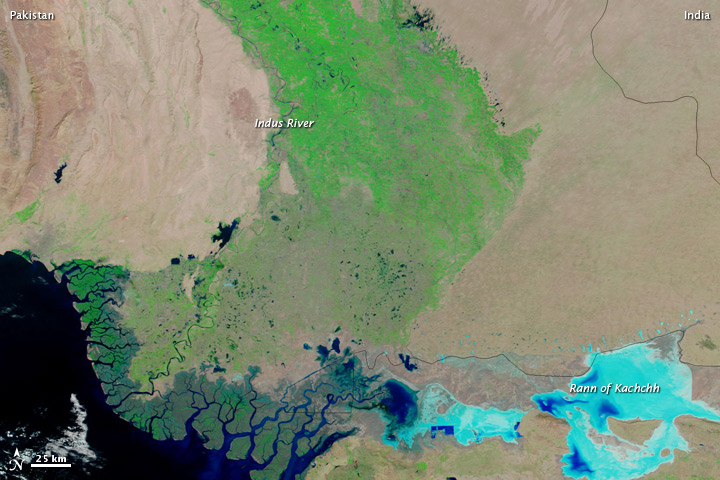
Nearly five months after severe flooding struck the region, in September 2011, parts of Pakistan’s Sindh Province remained flooded. The Moderate Resolution Imaging Spectroradiometer (MODIS) on NASA’s Terra satellite captured the top image on January 23, 2012. For comparison, the bottom image shows the same region two years earlier, on January 24, 2010.
Both images use a combination of visible and infrared light to better distinguish between water and land. Water varies in color from bright turquoise to navy, and darker shades generally indicate deeper water. Vegetation is green, and bare ground is pink-beige.
In January 2012, patches of standing water occur east of the Indus River. The Rann of Kachchh (or Kutch), a salt marsh, holds far more water than in 2010, evidenced by deeper shades of blue. Water is, however, receding from flooded areas and shows improvement over previous months.
In early January 2012, Pakistan-based publication The News reported that 1.5 million people affected by the floods still lacked shelter in Sindh Province, even as winter reached its peak.
NASA images courtesy LANCE/EOSDIS MODIS Rapid Response Team at NASA GSFC. Caption by Michon Scott.