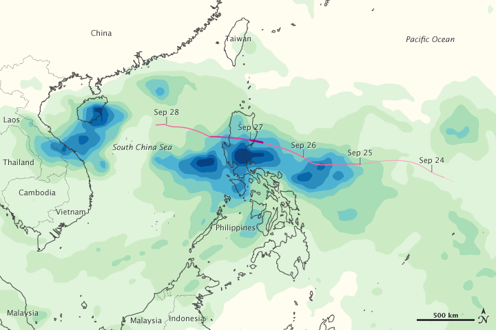

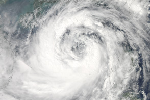
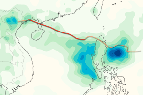
Rain from Typhoon Nesat (called Pedring in the Philippines) caused widespread flooding in the Philippines on September 27 and 28, 2011. The image, made from the Multi-satellite Precipitation Analysis, which is based on data from the Tropical Rainfall Measuring Mission (TRMM) satellite, shows heavy rain along the path of the storm between September 23 and September 27. The satellite data recorded more than 350 millimeters (14 inches) of rain across broad regions. Local rainfall totals may be higher. The image also shows an area of heavy rain over Vietnam and Hainan from Tropical Storm Haitang.
According to local news reports, the heavy rain from Nesat contributed to flooding across central Luzon, the largest island in the Philippines. The affected areas included key crop-growing regions. An estimated 33,890 tons of rice were lost, said news reports. Nesat affected nearly 350,000 people and caused 33 deaths with 41 missing as of September 29.
NASA Earth Observatory image by Jesse Allen, using near-real-time data provided courtesy of TRMM Science Data and Information System at Goddard Space Flight Center. Caption by Holli Riebeek.


