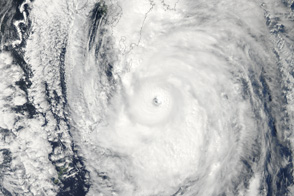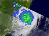
Typhoon Roke followed a looping path for five days while maintaining tropical-storm strength prior to intensifying to typhoon-strength at 12:00 UTC on September 19, 2011. When the TRMM satellite flew over Typhoon Roke, it was in the process of rapidly intensifying from a category 1 to a category 3 storm.
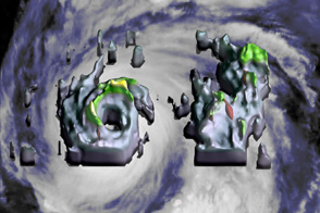
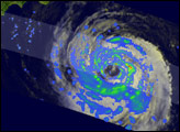
This image zooms into the inner core of Typhoon Roke during a period of rapid intensification, seen by the Tropical Rainfall Measuring Mission (TRMM) satellite at 13:51 UTC (10:51 p.m. Japan local time). The storm came ashore on September 21.
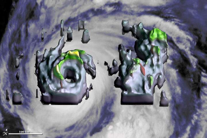
The background is the cloud-top temperatures seen by the infrared instrument on the TRMM satellite. Dark gray indicates regions where clouds are shallow, blue shades indicate regions where the clouds reach above the freezing level, and light-gray shades are for clouds that approach the tropopause indicating vigorous convection.
The three dimensional volume locates the precipitation inside the visible storm clouds. Green tinting indicates precipitation reaching an altitude of 8.5 kilometers (5.3 miles) and yellow tinting indicates an altitude of 11 kilometers (6.8 miles). These altitudes are far above the freezing level, which is typically near an altitude of 5 kilometers (3 miles) in the tropics. When air rises more than a kilometer or so above the freezing level, any moisture that condenses is likely to form ice particles instead of liquid drops and thereby release additional latent heat that may help fuel the storm.
This particular overflight of Typhoon Roke shows a remarkably well-organized circular eyewall, especially for a typhoon that was classified at merely tropical-storm strength earlier the same day. However, other aspects of the TRMM radar data suggest modest intensity. Specifically, the storm contains no towering clouds, and the red-colored inner volume indicating intense activity is very small in the circular eyewall. A larger volume would indicate the formation of large ice particles or extremely heavy liquid precipitation. Either event would be evidence of very vigorous updrafts. Also, there was a complete absence of lightning flashes in either the eyewall or in the rainband to the east of the eyewall, based on observations by the TRMM Lightning Imaging System (LIS).
TRMM is a joint mission between NASA and the Japanese space agency JAXA.
Image and caption by Owen Kelley (NASA Goddard Space Flight Center and George Mason University) using data from the NASA/JAXA Tropical Rainfall Measuring Mission (TRMM) satellite.