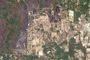
On September 6, 2011, the Texas Forest Service responded to 19 new fires. As of September 7, 2011, the agency had responded to 172 fires affecting a total of 135,051 acres (54,653 hectares) over the previous week. The Bastrop County Complex Fire had destroyed 785 homes, and other fires had destroyed 238 homes.
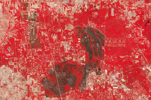
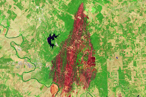
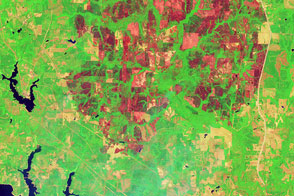
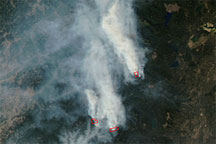
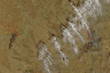
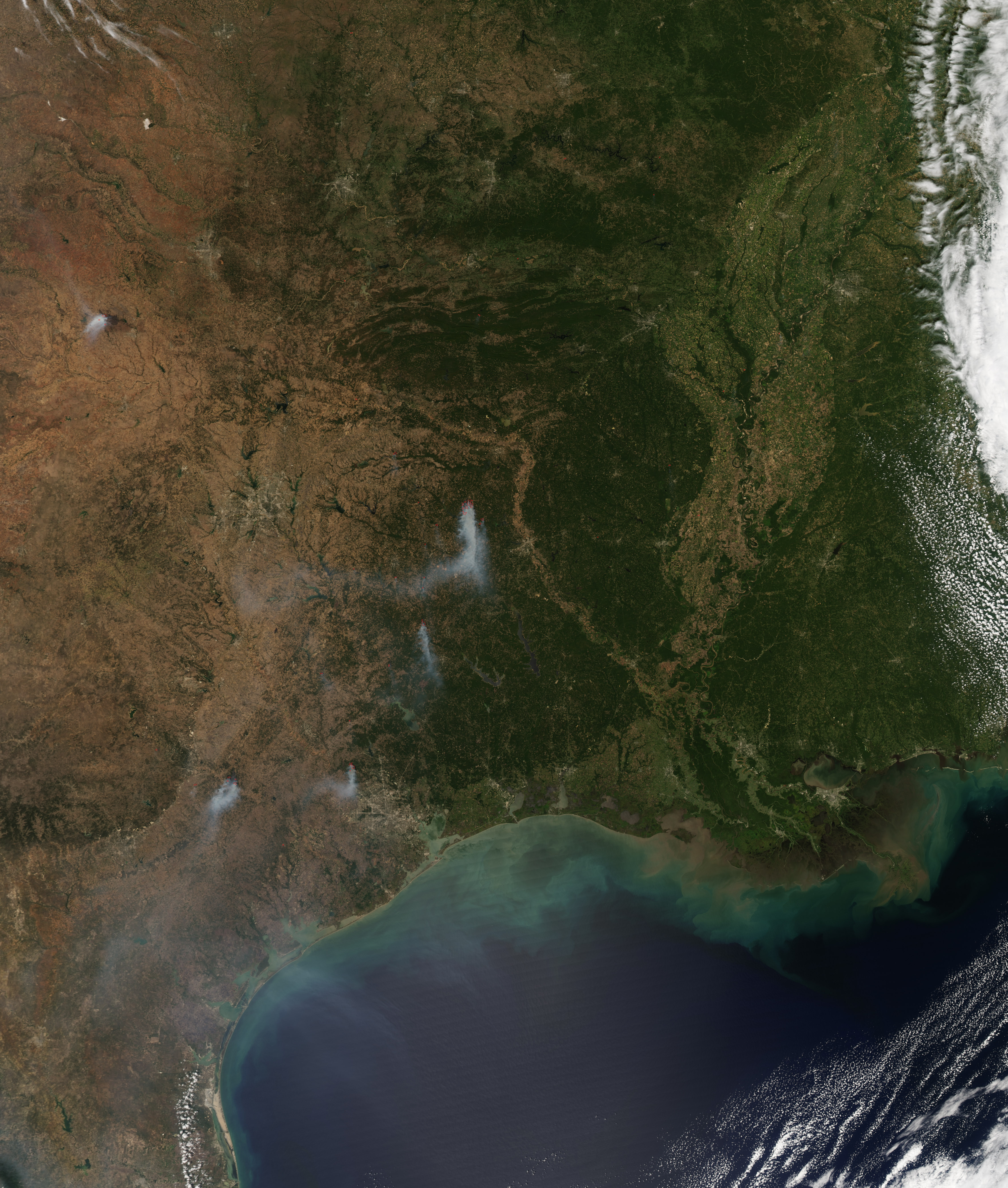
The Moderate Resolution Imaging Spectroradiometer (MODIS) on NASA’s Aqua satellite captured this image on September 6, 2011. It shows multiple fires burning around Dallas, Houston, and Shreveport. Red outlines indicate areas where MODIS has detected high surface temperatures associated with actively burning fires. Smoke plumes from the fires blow southward.
The Incident Information System provided updates for the fire complexes. As of September 6, the Riley Road Fire had burned 5,000 acres (2,000 hectares) and was 30 percent contained. The Bastrop County Complex Fire had burned 33,089 acres (13,391 hectares) and was 30 percent contained). The Bear Creek Fire had burned 14,000 acres (5,700 hectares) and had unknown containment. The Bastrop County Complex and Bear Creek Fires started on September 4. The Riley Road Fire started the following day.
Fires continued to menace Texas in the midst of ongoing drought.
NASA Earth Observatory image created by Jesse Allen, using data obtained from the MODIS-LANCE near-real time data system. Caption by Michon Scott.