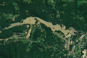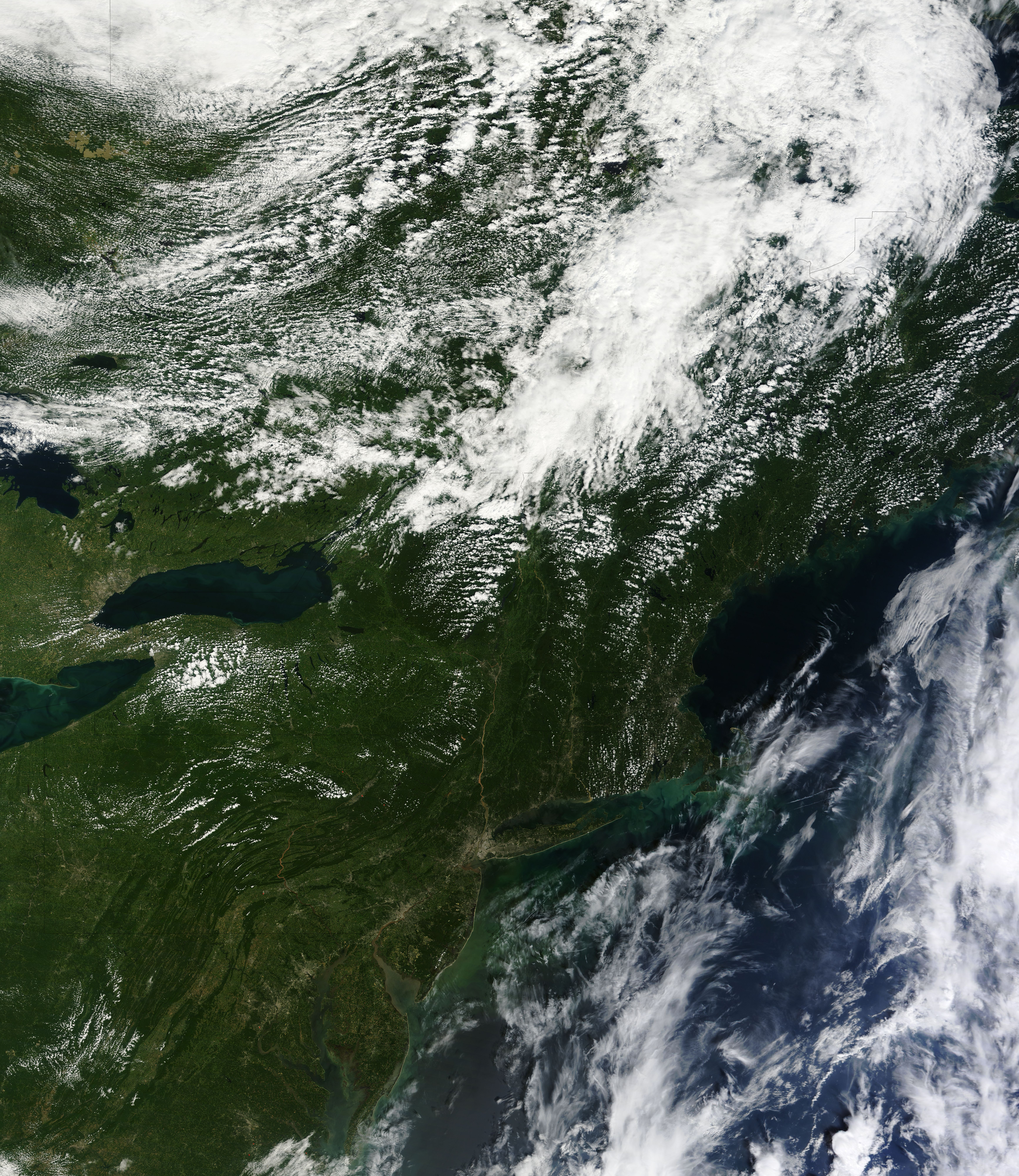
Hurricane Irene was surprisingly destructive to the inland state of Vermont. Heavy rain triggered widespread flash floods that swelled rivers and creeks and washed out roads and bridges across the mountainous state. On August 30, helicopters began to bring food and emergency supplies to 13 communities entirely cut off by the floods, said news reports.
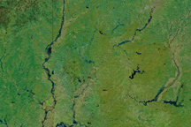
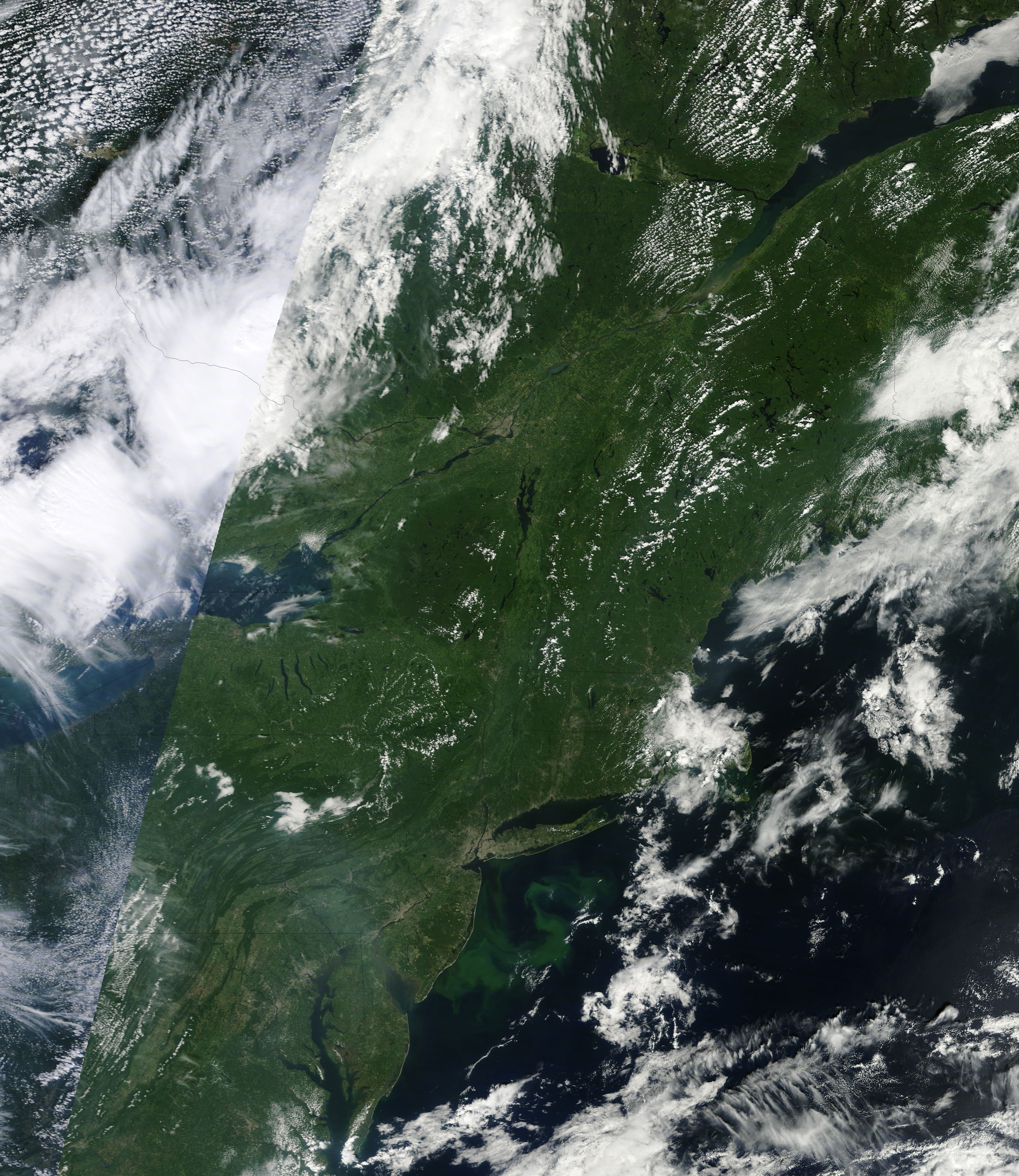
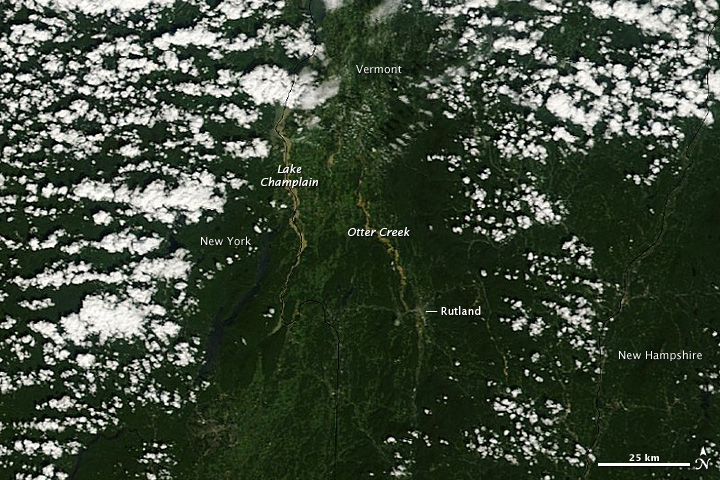
The Moderate Resolution Imaging Spectroradiometer (MODIS) on NASA’s Terra satellite captured the top image on August 30, 2011, after the clouds cleared. The ravaged roads and missing bridges aren’t visible at this scale, but the violence of the fast-moving flood is evident nonetheless. The churning water swept dirt and debris into Vermont’s rivers, turning them brown. The green land is marbled with muddy brown streams and rivers in this image.
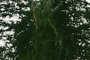
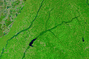
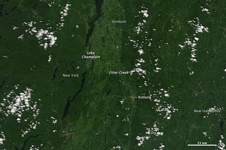
The most prominent water features are the southern river-like arm of Lake Champlain and Otter Creek. Both are swollen in comparison to conditions on August 20, lower image. Early on August 29, after Irene passed, Otter Creek reached a record 17.21 feet in downtown Rutland, where the U.S. Geological Survey has a stream gauge. Flood stage for the creek is 8 feet, and the previous record, set in 1938, was 13.45 feet.
NASA images courtesy the MODIS Rapid Response Team at NASA GSFC. Caption by Holli Riebeek.