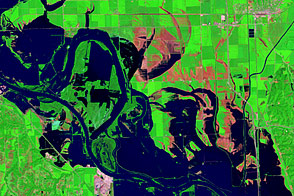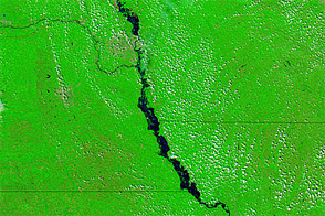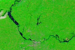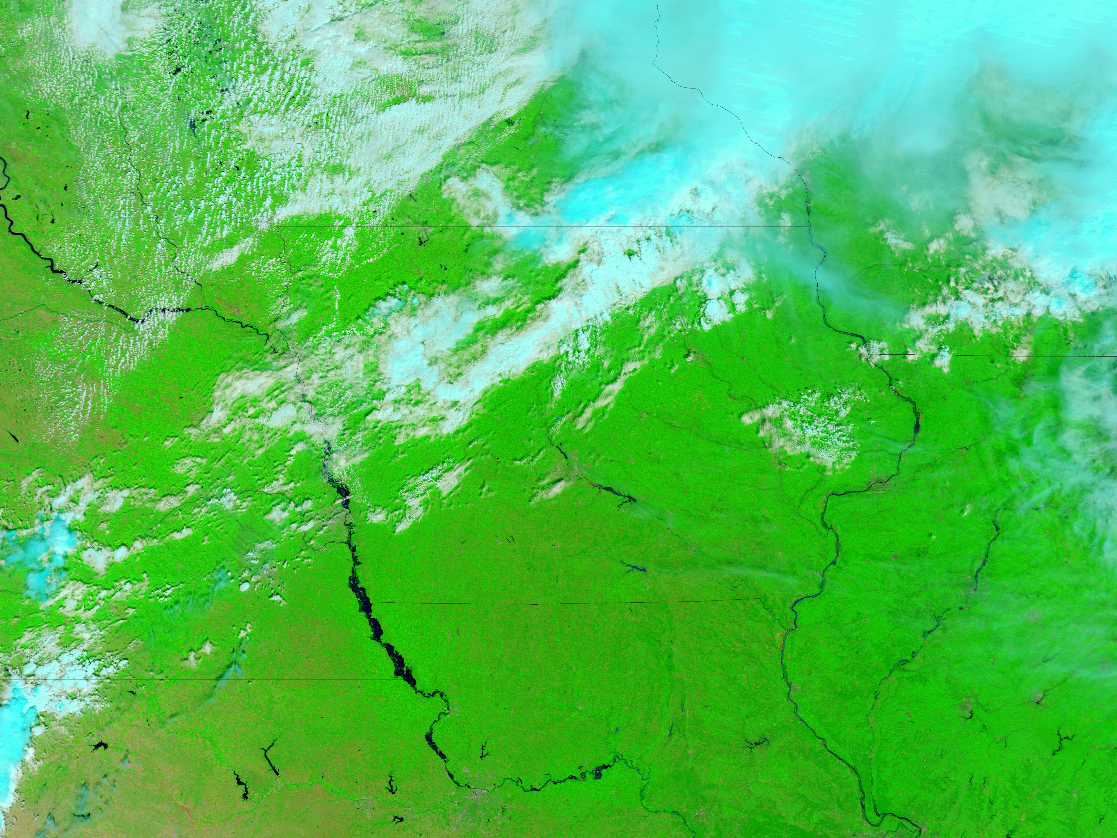
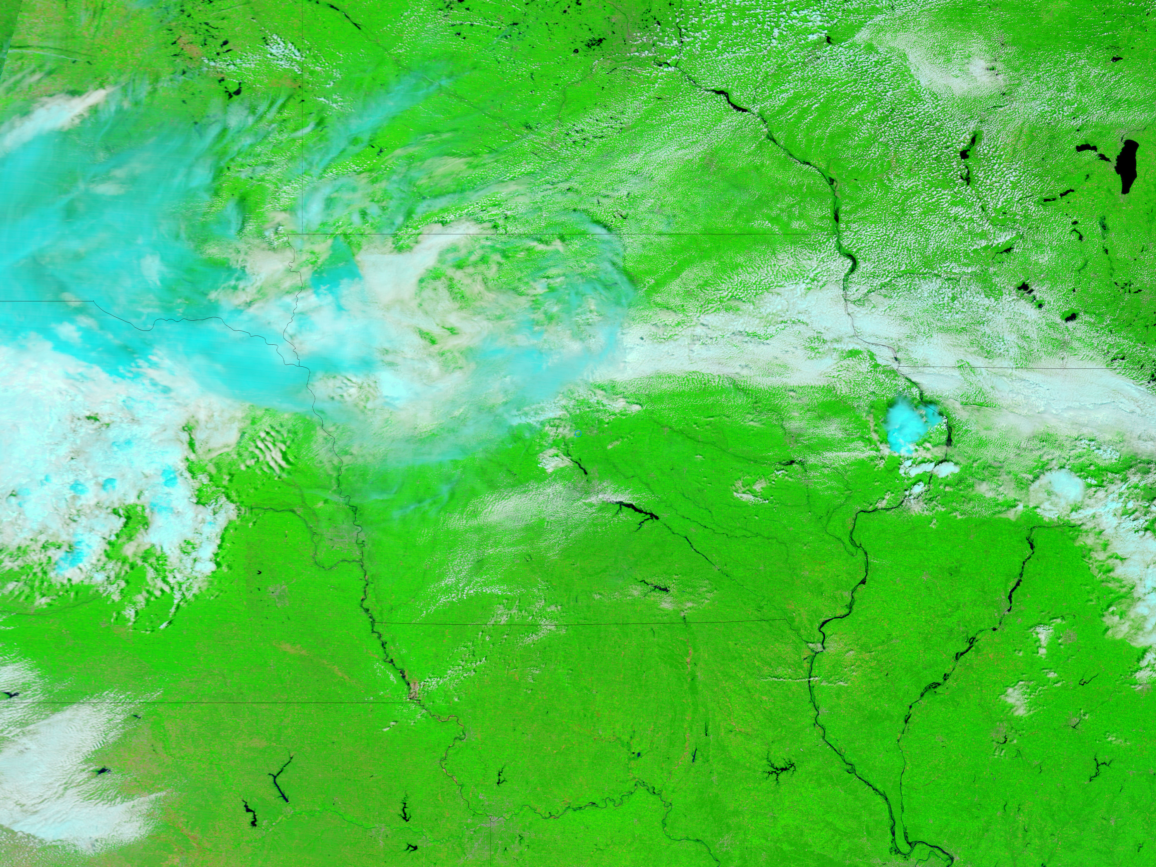
The Missouri River remained swollen through parts of Nebraska, Iowa, Missouri, and Kansas in early August 2011. The Moderate Resolution Imaging Spectroradiometer (MODIS) on NASA’s Terra satellite captured the top image on August 2, 2011. For comparison, the bottom image shows the same area one year earlier, on August 3, 2010.
Both images use a combination of visible and infrared light to increase contrast between water and land. Water is navy blue. Vegetation is green. Clouds range in color from off-white to pale glue-green.
Compared to the previous year, the Missouri River is substantially swollen in 2011, especially along Nebraska’s eastern border. The river has also pushed over its banks in parts of Kansas and Missouri.
On August 5, 2011, the Advanced Hydrological Prediction Service (AHPS) of the U.S. National Weather Service reported major flooding in St. Joseph, Missouri. The AHPS also reported moderate flooding in the Kansas communities of Atchison and Leavenworth; in the Missouri community of Napoleon; and in the Nebraska communities of Blair, Omaha, Plattsmouth, Brownville, and Rulo.
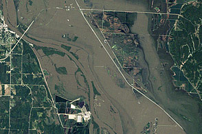
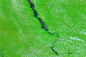
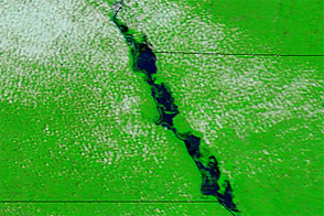
High-resolution imagery acquired on August 1, 2011, shows flooded agricultural fields around Blair, Nebrasa.
NASA images courtesy MODIS Rapid Response Team, Goddard Space Flight Center. Caption by Michon Scott.