
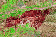
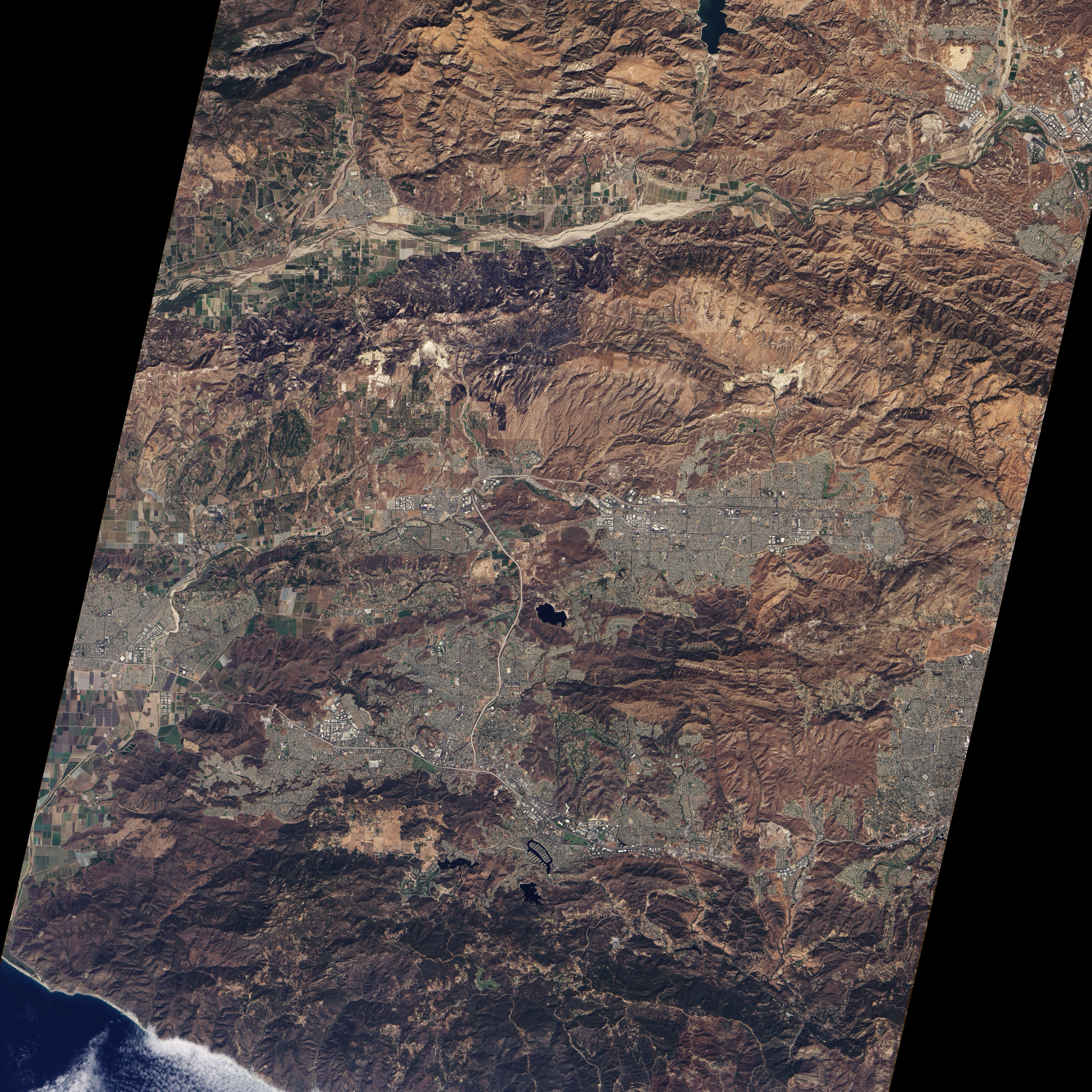
According to the California Department of Forestry and Fire Protection, the Guiberson Fire in Ventura County, California, was 100 percent contained as of September 27, 2009. The fire had burned 17,500 acres (approximately 70 square kilometers), caused 10 injuries, and destroyed one outbuilding. The cause of the fire was still under investigation.
The Advanced Land Imager (ALI) on NASA’s Earth Observing-1 (EO-1) satellite acquired this false-color image on September 26, 2009. The image uses shortwave infrared light to increase the contrast between burned and unburned land. Agricultural fields appear fluorescent green. Natural vegetation not burned by the fire appears greenish tan. The burn scar appears deep brick red. The boundary between the burn scar and the neighboring fields suggests that the Guiberson Fire encroached upon agricultural fields, burning irregular borders along what would otherwise have been straight lines. Irregularly shaped splashes of bright green appear inside the burn scar.
NASA image created by Jesse Allen, using EO-1 ALI data provided courtesy of the NASA EO-1 team. Caption by Michon Scott.


