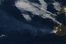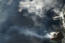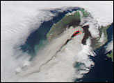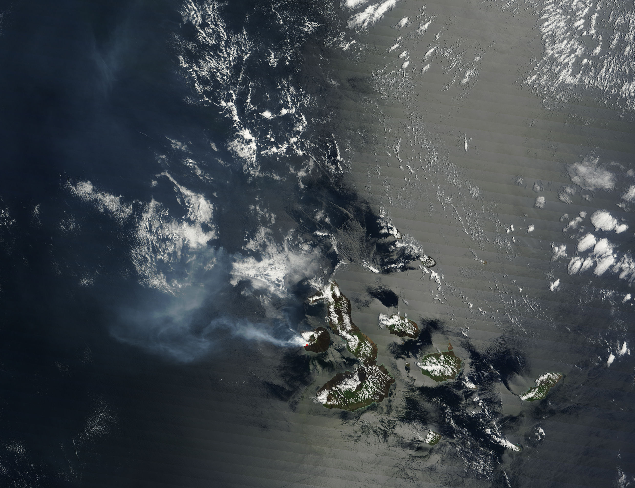
La Cumbre Volcano on Isla Fernandina continued erupting in mid-April 2009. On April 14, 2009, continuous ash and steam emissions produced a plume that stretched some 250 kilometers (135 nautical miles) west of the summit, according to the U.S. Air Force Weather Agency. The Moderate Resolution Imaging Spectroradiometer (MODIS) on NASA’s Terra satellite took this picture the same day.
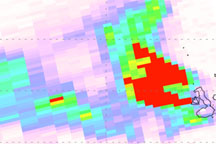
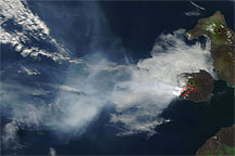
In this true-color image, the volcano sends a plume westward; it expands, mingles with clouds, and turns north. Although faint, the plume perseveres far northwest of the volcano (image upper left). Opaque white puffs near the volcanic summit may be part of the plume, or may be clouds collected over the volcano. Compared to the nearby clouds, the volcanic plume is blue-gray, with less distinct margins. The red outlines on the volcano are hotspots where MODIS detected unusually warm surface temperatures.
Along the right edge of this image, the ocean surface appears strangely textured, similar to a rough land surface. This appearance results from sunglint—the mirror-like reflection of sunlight off the ocean surface.
Isla Fernandina is a shield volcano with a low, broad shape that resembles an ancient warrior shield. Producing both plumes and lava flows, the 2009 eruption marked Isla Fernandina’s first burst of volcanic activity since 2005. Because the Galapagos Islands are home to unique species, authorities expressed concern that the new spate of eruptions might threaten local wildlife.
NASA image by Jeff Schmaltz, MODIS Rapid Response Team, Goddard Space Flight Center. Caption by Michon Scott.