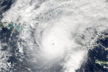

Although it was November, Cuba potentially faced its a third major hurricane of the season. The island nation was hit hard by Hurricanes Gustav and Ike in a little over a week in late August and early September 2008. Climatologically, the Atlantic hurricane season was winding down in early November 2008, but Hurricane Paloma was a reminder that the season was not yet over. On average, one storm forms every other year in the Atlantic during the month of November. The favored development region is the central and western Caribbean, which is exactly where Paloma formed.
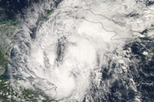
Paloma originated from a persistent area of disturbed weather in the southwestern Caribbean Sea. A tropical depression formed on the afternoon of November 5, 2008, about 170 kilometers (about 105 miles) off the northeast coast of Nicaragua. The following day, with conditions favorable for development, the depression was upgraded to a tropical storm and officially became Paloma as it moved slowly northward. By early that same evening, Paloma had become a hurricane as it entered the northwestern Caribbean.
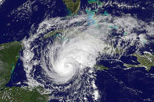
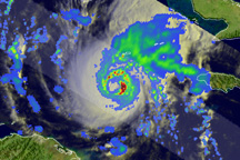
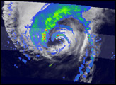
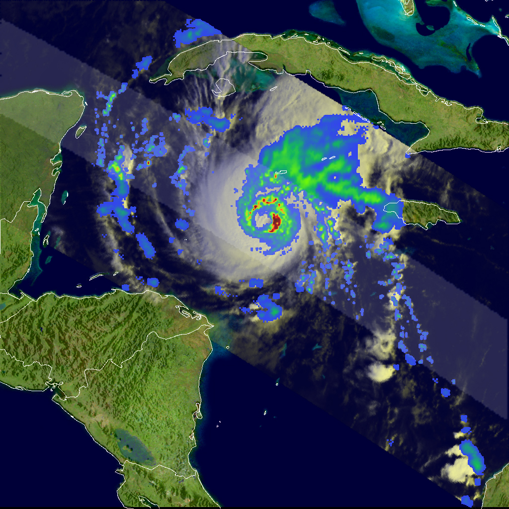
The Tropical Rainfall Measuring Mission (TRMM) satellite took this image at 12:46 UTC (7:46 a.m. EST) on November 7, 2008, as the storm was moving slowly northward through the western Caribbean south of the Cayman Islands. The image shows the horizontal pattern of rainfall associated with Paloma, revealing features that might not be visible in the cloud patterns. TRMM shows that Paloma has a well-organized circulation with a closed eye surrounded by a complete ring of moderate intensity rain (green circular region). A broad area of light to moderate rain (blue and green areas, respectively) extends farther out northeast of the center. Another interesting feature is the area of intense rainfall (shown in red) embedded in the eastern eyewall.
At the time this image was taken, Paloma was a Category 1 hurricane with sustained winds reported at 70 knots (~81 mph) by the National Hurricane Center (NHC). After these images were taken, Paloma continued to shows signs of intensifying and was expected to become a major hurricane before possibly making landfall along the south-central coast of Cuba.
The image was produced with data from several different sensors flying aboard the TRMM satellite. Rain rates in the center of the swath come from the TRMM Precipitation Radar and those in the outer swath from the TRMM Microwave Imager. The rain rates are overlaid on infrared data from the TRMM Visible Infrared Scanner.
TRMM has been in service for more than 10 years and continues to provide valuable images and information on tropical cyclones around the tropics using a combination of a passive microwave sensor and a first-of-its-kind spaceborne precipitation radar. TRMM is a joint mission between NASA and the Japanese space agency JAXA.
Images produced by Hal Pierce (SSAI/NASA GSFC) and caption by Steve Lang (SSAI/NASA GSFC).