Cyclone Gula did not look like much of a cyclone on January 30, 2008. By this time, it was traveling southward near the islands of Mauritius and Reunion in the Indian Ocean. A disorganized ball of clouds over the Indian Ocean lacking any evident eye structure, the cyclone seemed little different from any band of storm clouds when seen from above.
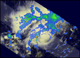
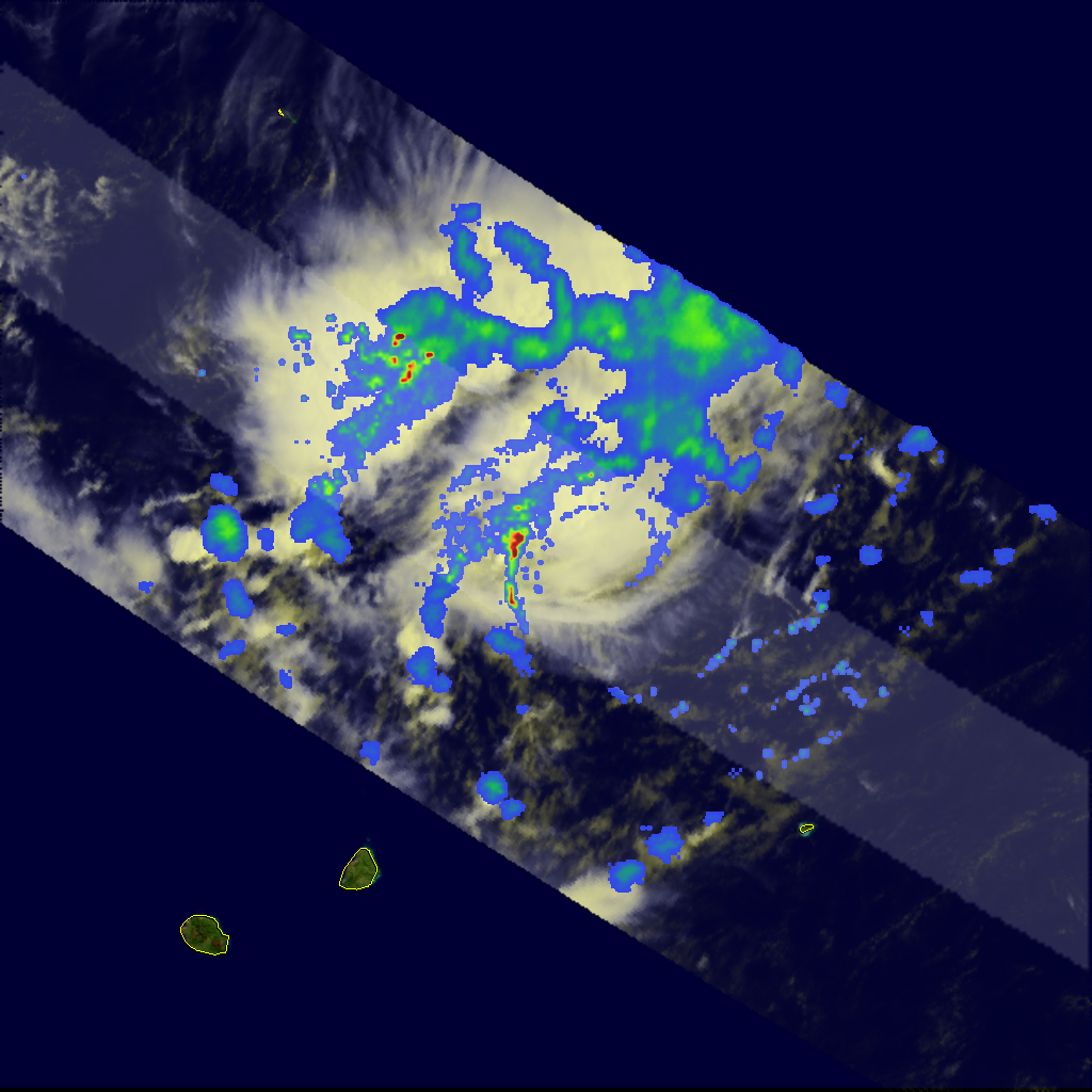
This image shows rain rates in Cyclone Gula as observed by the Tropical Rainfall Measuring Mission (TRMM) satellite on January 30, 2008, at 9:46 a.m. local time (05:46 UTC). Looking only at the underlying white-toned data, which is similar to what the human eye view, the storm system seems to be a gathering of clouds with no obvious pattern of circulation. The rainfall rate data, however, paints a slightly different picture, showing stronger hints of circulation and a central eye-shaped structure.
The TRMM satellite was placed into service in November 1997. From its low-earth orbit, TRMM provides valuable images and information on storm systems around the tropics using a combination of passive microwave and active radar sensors, including the first precipitation radar in space. In this image, rain rates in the center of the swath are from the TRMM Precipitation Radar, and those in the outer swath come from the TRMM Microwave Imager. The rain rates are overlaid on infrared data from the TRMM Visible Infrared Scanner. TRMM is a joint mission between NASA and the Japanese space agency, JAXA.
NASA image produced by Hal Pierce. Caption by Steve Lang and Jesse Allen.