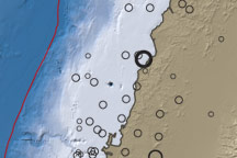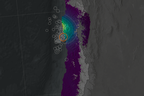
At 12:40 pm local time, a powerful earthquake hit northern Chile. The 7.7-magnitude event was centered in a remote area of the country, 170 kilometers (105 miles) north of the port city of Antofagasta, and well inland from the coast. According to the United States Geological Survey, the epicenter was located at a depth of 50 kilometers (37 miles) underground. The substantial depth meant that the powerful quake did not cause the severe damage a shallower event of similar strength would have caused. However, news reports indicated that power lines were knocked down, and many buildings collapsed across a wide area, leaving as many as 15,000 homeless. The quake also produced major cracks in the runways at the Antofagasta airport. In the immediate hours after the major event, the USGS also recorded a series of smaller aftershocks, with magnitudes ranging from 4.9 to 5.7. (The magnitude scale measurement for earthquakes is logarithmic, such that a 5.7-magnitude event is 100 times less powerful than a 7.7-magnitude event.)
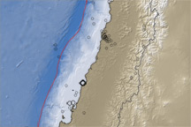
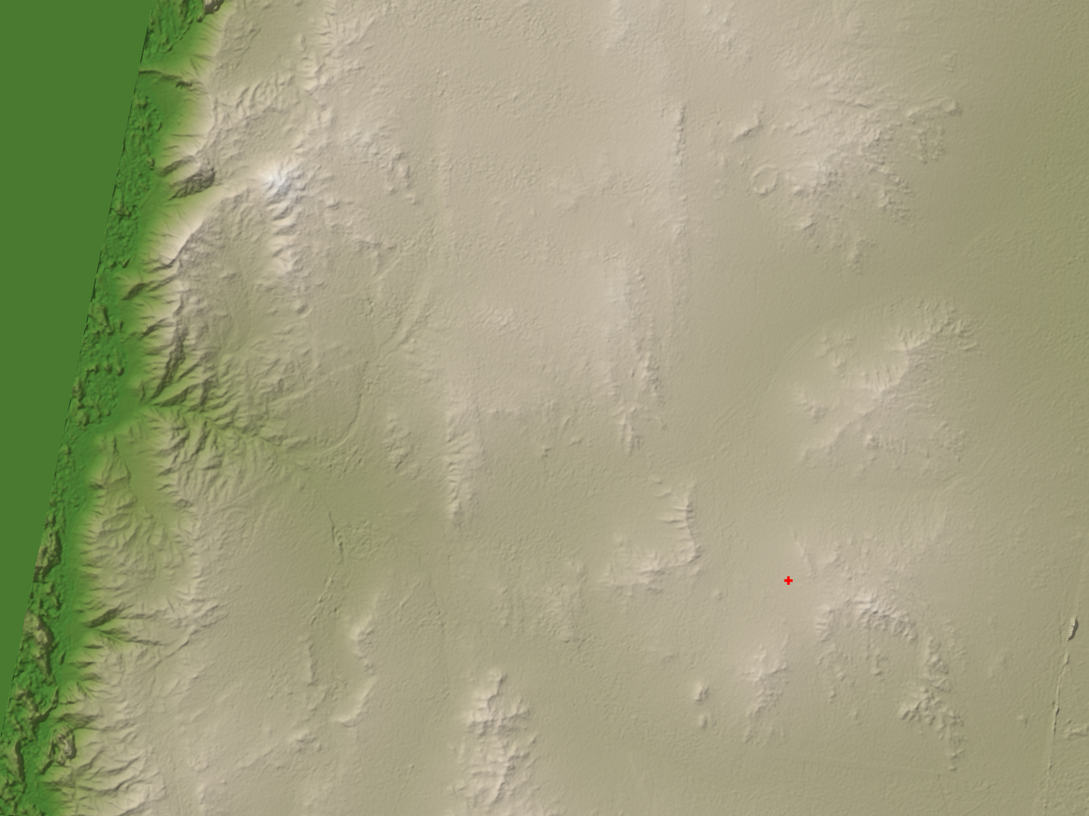
This visualization shows the landscape around the epicenter of the earthquake. The elevation data was recorded by the ASTER instrument on NASA’s Terra satellite. This region of Chile has steep coastal cliffs, a high coastal plain, and further inland, the ridgelines of the Andes Mountains. All these are formed through the interaction of many different geological processes, but the dominant force at work in shaping and reshaping Chile’s coast and mountain ranges is plate tectonics.
Along the edge of the continent, two blocks of the Earth’s crust meet. The Nazca plate under the ocean is heavier than the South American plate, which houses the continent. The Nazca plate slides eastward beneath the South America plate, forcing the lighter plate upwards. This subduction process is slow and steady in some locations, but gets stuck in others. Stress builds up where the two plates are locked together until the rock reaches a breaking point. The fracture causes a sudden shift that sends shockwaves through the surrounding rock: an earthquake.
In Chile, large earthquakes through recent history occur roughly every 25 to 100 years apart. The strongest earthquake ever recorded by modern instruments was a 9.5-magnitude quake on May 22, 1960, which was centered offshore in southern Chile, where it set off a huge tsunami. Other large quakes in Chile were recorded on March 3, 1985 (magnitude 7.8 offshore of central Chile) and July 30, 1995 (magnitude 8.1 in Antofagasta, Northern Chile). The depth of the recent event and its distance in from the shoreline meant that although tsunami warnings were issued, no serious tsunami event was recorded.
NASA image created by Jesse Allen, using data provided courtesy of NASA/GSFC/METI/ERSDAC/JAROS, and U.S./Japan ASTER Science Team.