Typhoon Yagi (the Japanese word for goat) formed as a tropical depression (area of low air pressure) in the northwestern Pacific Ocean on September 17, 2006. The depression gained power swiftly, reaching typhoon status by late on September 18, and as of September 20, Yagi was a powerful Category 3 typhoon. According to the Joint Typhoon Warning Center, Yagi was predicted to come close to the Japanese mainland by September 23 or 24, not directly passing over land, but bringing storm weather to Tokyo. Yagi, the sixteenth named storm of the Pacific typhoon season, was whipping up the seas with wave heights as much as 11.6 meters (38 feet) in the heart of the storm, driven by winds gusting as high as 230 kilometers per hour (144 miles per hour).
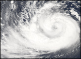
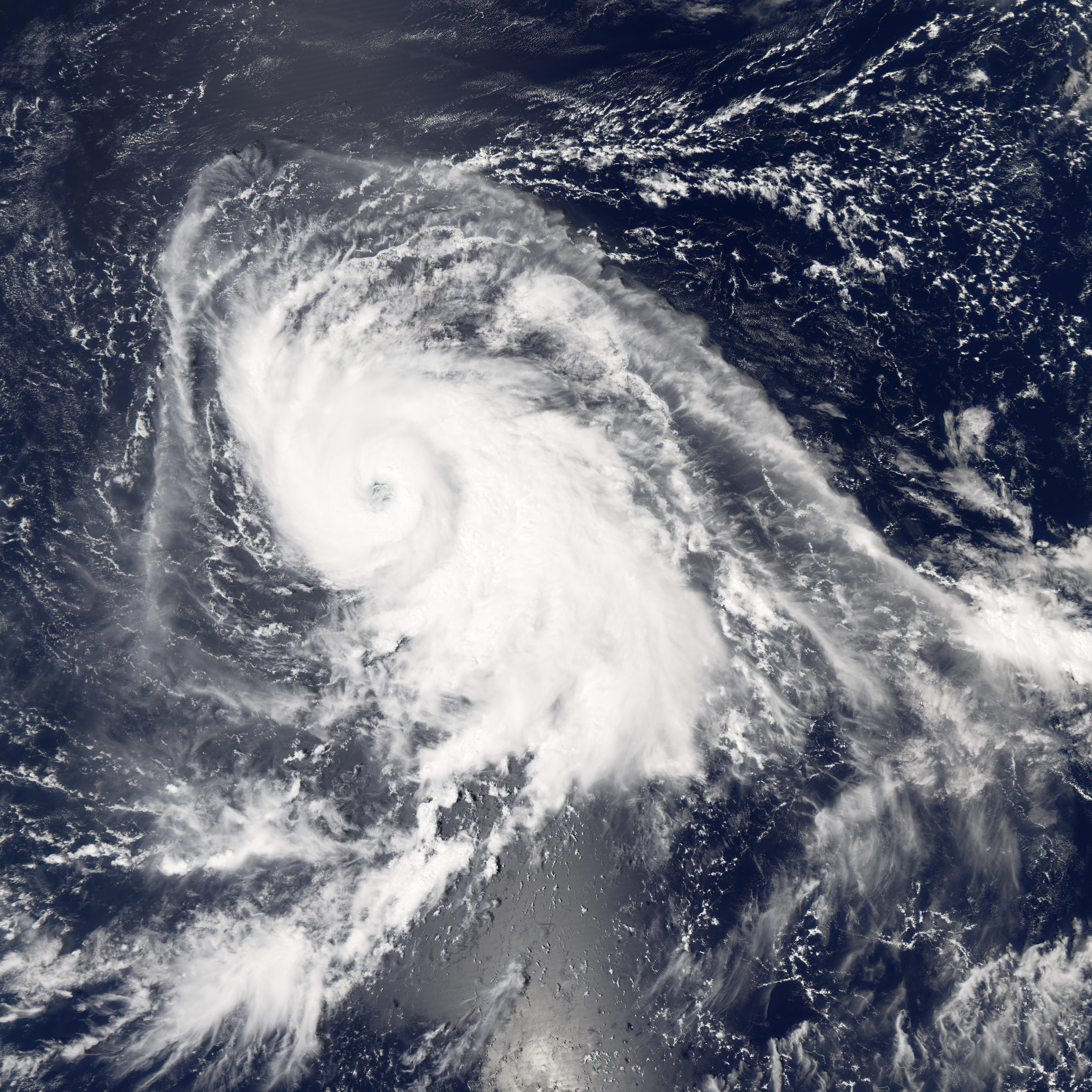
This photo-like image was acquired by the Moderate Resolution Imaging Spectroradiometer (MODIS) on NASA’s Terra satellite on September 19, 2006, at 1:10 p.m. local time (04:10 UTC). In this image, Yagi is a large, sprawling storm system with long spiraling arms, a tightly wound central portion, distinct eyewall, and a cloud-filled eye. These are all hallmarks of a powerful typhoon, and Yagi was predicted to continue to gather size and power as it travelled across the open, warm waters of the Pacific Ocean. It was not predicted to make significant landfall in its arc towards Japan, though a number of Pacific Islands, such as Iwo Jima, may see very severe weather as Yagi passes nearby.
NASA image created by Jesse Allen, Earth Observatory, using data provided courtesy of the MODIS Rapid Response team.