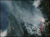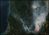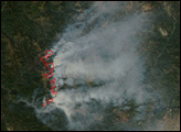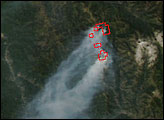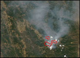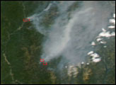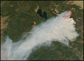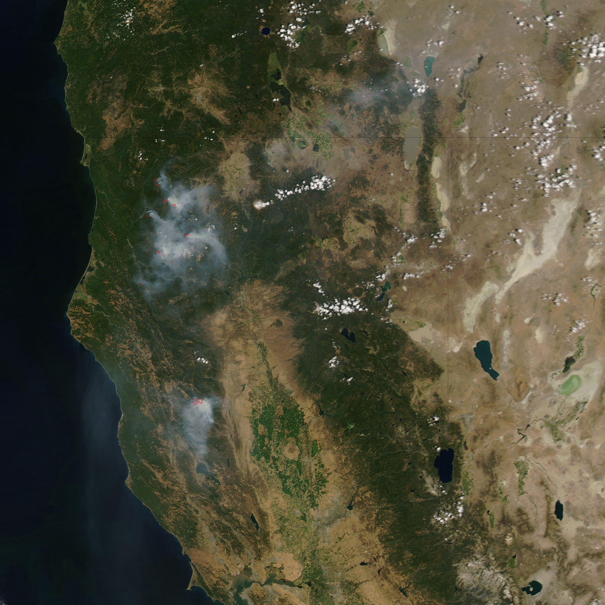
Several large wildfires were burning in Northern California on August 1, 2006, when the Moderate Resolution Imaging Spectroradiometer (MODIS) on NASA’s Aqua satellite passed overhead and captured this image. Places where MODIS detected actively burning fire are outlined in red. Smoke hangs over the forested mountains.
Firefighters in the area had their hands full with numerous blazes that were threatening residences, communications infrastructure, old growth forest, wildlife habitat, and cultural resources. According to reports form the National Interagency Fire Center on August 2, 2006, the 3,450-acre Orleans Complex Fire was threatening a municipal water supply. Challenges at the 6,450-acre Uncles Fire included steep terrain, limited access roads, and poor visibility from smoke that was lingering near the ground. The 4,805-acre Hunter Fire was threatening spotted owl habitat and fisheries.
The high-resolution image provided above has a spatial resolution of 250 meters per pixel. The MODIS Rapid Response System provides daily images of this area at additional resolutions. Additional information on fires in the United States is available from the National Interagency Fire Center.
NASA image courtesy the MODIS Rapid Response Team, Goddard Space Flight Center