Heavy rain triggered widespread flooding across the eastern United States from June 23 to June 27, 2006. The rains fell as a steady stream of very moist tropical air was channeled up the East Coast from the South. The air stalled over the Mid-Atlantic region, where it produced heavy rain through June 28. The resulting floods closed major roads, forced evacuations, and killed ten people, say news reports.
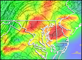
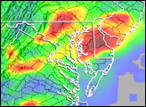
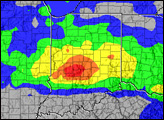
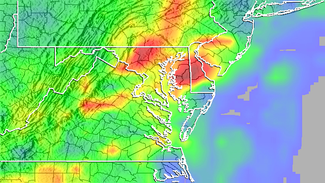
This image shows an estimate of rainfall totals for June 23 through June 28. The heaviest rainfall totals (shown in red) were on the order of 7 to 10 inches and occurred over Maryland’s Eastern Shore (east of the Chesapeake Bay), over central Delaware, and in central Maryland. Locally, more than 12 inches of rain were reported in Federalsburg, Maryland, which is in the red area east of the Chesapeake Bay. Washington National Airport reported over 13 inches of rain. Nearly the entire area received 3 inches of rain (green areas) or more.
The rainfall totals in this image are from the near-real-time, Multi-satellite Precipitation Analysis (MPA) developed at NASA Goddard Space Flight Center to monitor rainfall over the global tropics. The MPA uses rainfall measurements from the Tropical Rainfall Measuring Mission satellite (