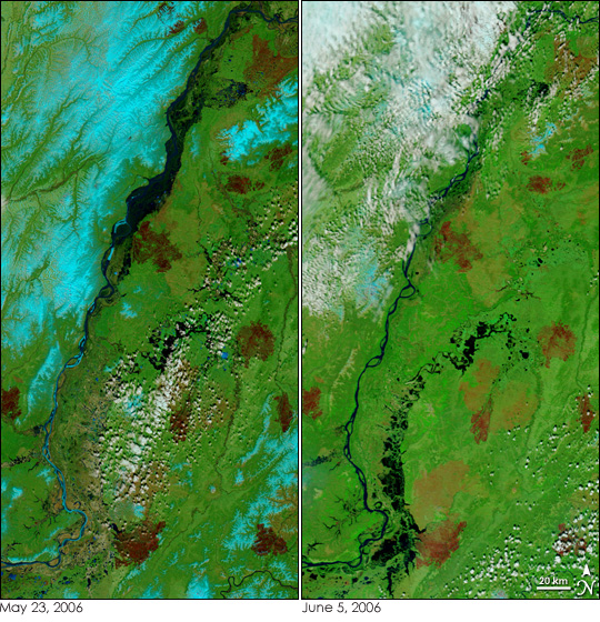
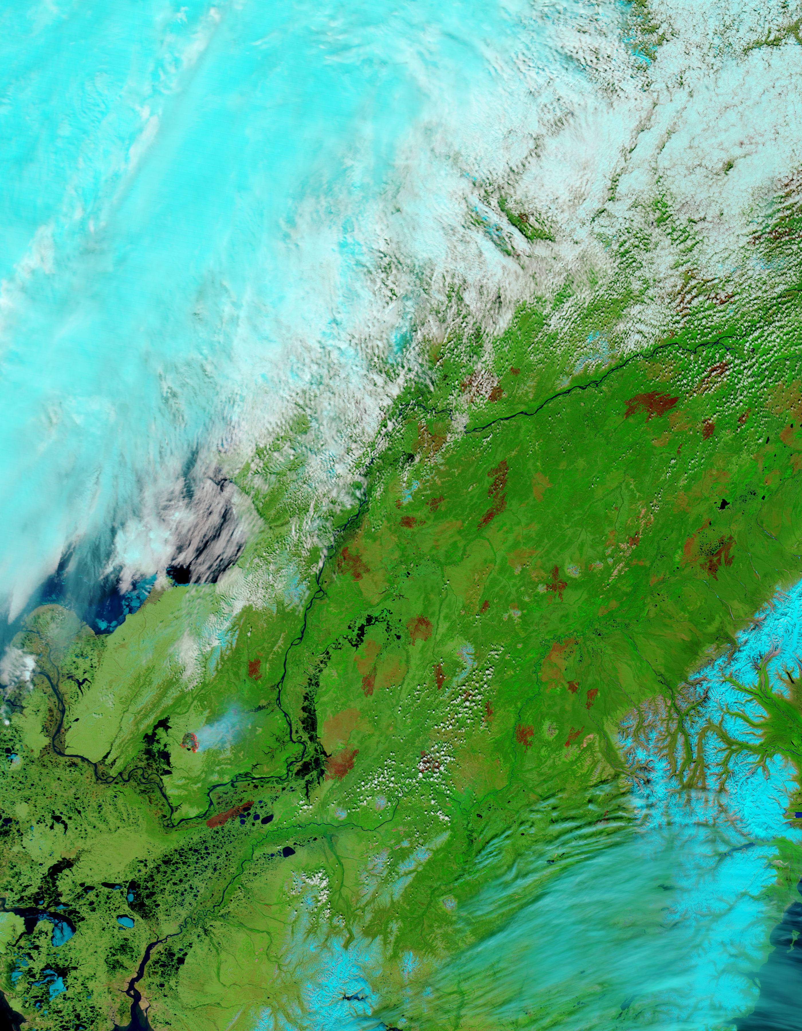
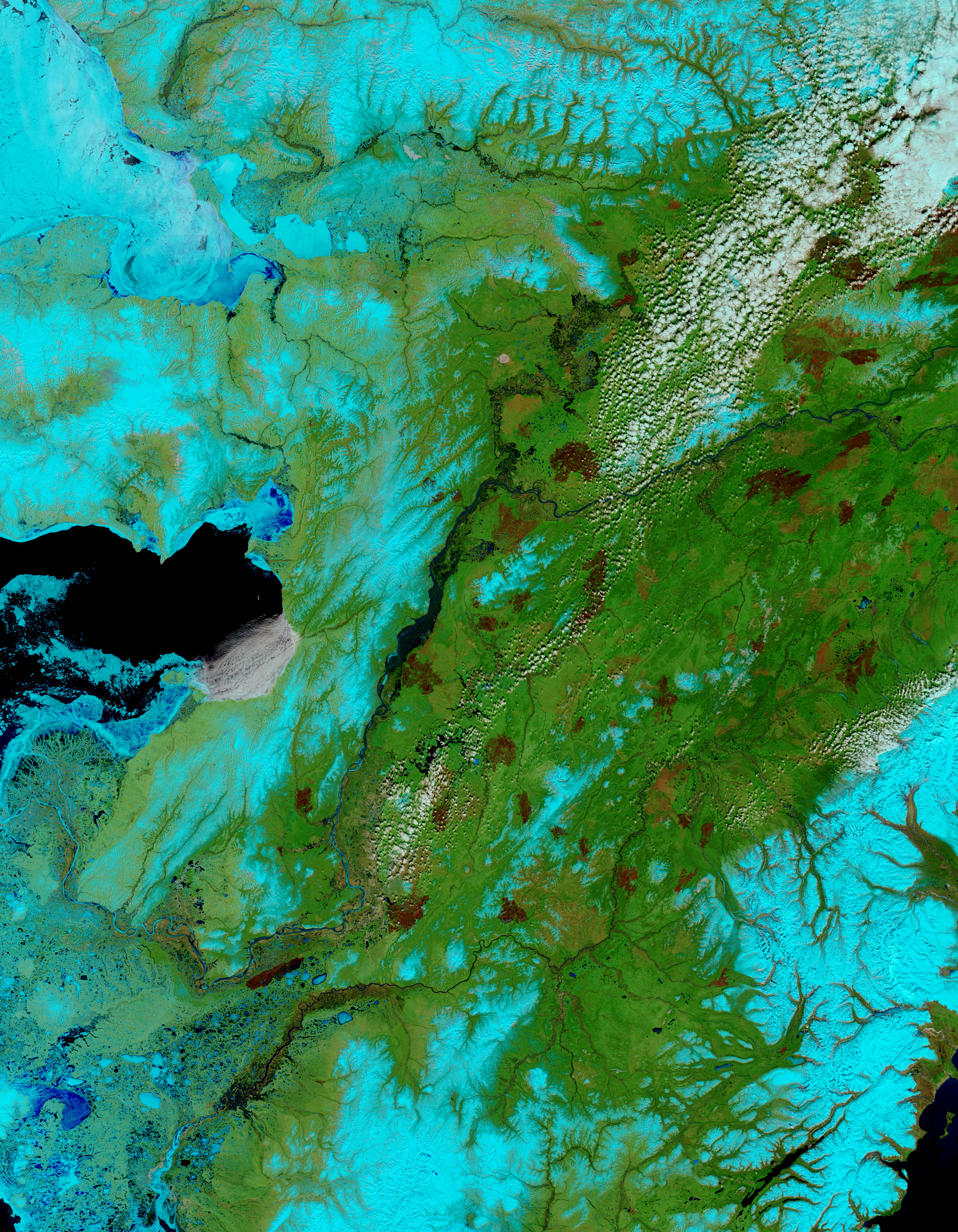
Alaska gradually thawed over the month of May as spring’s warmth crept north. The melting snow and thawing ice filled the Yukon River until it bulged over its banks with runoff when the Moderate Resolution Imaging Spectroradiometer (MODIS) on NASA’s Terra satellite captured the left image on May 23, 2006. Two weeks later, on June 5, the floods had drained and the Innoko River near Holy Cross, Alaska, was flooded.
These images have been enhanced using MODIS’ observations of shortwave and near-infrared energy to make it possible to see the transition on the surface from frozen to liquid water. On May 23, snow (light blue) still dusts the mountains around the river and chunks of light blue ice cling to the river’s banks. Despite these signs of winter, most of the land and river are free of snow and ice. Just two weeks earlier, on May 10, the whole region had been frozen, and the rapid melt-off is evident in the swollen Yukon River. By June 5, nearly all of the snow was gone. Though clouds cover the mountains in the northwest, the ground beneath shows only traces of snow.The flooding in the upper reaches of the Yukon River has subsided, but the Innoko River, a tributary of the Yukon, is now flooded, the liquid water an inky black.
The melting snow has revealed patches of dark red where widespread fire has charred the landscape. In the summers of 2004 and 2005, millions of acres of Alaska’s forest burned in lightning-ignited fires. In this image, burn scars range form very red, likely more recent or more severe burns, to pinkish, likely older or less severe burns.
NASA images courtesy Jeff Schmaltz, MODIS Land Rapid Response Team at NASA GSFC


