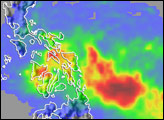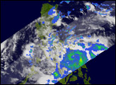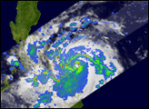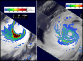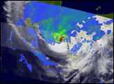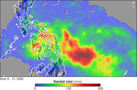
Typhoon Chanchu (known as Caloy in the Philippines) brought strong winds and heavy rains to the central Philippines as the storm passed through the mid-section of the country. This image shows rainfall totals around the Philippines from May 8-12, 2006, based on data collected by the Topical Rainfall Measuring Mission (TRMM) as Typhoon Chanchu approached and crossed the island chain. In particular, it shows the changing patterns of light and heavy rain as the storm system approached the islands. The storm’s most dramatically heavy rain fell offshore, when the storm was particularly intense, but rains decreased as the typhoon crossed the islands. The image was compiled from the TRMM-based, near-real time Multi-satellite Precipitation Analysis (MPA) at the NASA Goddard Space Flight Center, which monitors rainfall over the global tropics.
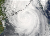
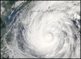
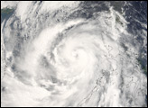
Though not a particularly powerful storm, Chanchu was responsible for 8 reported deaths as of May 14, 2006, six of which occurred when a boat capsized while traveling between islands, according to news reports. Chanchu became a tropical depression on May 9, 2006, east of the main southern island, Mindanao. The system then organized into a tropical storm and moved west-northwest before making landfall on the island of Samar in the central Philippines on the evening of May 11 as a Category 1 typhoon. Chanchu regained strength, briefly becoming a Category 2 storm, as it passed between the central islands before hitting Mindoro Island and weakening somewhat.
TRMM is a joint mission between NASA and the Japanese space agency, JAXA. Since its launch in 1997, TRMM has provided valuable information on tropical storms. With an active radar and a passive microwave sensor, TRMM can peer into the core of these storms and relay details on storm structure and location to forecasters.
Images produced by Hal Pierce (SSAI/NASA GSFC) and caption by Steve Lang (SSAI/NASA GSFC).