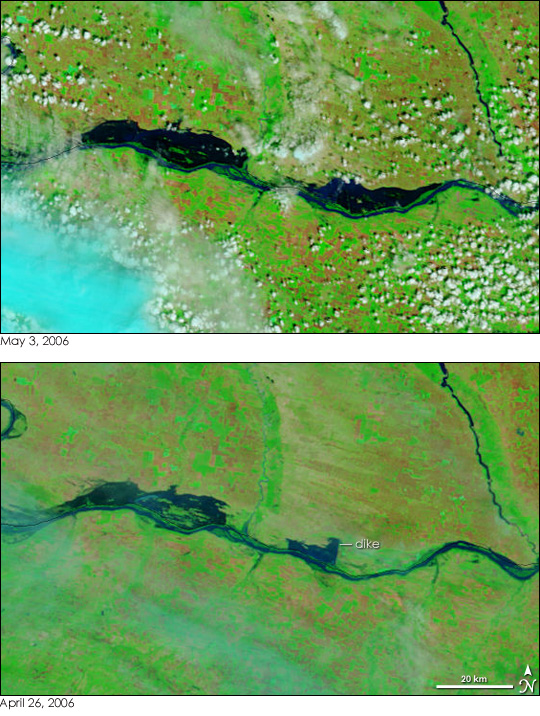
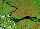
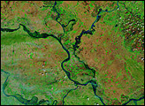
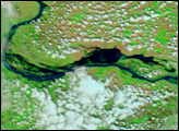
In 2006, springtime flooding continued to threaten communities along the Danube as April rolled into May. Heavy rains and melting snow pushed the river and many of its tributaries over their banks in early April, and by late April, the floods had arrived at the lower reaches of the 2,850-kilometer-long Danube in Romania and Bulgaria. Though water levels on the Danube had begun to drop by May 1, a water-logged dike burst, inundating a wide swath of Romanian farmland with fresh floods. Hundreds of people fled their homes, bringing the total number of evacuees in Romania to about 16,000, reported Reuters.
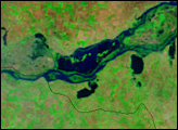
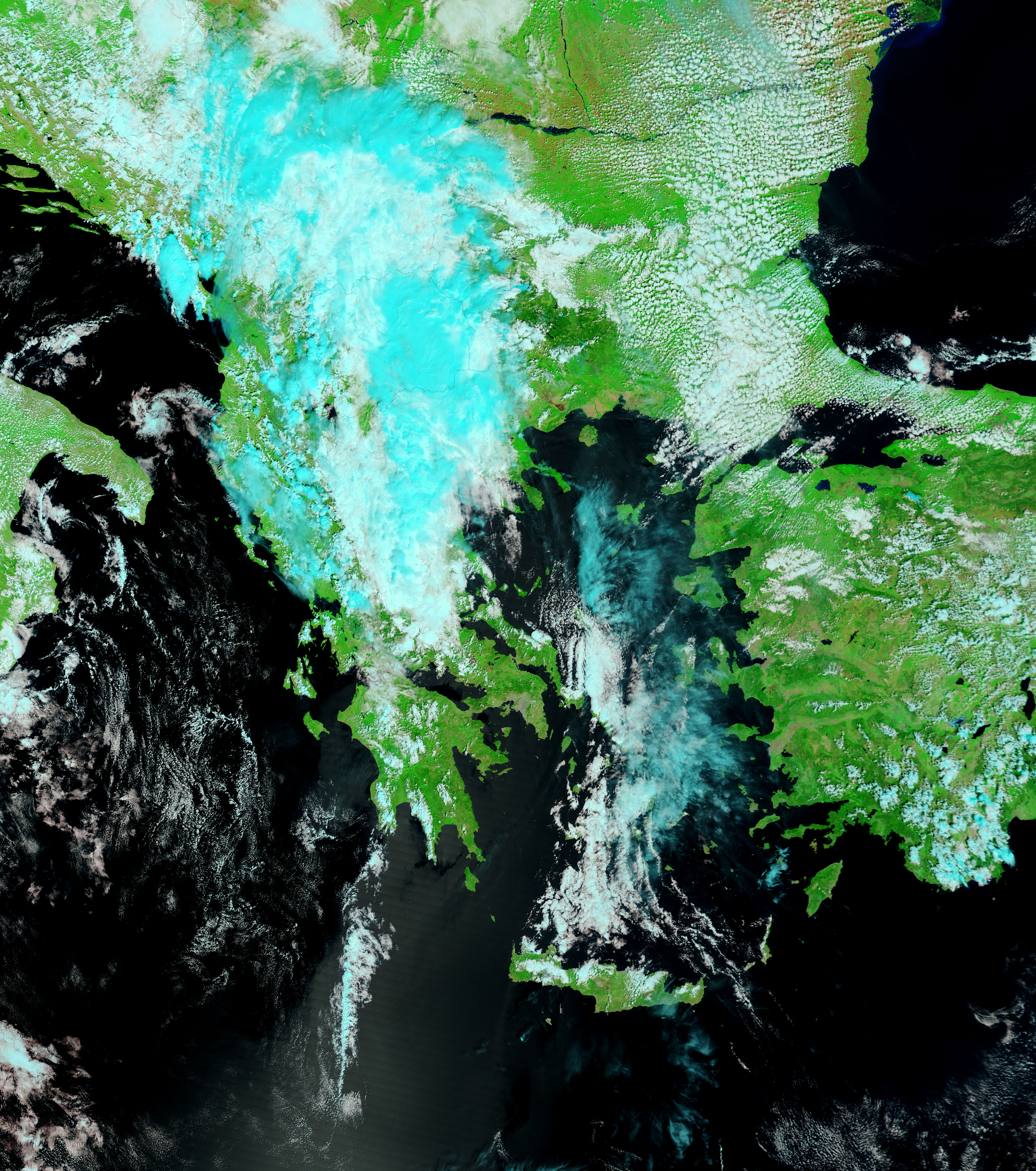
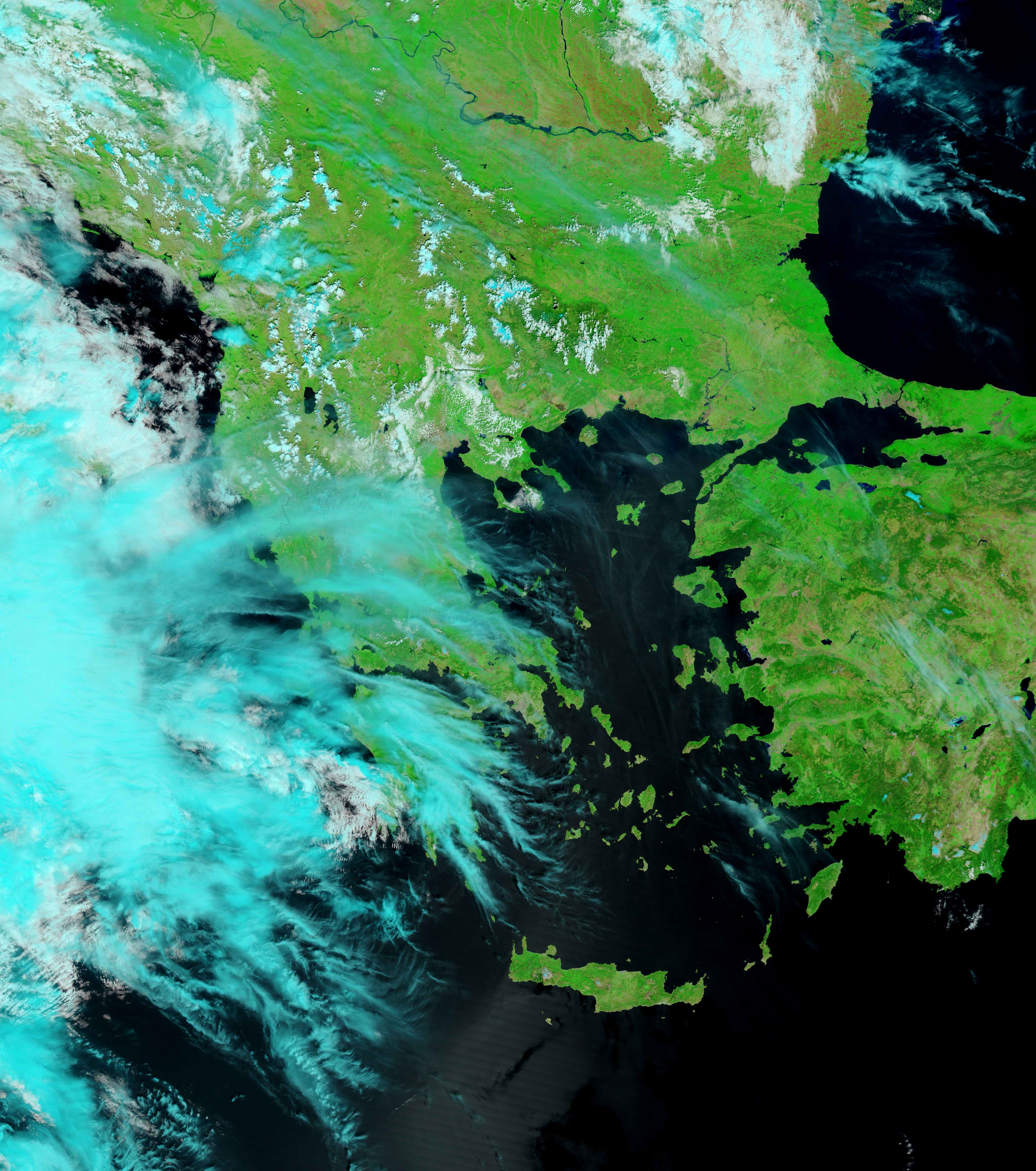
The new floods were clearly visible when the Moderate Resolution Imaging Spectroradiometer (MODIS) on NASA’s Terra satellite captured the top image on May 3, 2006. Water, dark blue to black in these images, stretches over tens of kilometers of land along the northern banks of the Danube. The floods have expanded in the week that passed between May 3 and April 26 (lower image), particularly in the eastern part of the scene. On April 26, a straight line along the eastern edge of the flood shows where a dike was holding water back. By May 3, the dike had failed.
On either side of the river, growing crops and bare fields form patchwork squares of tan-pink and vivid green. Clouds are pale blue and white. Both photo-like and false-color images of the flood are available from the MODIS Rapid Response Team on a daily basis.
NASA images courtesy the MODIS Rapid Response Team at NASA GSFC.


